
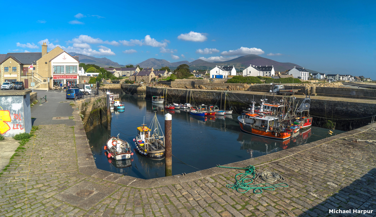
Annalong Harbour is located on the northeastern coast of Ireland at the mouth of the Annalong River, approximately eight miles northeast of the entrance to Carlingford Lough. It is a small tidal boat harbour used by small fishing boats. It is small, space-constrained and subject to silting and best suited to medium to small shallow draft vessels. Larger vessels can anchor outside in settled conditions and land at a nearby slipway.
The harbour offers good protection in offshore winds but there can be a surge in strong onshore winds. Access is subject to space and tidal constraints but outside of these limitations is straightforward.


Keyfacts for Annalong Harbour


Last modified
May 24th 2023 Summary* Restrictions apply
A good location with straightforward access.Facilities


Nature


Considerations


Position and approaches

Expand to new tab or fullscreen
Haven position
 54° 6.494' N, 005° 53.771' W
This is the position of the narrow 9-metre wide entrance to the basin.
What is the initial fix?
The following Annalong Harbour Initial Fix will set up a final approach:
 54° 6.485' N, 005° 52.847' W



What are the key points of the approach?
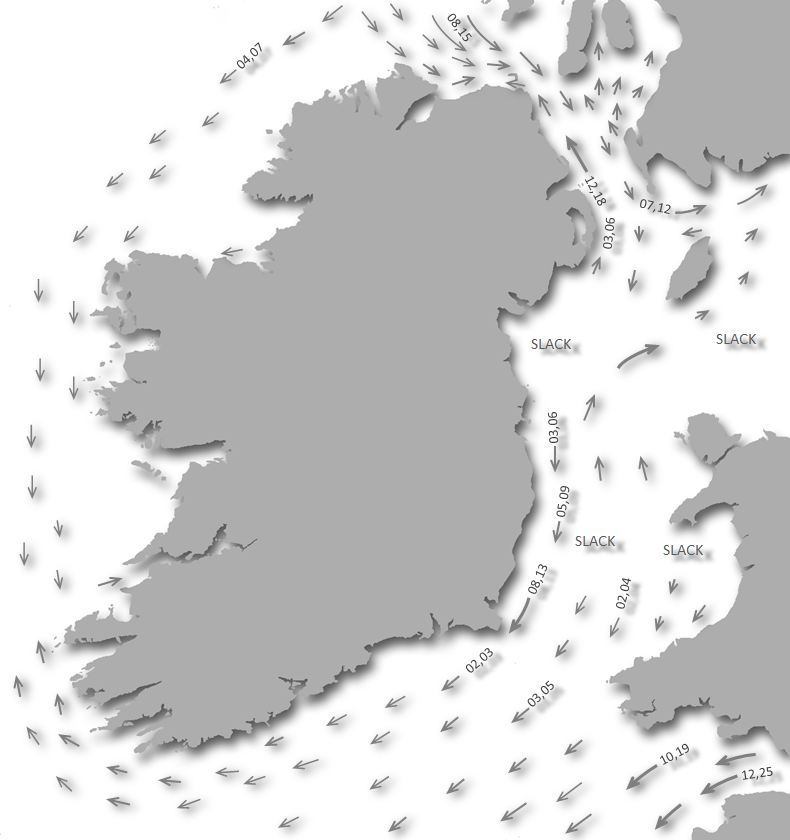
Offshore details are available in eastern Ireland’s Coastal Overview for Strangford Lough to Dublin Bay  .
.
.- Contact the harbour master to ascertain current depths and berth availability.
- Approach the harbour from the east with the south wall of the pier and channel just open.
- Slowly proceed in and swing hard to port to enter the basin.
Not what you need?
Click the 'Next' and 'Previous' buttons to progress through neighbouring havens in a coastal 'clockwise' or 'anti-clockwise' sequence. Below are the ten nearest havens to Annalong Harbour for your convenience.
Ten nearest havens by straight line charted distance and bearing:
- Kilkeel Harbour - 4.5 nautical miles SW
- Newcastle Harbour - 5.4 nautical miles N
- Greencastle - 8.4 nautical miles WSW
- Dundrum Harbour - 9.1 nautical miles NNE
- Killowen - 10.5 nautical miles W
- Rostrevor - 10.6 nautical miles W
- Carlingford Harbour - 10.8 nautical miles WSW
- Carlingford Marina - 10.9 nautical miles WSW
- Greer’s Quay - 12.1 nautical miles W
- Omeath - 12.5 nautical miles W
These havens are ordered by straight line charted distance and bearing, and can be reordered by compass direction or coastal sequence:
- Kilkeel Harbour - 4.5 miles SW
- Newcastle Harbour - 5.4 miles N
- Greencastle - 8.4 miles WSW
- Dundrum Harbour - 9.1 miles NNE
- Killowen - 10.5 miles W
- Rostrevor - 10.6 miles W
- Carlingford Harbour - 10.8 miles WSW
- Carlingford Marina - 10.9 miles WSW
- Greer’s Quay - 12.1 miles W
- Omeath - 12.5 miles W


What's the story here?
 Annalong Harbour
 Image: Michael Harpur
Annalong is a small town and harbour at the mouth of the Annalong River that hosts several small lobster boats. It has a population of between 1,500 and 2,000 people and lies within the Newry and Mourne District Council area. The harbour consists of a drying inner basin excavated into the shore adjacent to the mouth of a mountain stream. The basin is accessed and protected by an outer channel enclosed by a pier extending the southern shore and a breakwater from the northern shoreline. The river exits to the sea through this outer channel adjacent to the basin.
 Analong's inner boat harbour
Image: Michael Harpur
Annalong is dry at three-quarters ebb, space-constrained, and only suitable for vessels of less than 10 metres LOA and, ideally, shallow draft vessels that can take to the bottom. Anything larger will find it difficult to manoeuvre within its tight turns and confines. The approach channel has 0.1 to 0.3 metres and the basin dries to very soft mud. Nevertheless, at half tide, a depth of more than 2 metres can be found throughout and the tidal range here is Springs 5.3 – 0.7 metres, Neaps 4.4 - 1.9 metres.
 Local boats in the harbour
Image: Michael Harpur
However, the harbour is subject to silting and only occasionally dredged. Dredging can be subject to the local council’s fiscal constraints so depths may vary and it would be best to appraise the conditions as they are experienced at the time of the visit.
 Local lobster boat exiting Annalong Harbour
Image: Eric Jones via CC BY-SA 2.0
Vessels of a draft of 1.5 metres, or more, should not enter the harbour until at least 2 hours after low water. Larger vessels will be better off planning to anchor off outside in settled conditions which vessels frequently do.
How to get in?
 The southern approached to Annalong from Carlingford Lough
Image: Michael Harpur
 Seaward approaches are detailed in eastern Ireland’s coastal overview for Strangford Lough to Dublin Bay . Annalong lies about eight miles northeast of the entrance to Carlingford Lough and about ¾ mile southward of Mullartown Point. The offshore approaches are largely clear with no outlying dangers existing 150 metres off the shoreline or within soundings of 5 metres or above.
 The northern approaches past Mullartone Point
Image: Michael Harpur
 From the Annalong Harbour initial fix, track into the harbour from the east. On closer approach, the short breakwater will be seen extending seaward from the northeast corner of the basin. At night a light stands at the head of the breakwater with a sectored light Oc.WRG.5s.8m9M. SS.(Int).
 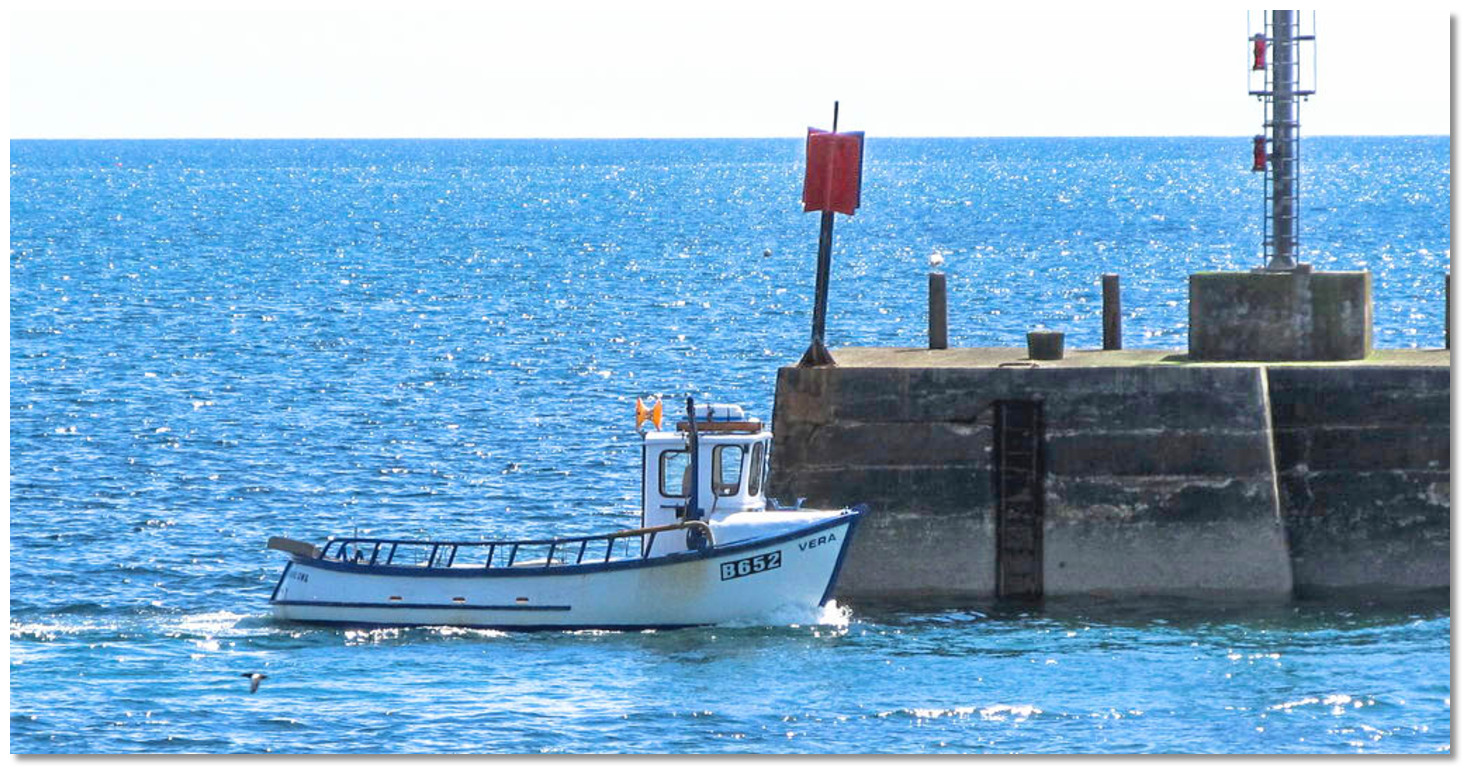 Local boat passing Annalong's pierhead
Image: Eric Jones via CC BY-SA 2.0
On closer approaches, from about 200 metres offshore, keep the north face of the outer pier wall just open to avoid the rocky shores north and south of the entrance. Proceed slowly, as manoeuvrability is highly constrained, along as close as possible to the north side of the outer pier and passing inside the outer breakwater extending from the north shore.
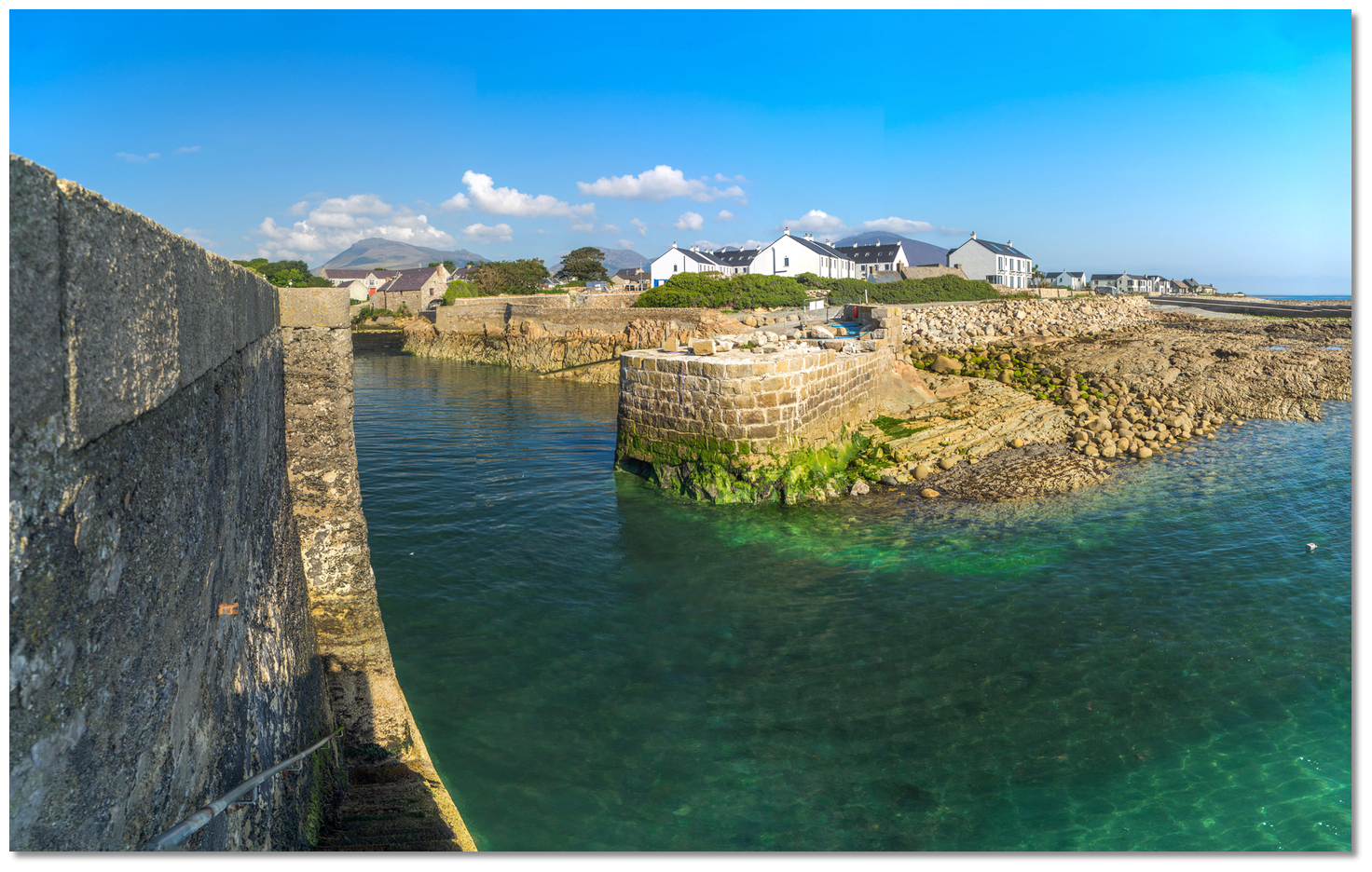 The breakwater extending from the north shore (under repair)
Image: Michael Harpur
Continue alongside the basin wall’s outer, or north face, where there is a little more space too the inner basin’s entrance. This is entered through a narrow 9-metre wide entrance gap at the basin’s northern end. This requires a hard swing to port turning the vessel due south to enter.
 Annalong Harbour
Image: Michael Harpur
Once inside the inner harbour basin come alongside a wall to dry over soft mud. There is limited space as the basin is 90 metres long and 25 metres wide.  Local boats alongside in Annalong Harbour
Image: Michael Harpur
Those anchoring off should note that the rocky foreshore dries nearly 200 metres from the entrance of the harbour. The Spring range is 3.9 metres here and Neaps 2.6m.
Why visit here?
Annalong's name is thought to have been derived from the Irish 'Áth na Long' meaning 'ford of the ships'. This dates back to raiding Viking longboats. In the early Christian period, the raiders would have been able to land and shelter their boats in the coastal cut formed by the original river mouth. The pretty harbour dates back to the early 1800s
Image: Michael Harpur
The current harbour dates back to the early 1800s and was built to support the exportation of dressed Mourne Mountain granite. Local masons built up such expertise that in time different types of granite were imported to be cut and polished by the stone masons of Annalong. Consequently, the harbour was enlarged to receive schooners carrying granite back and forth to English cities. Between 1904 and 1922 the harbour was the base that was used by the Belfast Water Commissioners to import materials for the construction of the nearby Silent Valley Reservoir.
 The Silent Valley Reservoir
Image: Ania via CC BY 2.0
The Silent Valley Reservoir was built to gather water from the Mourne Mountains and remains to this day the main water supply source for most of County Down and a large part of Belfast. This was an enormous undertaking and a purpose-built standard-gauge railway was built from Annalong to the dam to transport the reservoir’s construction material. The project included the construction of the spectacular drystone Mourne Wall which took 18 years to complete and is an engineering phenomenon in itself.
 The Mourne Wall marching across its peaks
Image: Peter Adamson via CC BY-SA 3.0
The wall was created to stop livestock from reaching the reservoir's catchment area of the Rivers Kilkeel and Annalong. In the event, poor geological conditions meant the Annalong River couldn’t be dammed, and its waters were diverted to the Silent Valley Reservoir via a 3.6km tunnel beneath Slieve Binnian.
 The Mourne Wall ascending
Image: Tourism Ireland
The Mourn Wall marches for more than 35 KM (22 miles) and crosses the summits of fifteen surrounding peaks including the highest, Slieve Donard (853m). Entirely crafted from natural granite stone, using traditional dry stone walling techniques, it has an average width of 0.8 to 0.9 metres and a height of 1.5 metres.
.jpg) Slieve Commedagh, Summit Shelter on the Mourne Wall (built 1913)
Slieve Commedagh, Summit Shelter on the Mourne Wall (built 1913)Image: Nick via CC BY 3.0
But the mariners who supported these craftsmen did so at their peril. This is a dangerous coast as is indicated by the construction of the coastguard house and rocket tower situated on the Kilkeel side of Annalong. Its tower once housed pigeons which were used as couriers between the coastguard stations. The garage housed a rocket launcher which fired ropes to boats which all too often ran aground during the 18th and 19th centuries.
 The old derelict Coastguard Station
 Image: Eric Jones via CC BY-SA 2.0
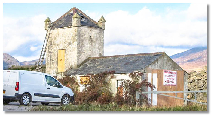 The old Coastguard Station Pidgeon loft
 Image: Eric Jones via CC BY-SA 2.0
When operations ceased in the 1960s the mill was abandoned and fell into disrepair. In 1983 it was acquired by Newry and Mourne District Council who restored and reopened it to the public in 1985. It is now one of Ulster's last working watermills that features a guided tour and an exhibition on windmills and waterpower. Visitors can see the production of flour and oatmeal and grind their own corn or have a browse at the exhibition on milling.
 Annalong's picturesque corn mill on the quayside
Image: Michael Harpur
From a boating point of view, Annalong is the domain of a moderate-sized vessel that can take to the bottom. Those who venture in will find a pretty and secure harbour situated at the foot of the awe-inspiring Mourne Mountains. Those who venture in will find plenty to experience with the mill, its many old cottages and houses in the harbour area. Beyond I there are beautiful walks through the surrounding countryside where hedgerows have long since given way to stone walls.
What facilities are available?
The town of Annalong lies mostly south of the harbour and has a population of almost 2,000. Hence almost all basic provisions and necessities are immediately available including a post office and fuel. There is also a pub overlooking the harbour aptly named the 'Harbour Inn'. There is a small launching slip 200 metres north of the harbour.Any security concerns?
Annalong Quay has a security gate.With thanks to:
Thomas Cunningham - Harbour Master for Carlingford and Irish Lights Commission.A film of Spegla Dam, Kilkeel, Annalong at 5minutes 15 seconds in and Newcastle.
A short view of the harbour.
Annalong harbour at low water
About Annalong Harbour
Annalong's name is thought to have been derived from the Irish 'Áth na Long' meaning 'ford of the ships'. This dates back to raiding Viking longboats. In the early Christian period, the raiders would have been able to land and shelter their boats in the coastal cut formed by the original river mouth.
The pretty harbour dates back to the early 1800sImage: Michael Harpur
The current harbour dates back to the early 1800s and was built to support the exportation of dressed Mourne Mountain granite. Local masons built up such expertise that in time different types of granite were imported to be cut and polished by the stone masons of Annalong. Consequently, the harbour was enlarged to receive schooners carrying granite back and forth to English cities. Between 1904 and 1922 the harbour was the base that was used by the Belfast Water Commissioners to import materials for the construction of the nearby Silent Valley Reservoir.
The Silent Valley ReservoirImage: Ania via CC BY 2.0
The Silent Valley Reservoir was built to gather water from the Mourne Mountains and remains to this day the main water supply source for most of County Down and a large part of Belfast. This was an enormous undertaking and a purpose-built standard-gauge railway was built from Annalong to the dam to transport the reservoir’s construction material. The project included the construction of the spectacular drystone Mourne Wall which took 18 years to complete and is an engineering phenomenon in itself.
The Mourne Wall marching across its peaksImage: Peter Adamson via CC BY-SA 3.0
The wall was created to stop livestock from reaching the reservoir's catchment area of the Rivers Kilkeel and Annalong. In the event, poor geological conditions meant the Annalong River couldn’t be dammed, and its waters were diverted to the Silent Valley Reservoir via a 3.6km tunnel beneath Slieve Binnian.
The Mourne Wall ascendingImage: Tourism Ireland
The Mourn Wall marches for more than 35 KM (22 miles) and crosses the summits of fifteen surrounding peaks including the highest, Slieve Donard (853m). Entirely crafted from natural granite stone, using traditional dry stone walling techniques, it has an average width of 0.8 to 0.9 metres and a height of 1.5 metres.
Slieve Commedagh, Summit Shelter on the Mourne Wall (built 1913)Image: Nick via CC BY 3.0
But the mariners who supported these craftsmen did so at their peril. This is a dangerous coast as is indicated by the construction of the coastguard house and rocket tower situated on the Kilkeel side of Annalong. Its tower once housed pigeons which were used as couriers between the coastguard stations. The garage housed a rocket launcher which fired ropes to boats which all too often ran aground during the 18th and 19th centuries.
The old derelict Coastguard Station Image: Eric Jones via CC BY-SA 2.0
The old Coastguard Station Pidgeon loft Image: Eric Jones via CC BY-SA 2.0
When operations ceased in the 1960s the mill was abandoned and fell into disrepair. In 1983 it was acquired by Newry and Mourne District Council who restored and reopened it to the public in 1985. It is now one of Ulster's last working watermills that features a guided tour and an exhibition on windmills and waterpower. Visitors can see the production of flour and oatmeal and grind their own corn or have a browse at the exhibition on milling.
Annalong's picturesque corn mill on the quaysideImage: Michael Harpur
From a boating point of view, Annalong is the domain of a moderate-sized vessel that can take to the bottom. Those who venture in will find a pretty and secure harbour situated at the foot of the awe-inspiring Mourne Mountains. Those who venture in will find plenty to experience with the mill, its many old cottages and houses in the harbour area. Beyond I there are beautiful walks through the surrounding countryside where hedgerows have long since given way to stone walls.
Other options in this area
Click the 'Next' and 'Previous' buttons to progress through neighbouring havens in a coastal 'clockwise' or 'anti-clockwise' sequence. Alternatively here are the ten nearest havens available in picture view:
Coastal clockwise:
Kilkeel Harbour - 2.8 miles SWGreencastle - 5.2 miles WSW
Killowen - 6.5 miles W
Rostrevor - 6.6 miles W
Warrenpoint - 7.8 miles W
Coastal anti-clockwise:
Newcastle Harbour - 3.3 miles NDundrum Harbour - 5.6 miles NNE
Killough Harbour - 7.8 miles NE
Ardglass Harbour (Phennick Cove Marina) - 8.5 miles NE
Kilclief Bay - 11.5 miles NE
Navigational pictures
These additional images feature in the 'How to get in' section of our detailed view for Annalong Harbour.


| Detail view | Off |
| Picture view | On |
A film of Spegla Dam, Kilkeel, Annalong at 5minutes 15 seconds in and Newcastle.
A short view of the harbour.
Annalong harbour at low water
 A photograph is worth a thousand words. We are always looking for bright sunny photographs that show this haven and its identifiable features at its best. If you have some images that we could use please upload them here. All we need to know is how you would like to be credited for your work and a brief description of the image if it is not readily apparent. If you would like us to add a hyperlink from the image that goes back to your site please include the desired link and we will be delighted to that for you.
Add your review or comment:
Please log in to leave a review of this haven.
Please note eOceanic makes no guarantee of the validity of this information, we have not visited this haven and do not have first-hand experience to qualify the data. Although the contributors are vetted by peer review as practised authorities, they are in no way, whatsoever, responsible for the accuracy of their contributions. It is essential that you thoroughly check the accuracy and suitability for your vessel of any waypoints offered in any context plus the precision of your GPS. Any data provided on this page is entirely used at your own risk and you must read our legal page if you view data on this site. Free to use sea charts courtesy of Navionics.