

Inside the Quoile River, akin to many of the islands and snug creeks on the western shore, a vessel will find complete protection. Of these, Brandy Bay is a particularly good anchorage for conditions from the southeast. The Lough's enclosed body of water provides sheltered sailing in all weather, all tides and ample marks to make daylight navigation straightforward.

Keyfacts for Brandy Bay (North Salt Island)
Facilities

Nature


Considerations

Protected sectors

Approaches

Shelter

Last modified
November 7th 2022 Summary
A good location with attentive navigation required for access.Facilities
Nature
Considerations
Position and approaches

Expand to new tab or fullscreen
Haven position
 54° 22.743' N, 005° 39.045' W
To the northwest of the center of Salt Island.
What is the initial fix?
The following Quoile River Initial Fix will set up a final approach:
 54° 23.614' N, 005° 38.195' W


What are the key points of the approach?
Offshore details for vessels approaching Strangford Lough from the north are available in northeast Ireland’s coastal overview for Malin Head to Strangford Lough  . Details for vessels approaching from the south are available in eastern Ireland’s coastal overview for Strangford Lough to Dublin Bay . Details of the approaches, tidal timings, the run up The Narrows and onward to Killyleagh, on the Lough's western shore, are covered in the Entering and exiting Strangford Lough route description. The run from Killyleagh is covered in the Quoile
  haven directions.
. Details for vessels approaching from the south are available in eastern Ireland’s coastal overview for Strangford Lough to Dublin Bay . Details of the approaches, tidal timings, the run up The Narrows and onward to Killyleagh, on the Lough's western shore, are covered in the Entering and exiting Strangford Lough route description. The run from Killyleagh is covered in the Quoile haven directions.Not what you need?
Click the 'Next' and 'Previous' buttons to progress through neighbouring havens in a coastal 'clockwise' or 'anti-clockwise' sequence. Below are the ten nearest havens to Brandy Bay (North Salt Island) for your convenience.
Ten nearest havens by straight line charted distance and bearing:
- Salt Island (Southwest) - 0.3 nautical miles SSW
- Moore’s Point - 0.3 nautical miles W
- Salt Island (South) - 0.3 nautical miles SE
- Quoile - 0.9 nautical miles SW
- Killyleagh - 1.1 nautical miles N
- Jackdaw Island - 1.5 nautical miles E
- Between Jackdaw & Chapel Island - 1.8 nautical miles ENE
- Holm Bay - 1.8 nautical miles NNE
- Chapel Island - 2 nautical miles E
- East Down Yacht Club - 2.1 nautical miles N
These havens are ordered by straight line charted distance and bearing, and can be reordered by compass direction or coastal sequence:
- Salt Island (Southwest) - 0.3 miles SSW
- Moore’s Point - 0.3 miles W
- Salt Island (South) - 0.3 miles SE
- Quoile - 0.9 miles SW
- Killyleagh - 1.1 miles N
- Jackdaw Island - 1.5 miles E
- Between Jackdaw & Chapel Island - 1.8 miles ENE
- Holm Bay - 1.8 miles NNE
- Chapel Island - 2 miles E
- East Down Yacht Club - 2.1 miles N

Chart

What's the story here?
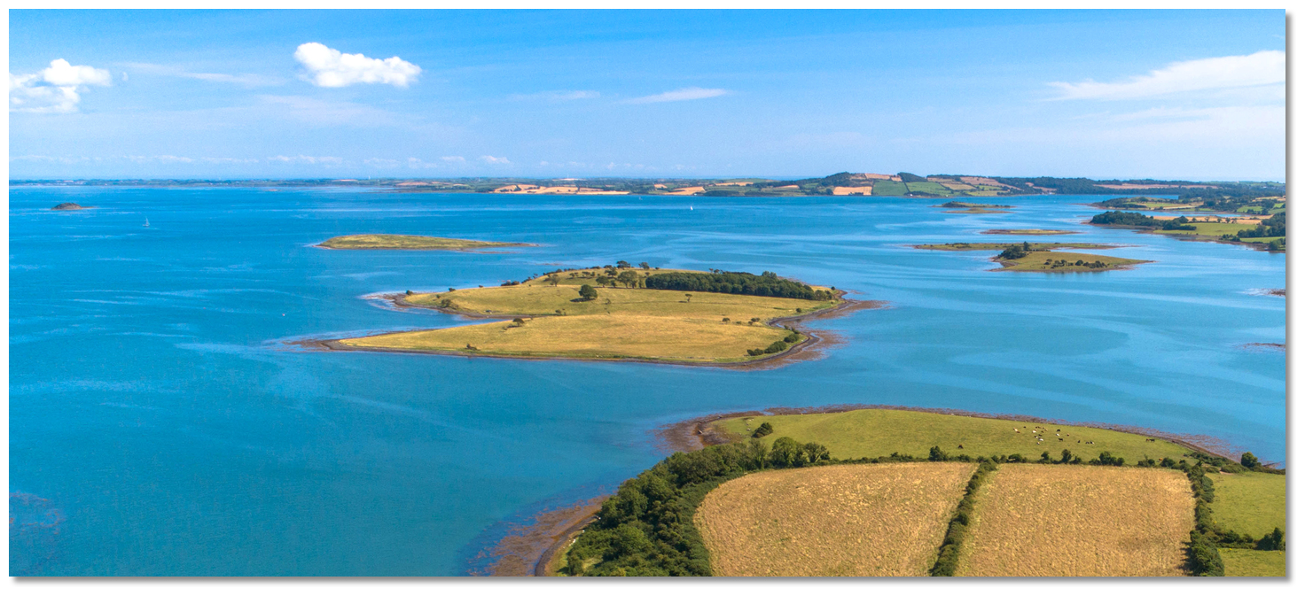 Salt Island as seen from above Gores Island with Green Island in the backdrop
Image: Michael Harpur
Salt Island is located within the Quoile Estuary just over 1 mile south of Killyleagh. It is a small island, about 0.4 miles long and 0.2 miles wide, lying in a northeast/southwest direction. It rises to 13 metres high at its northeast end and the island dries to the shoreline on its southeastern side at low water. Brandy Bay is a small indentation on its northwest-facing side which dries out beyond its points.
The anchorage is off of the points and on the edge of the Quolie River. Brandy Bay is attractive because it has deep water and, unlike other landing points that are subject to mud flats at low tide that can be treacherous, it offers landings at all times. It is also possible to pass around to the landing point fronting the Bothy on the southeast side of the island. The small dilapidated stone jetty here was in the past used to land farm animals but it is today still called upon for landing on the island. It is accessible ±2½ hours of high tide but best avoided outside of this.
How to get in?
.jpg) The passage up river from Killyleagh
The passage up river from Killyleagh (with the small Rat Island centre)
Image: Michael Harpur
 Details of the approaches, tidal timings, the run up The Narrows and onward to Killyleagh, on the Lough's western shore, are covered in the Entering and exiting Strangford Lough route description.
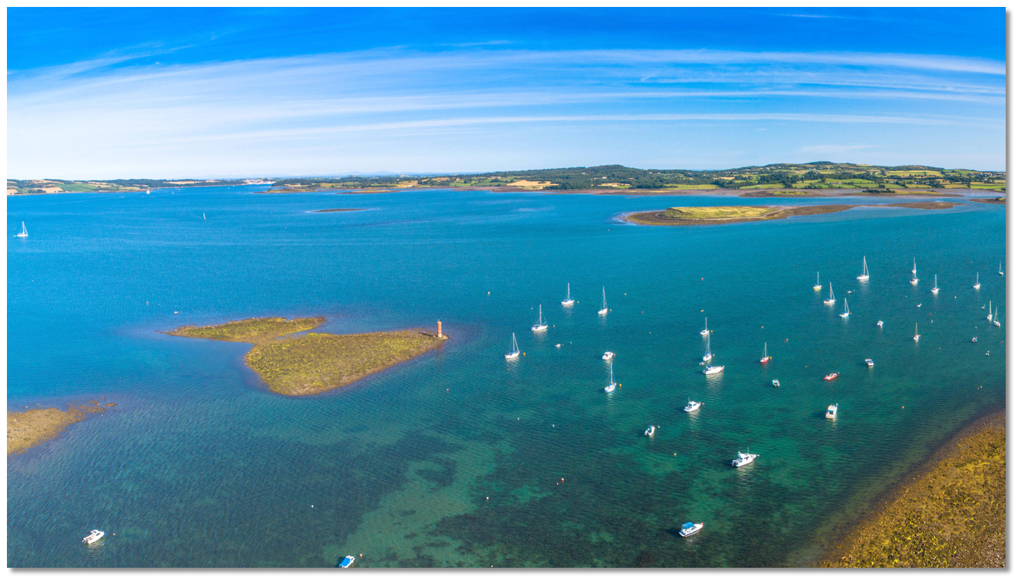 The entrance to the River Quoile as seen from Killyleagh
Image: Michael Harpur
 The Initial Fix places a vessel off Killyleagh and the run up the Quoile River is then covered in the Quoile haven directions.
 Brandy Bay opposite Moore's Point
Image: Michael Harpur
Salt Island will become readily apparent after a ½ mile southwest of Green Island opposite Moore’s Point. Proceed to Salt Island steering for the centre of the points on either side of the small indentation of Brandy Bay.
 Brandy Bay as seen from the anchoring area
Image: Michael Harpur
Anchor according to draft off the bay where excellent holding is to be found. Land on the beach between its points.Why visit here?
Salt Island is one of the many picturesque islands in Strangford Lough owned and preserved for future generations by the National Trust. Information on the island is covered in the Salt Island (South) haven entry that leads to the island's old stone quay.From a boating point of view, Brandy Bay is an ideal anchorage to acquire protection from the southeast. It is a favourite location with the local boatmen planning on picnicking on the island as unlike any other part of the island it is accessible at all times.
What facilities are available?
There are no facilities at this river anchorage save the beach to land upon.Any security concerns?
Never a problem known to have occurred off Salt Island.With thanks to:
Brian Crawford, local Strangford Lough boatman of many decades. eOceanic would like to thank Quoile Yacht Club for hosting our survey boat during the survey of Strangford Lough.


Add your review or comment:
Please log in to leave a review of this haven.
Please note eOceanic makes no guarantee of the validity of this information, we have not visited this haven and do not have first-hand experience to qualify the data. Although the contributors are vetted by peer review as practised authorities, they are in no way, whatsoever, responsible for the accuracy of their contributions. It is essential that you thoroughly check the accuracy and suitability for your vessel of any waypoints offered in any context plus the precision of your GPS. Any data provided on this page is entirely used at your own risk and you must read our legal page if you view data on this site. Free to use sea charts courtesy of Navionics.