

Inside the Quoile River, akin to many of the islands and snug creeks on the western shore, a vessel will find complete protection but this is a tidal anchorage that is the reserve of vessels that can take to the bottom. The Lough's enclosed body of water provides sheltered sailing in all weather, all tides and ample marks to make daylight navigation straightforward.

Keyfacts for Salt Island (South)
Facilities

Nature


Considerations

Protected sectors

Approaches

Shelter

Last modified
November 7th 2022 Summary
A completely protected location with attentive navigation required for access.Facilities
Nature
Considerations
Position and approaches

Expand to new tab or fullscreen
Haven position
 54° 22.485' N, 005° 38.649' W
South of Salt Island off the Bothy and pier.
What is the initial fix?
The following Quoile River Initial Fix will set up a final approach:
 54° 23.614' N, 005° 38.195' W


What are the key points of the approach?
Offshore details for vessels approaching Strangford Lough from the north are available in northeast Ireland’s coastal overview for Malin Head to Strangford Lough  . Details for vessels approaching from the south are available in eastern Ireland’s coastal overview for Strangford Lough to Dublin Bay . Details of the approaches, tidal timings, the run up The Narrows and onward to Killyleagh, on the Lough's western shore, are covered in the Entering and exiting Strangford Lough route description. The run from Killyleagh is covered in the Quoile
  haven directions.
. Details for vessels approaching from the south are available in eastern Ireland’s coastal overview for Strangford Lough to Dublin Bay . Details of the approaches, tidal timings, the run up The Narrows and onward to Killyleagh, on the Lough's western shore, are covered in the Entering and exiting Strangford Lough route description. The run from Killyleagh is covered in the Quoile haven directions.Not what you need?
Click the 'Next' and 'Previous' buttons to progress through neighbouring havens in a coastal 'clockwise' or 'anti-clockwise' sequence. Below are the ten nearest havens to Salt Island (South) for your convenience.
Ten nearest havens by straight line charted distance and bearing:
- Brandy Bay (North Salt Island) - 0.3 nautical miles NW
- Salt Island (Southwest) - 0.3 nautical miles W
- Moore’s Point - 0.6 nautical miles WNW
- Quoile - 1 nautical miles WSW
- Jackdaw Island - 1.3 nautical miles ENE
- Killyleagh - 1.4 nautical miles N
- Between Jackdaw & Chapel Island - 1.6 nautical miles ENE
- Chapel Island - 1.8 nautical miles ENE
- Holm Bay - 2 nautical miles N
- Audley’s Point - 2.3 nautical miles ENE
These havens are ordered by straight line charted distance and bearing, and can be reordered by compass direction or coastal sequence:
- Brandy Bay (North Salt Island) - 0.3 miles NW
- Salt Island (Southwest) - 0.3 miles W
- Moore’s Point - 0.6 miles WNW
- Quoile - 1 miles WSW
- Jackdaw Island - 1.3 miles ENE
- Killyleagh - 1.4 miles N
- Between Jackdaw & Chapel Island - 1.6 miles ENE
- Chapel Island - 1.8 miles ENE
- Holm Bay - 2 miles N
- Audley’s Point - 2.3 miles ENE

Chart

What's the story here?
 Salt Island
Image: Michael Harpur
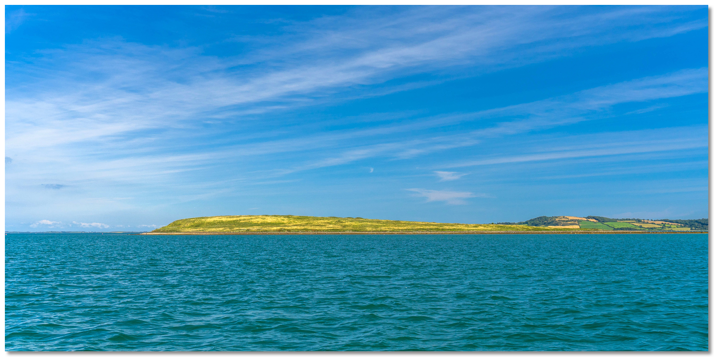
Salt Island is located within the Quoile Estuary just over 1 mile south of Killyleagh. It is a small island, about 0.4 miles long and 0.2 miles wide, lying in a northeast/southwest direction. It rises to 13 metres high at its northeast end and the island dries to the shoreline on its southeastern side at low water. Today it is completely owned by the National Trust which has established a Bothy which offers basic shelter and toilets but no electricity and it is also possible to camp on the island.
 The Bothy and the landing area
Image: Michael Harpur
The anchorage off the southeast side of the island offers complete protection. For shoal draft vessels it also offers a short tidal stop that is convenient to the island landing point fronting the Bothy. This is accessible for up to ±2½ hours of high tide but avoided outside of this as the extensive mud flats at low tide can be treacherous. Brandy Bay, on the northwestern side, is accessible, with care, at all times and is about five minutes walk to the Bothy.
How to get in?
 Salt Island with Killyleagh and Green Island in the backdrop
Image: Michael Harpur
 Details of the approaches, tidal timings, the run up The Narrows and onward to Killyleagh, on the Lough's western shore, are covered in the Entering and exiting Strangford Lough route description.
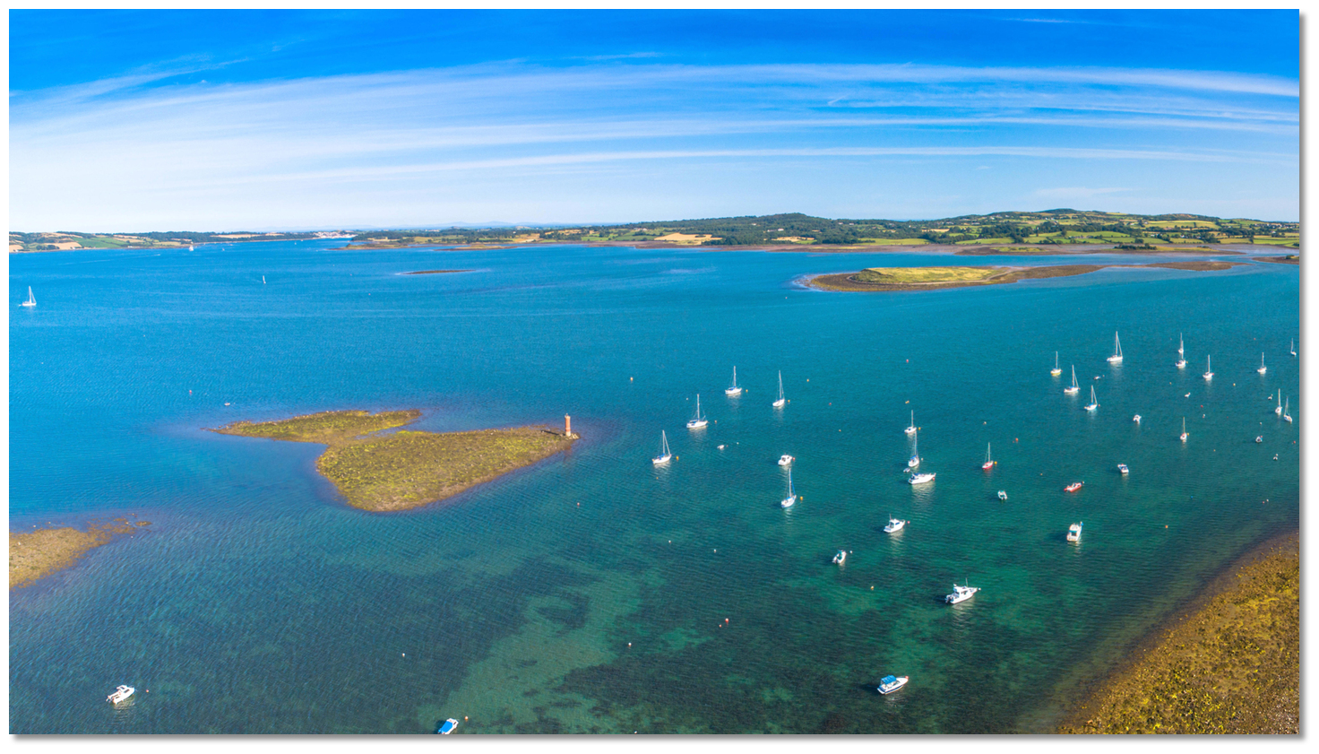 The entrance to the River Quoile as seen from Killyleagh
Image: Michael Harpur
 The Initial Fix places a vessel off Killyleagh and the run up the Quoile River is then covered in the Quoile haven directions.
_on_the_opposite_northwest_shore_.jpg) Moore's Point (right) on the opposite northwest shore
Moore's Point (right) on the opposite northwest shore Image: Michael Harpur
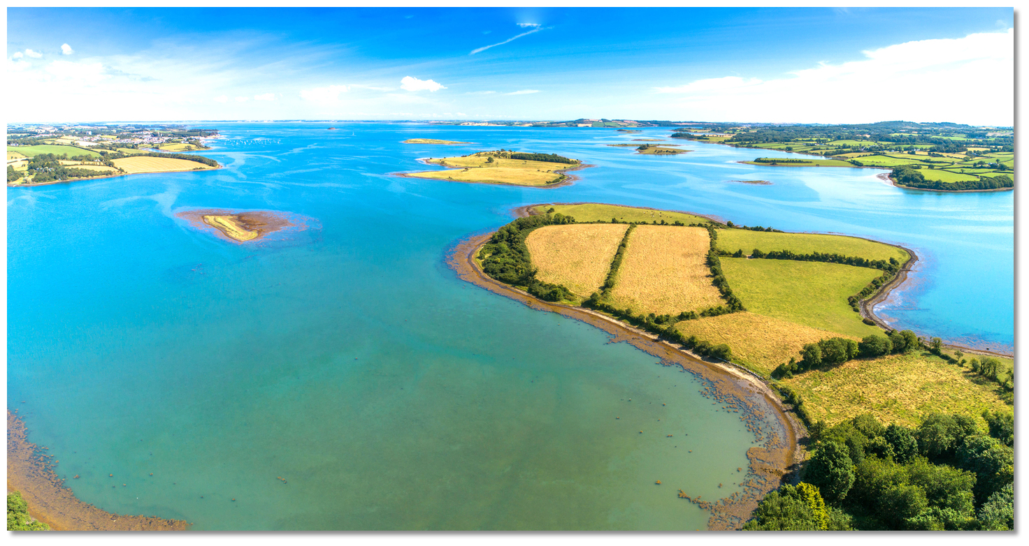
Salt Island will become readily apparent after a ½ mile southwest of Green Island opposite Moore’s Point. Proceed to Salt Island and with a suitable rise pass around its northeastern or southwestern side.
 Wee Wile seen from above Salt Island with Green Island in the backdrop
Image: Michael Harpur
The southwestern end, between Salt Island and Rat then Gores island, is the preferred pathway. It is clear and always has deep water in which there is anchoring opportunity. The northwest end of the island has Wee Wile Rock which dries to 0.3 metres.
 Green Island and Salt Island as seen from the River Quoile
Image: Michael Harpur
Anchor in a depth to your preference where excellent holding is to be found. Be aware this entire area dries to substantial mud flats at low tide. Land at the old pier below the Bothy on the top third of the tide or round the island to Brandy Bay.
Why visit here?
It is not known how Salt Island acquired its name. It could have come from Viking times where the Norse word 'Saltøy' means 'salt island'. The placename could bear testament to small-scale salt production as it is recorded that in 1300, Ireland was exporting salt to supply Edward I’s army in Scotland. There is also evidence of salt manufacture on the nearby mainland during the later Middle Ages. The remains of the medieval abbey on the Saul site
Image: Eric Jones via CC BY-SA 3.0
It is here that Saint Patrick died on the 17th of March 461 A.D. at the age 78 years and he was buried in nearby Downpatrick. Saul's early Christian Monastery survived for over three centuries before being destroyed by Viking raids. It was later replaced by a medieval abbey, which was plundered by Edward Bruce when he invaded Ireland in 1315. A Church of Ireland church was built there in 1932 to commemorate the 1500th anniversary of Patrick’s arrival.
.jpg) The Death of St. Patrick, the apostle of Ireland. At the Monastery of Saul in
The Death of St. Patrick, the apostle of Ireland. At the Monastery of Saul inUlidia (Ulster)
Image: Public Domain
Although there was no barn on the island it is most likely that it was used in the 1700s for warehousing activities. Then it is thought that it served as a convenient location to avoid excise duties applicable at Quoile Quay. The convenient Brandy Bay, adjacent to the river and accessible at all times, would make the perfect point to drop off illicit liquor on the way upriver. As the old saying goes… in Ireland, the only way that two men can keep a secret is for one of them to be dead. Doubtlessly this is how the inlet acquired the name Brandy Bay.
 St Patrick's Church Saul today
Image: Tourism NI
It was owned by Lord Bangor (who lived at Castle Ward) in 1836 but it appears that there were no dwellings on the Island at that time. The island was farmed and there is still evidence of mid to late Victorian paddocks, 'lazy beds', stone banks and remnants of hedges. A farm cottage did exist after Lord Bangor's time and old maps indicate there were several wells on the island. The original dwelling was used as a bothy, (taken from the term bunkhouse) after The National purchased the island in 1980. In about 1987 and with the help of volunteers the National Trust planted the trees now seen directly behind the Bothy. However, repeated vandalism led to its closure in the late 90s where it was reduced to function as a sheep house.
 Salt Island is part of the drumlin belt stretching into Strangford Lough to the
Ards Peninsula
Image: Michael Harpur
Today Salt Island is a fully owned National Trust island that will be preserved for future generations. Happily, they restored the bothy in 2008 from the stones of the original building. It offers basic shelter for up to 12 people with running water, wood burning stove, and toilets. The bothy is locked when not in use and advance booking is essential to gain access. For bookings and further information contact The National Trust on +44 28 4488 1204. There are also two official camping areas on the island – one within the bothy grounds and one on the opposite northwest side of the island. It is a wonderful place to go for a walk or even stay over camping.
From a boating point of view, this tidal anchorage is the closest location to the small dilapidated stone jetty. In the past, it was used to land farm animals but it is today still called upon for landing on the island.
What facilities are available?
There are no facilities in this river anchorage.Any security concerns?
Never a problem known to have occurred off Salt Island.With thanks to:
Brian Crawford, local Strangford Lough boatman of many decades. eOceanic would like to thank Quoile Yacht Club for hosting our survey boat during the survey of Strangford Lough.
Green Island as seen from the River Quoile
Image: Michael Harpur


Add your review or comment:
Please log in to leave a review of this haven.
Please note eOceanic makes no guarantee of the validity of this information, we have not visited this haven and do not have first-hand experience to qualify the data. Although the contributors are vetted by peer review as practised authorities, they are in no way, whatsoever, responsible for the accuracy of their contributions. It is essential that you thoroughly check the accuracy and suitability for your vessel of any waypoints offered in any context plus the precision of your GPS. Any data provided on this page is entirely used at your own risk and you must read our legal page if you view data on this site. Free to use sea charts courtesy of Navionics.