

Holm Bay is a good anchorage with westerlies or north-westerlies but it is uncomfortable in anything from the south round through east to northeast. The Lough's enclosed body of water provides sheltered sailing in all weather, all tides and ample marks to make daylight navigation straightforward.

Keyfacts for Holm Bay
Facilities
None listedNature


Considerations

Protected sectors

Approaches

Shelter

Last modified
November 7th 2022 Summary
A good location with attentive navigation required for access.Facilities
None listedNature
Considerations
Position and approaches

Expand to new tab or fullscreen
Haven position
 54° 24.460' N, 005° 38.200' W
300 metres offshore in a depth of around six metres.
What is the initial fix?
The following Holm Bay Initial Fix will set up a final approach:
 54° 23.900' N, 005° 38.060' W


What are the key points of the approach?
Offshore details for vessels approaching Strangford Lough from the north are available in the northeast Ireland’s Coastal Overview for Malin Head to Strangford Lough  . Details for vessels approaching from the south are available in eastern Ireland’s Coastal Overview for Strangford Lough to Dublin Bay . Details of the approaches, tidal timings, the run up The Narrows and onward to Killyleagh, on the Lough's western shore, are covered in the Entering and exiting Strangford Lough route description.
. Details for vessels approaching from the south are available in eastern Ireland’s Coastal Overview for Strangford Lough to Dublin Bay . Details of the approaches, tidal timings, the run up The Narrows and onward to Killyleagh, on the Lough's western shore, are covered in the Entering and exiting Strangford Lough route description.Not what you need?
Click the 'Next' and 'Previous' buttons to progress through neighbouring havens in a coastal 'clockwise' or 'anti-clockwise' sequence. Below are the ten nearest havens to Holm Bay for your convenience.
Ten nearest havens by straight line charted distance and bearing:
- East Down Yacht Club - 0.5 nautical miles NNW
- Don O’Neill Island - 0.7 nautical miles ENE
- Killyleagh - 0.7 nautical miles SSW
- Simmy Island - 1.1 nautical miles N
- Jackdaw Island - 1.8 nautical miles SSE
- Brandy Bay (North Salt Island) - 1.8 nautical miles SSW
- Between Jackdaw & Chapel Island - 1.9 nautical miles SE
- Moore’s Point - 1.9 nautical miles SSW
- Salt Island (South) - 2 nautical miles S
- Pawle Island - 2 nautical miles N
These havens are ordered by straight line charted distance and bearing, and can be reordered by compass direction or coastal sequence:
- East Down Yacht Club - 0.5 miles NNW
- Don O’Neill Island - 0.7 miles ENE
- Killyleagh - 0.7 miles SSW
- Simmy Island - 1.1 miles N
- Jackdaw Island - 1.8 miles SSE
- Brandy Bay (North Salt Island) - 1.8 miles SSW
- Between Jackdaw & Chapel Island - 1.9 miles SE
- Moore’s Point - 1.9 miles SSW
- Salt Island (South) - 2 miles S
- Pawle Island - 2 miles N

Chart

What's the story here?
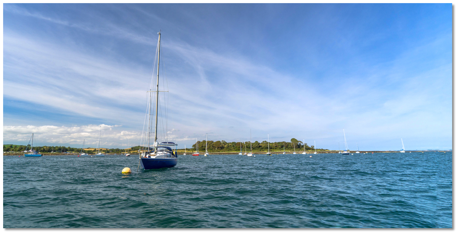
 Holm Bay
Image: Michael Harpur
Holm Bay, locally pronounced 'Home Bay', lies off the western shore of Strangford Lough, ¾ of a mile northwestward of Killyleagh and to the south of Island Taggart. It provides an anchorage in a rural setting or the option to pick up visitor moorings.
 Island Taggart, to the north of Holm Bay, with East Down Yacht Club within
Image: Michael Harpur
The bay is largely used as a tide wait to enter the channel to the East Down Yacht Club, which is located inshore of the island, but it makes for a perfectly good berth of itself as is evident by its many local boat moorings and visitor moorings.
How to get in?
 The run northward to Holm Bay from Killyleagh
Image: Michael Harpur
 Details of the approaches, tidal timings, the run up The Narrows and onward to Killyleagh, on the Lough's western shore, are covered in the Entering and exiting Strangford Lough route description. Having entered Strangford Lough make for the Quoile River Initial Fix set at the mouth of the River Quoile. Then turn north to pass the Mill Rock, a ¼ northward of Town Rock Beacon with a marker pole, and pass inside the Barrel Rock which should be given a sensible distance.
Image: Michael Harpur
It is possible to cut directly for the entrance to Holm Bay by passing between Barrel and Long Rocks. This is the most direct route, a distance of just under 2 miles from the Lough’s entrance but it is likely to take a vessel directly over McLaughlin Rock.
McLaughlin Rock - awash pinnacle rock, unmarked position: 54˚ 23.976'N 5˚ 36.915'W
The unmarked McLaughlin Rock has charted cover of 2.7 metres but with a charted awash pinnacle rock at its northwest end which presents the problem. During the season this route could be made easier by Club Race Marks as the N Race Marker is normally moored at McLaughlin Rock. The Y Race Marker is also moored centrally between Barrel and Long Rocks.
 Long Rock and the No. 8 race mark
Image: Michael Harpur
Additionally, Long Rock has race mark No. 8 off of its northwest corner. Barrel Rock, which uncovers at low water, also marked by a perch, normally has a racing mark 4 to the southeast and a racing mark U to the northwest. It is also important to stay central between Barrel and Long Rocks as there is an outcropping to the southwest of Long Rock. Once between these two reefs it is safe to proceed into Holm Bay.
 Anchor outside the local boat moorings or pick up a visitor mooring
Image: Michael Harpur
Anchor according to draft outside the moorings or pick up one of the three clearly marked visitors’ moorings. Land at the slip which has road access.Why visit here?
Holm Bay takes its name from the Viking 'holm' which means 'an island' and the name most likely refers to the several islands that enclose it immediately offshore. This in time has been anglicised and transferred to 'home bay' which it is colloquially known as today. Holm Bay, a beautiful anchorage on a beautiful Lough
Image: Michael Harpur
Holm Bay is another quiet location in a Lough that offers endless anchoring opportunities in an area of outstanding beauty. It is possible to land and the is a rewarding marked walk immediately ashore. The 3.64 km (2.3 miles) walk passes along the Holm Bay shoreline through to the town of Killyleagh then looping back along the shore over the Dibney River that exits at Killyleagh Quay. The shore section of this walk is rough underfoot and is best done at low tide.
 Holm Bay as seen from the shore
Image: Eric Jones via CC BY-SA 2.0
In its course, the walk passes Killyleagh Castle which dates back to the 1600s and is the oldest in Ireland that is still inhabited. The Town Rock Beacon brick tower was built as a navigational aid for commercial vessels when Killyleagh was a busy port. The Killowen Graveyard houses many of the victims of the first Irish Famine. A house that is called 'Fools Penny' above a double boathouse is also worthy of note in local boating lore. It was so named as a caveat to the generosity of drinkers. The Lady who built it was a publican and it was built entirely on the tips she received.
What facilities are available?
There are no facilities in Holm Bay save for the moorings. ‘East Down Yacht Club’ (EDYC) located inside Taggart Island, half a mile away, has good facilities for both cruising and racing boats with a nine acre site, which includes a modern clubhouse, a caravan and camping park, car parking, a boat-park and slipway. Fresh water is available on the pontoon but no power.A mile to the south is Killyleagh, the largest town on Strangford Lough with a population of almost two and half thousand. The town has good shopping plus a basic chandlery, garage, bank, taxis and buses. It is situated on the A22 road to Downpatrick which is a sizeable town that serves as a commercial and administrative centre for the locality.
Any security concerns?
Never a problem known to have occurred at Holm Bay.With thanks to:
Brian Crawford, local Strangford Lough boatman of many decades. eOceanic would like to thank Quoile Yacht Club for hosting our survey boat during the survey of Strangford Lough.


Add your review or comment:
Please log in to leave a review of this haven.
Please note eOceanic makes no guarantee of the validity of this information, we have not visited this haven and do not have first-hand experience to qualify the data. Although the contributors are vetted by peer review as practised authorities, they are in no way, whatsoever, responsible for the accuracy of their contributions. It is essential that you thoroughly check the accuracy and suitability for your vessel of any waypoints offered in any context plus the precision of your GPS. Any data provided on this page is entirely used at your own risk and you must read our legal page if you view data on this site. Free to use sea charts courtesy of Navionics.