
Pawle Island is located on the northeast coast of Ireland, off the western shore of Strangford Lough to the east of Islandmore off the approaches to Ringhaddy Sound. It is a quiet and out of the way anchorage.
Tucked in between Islandmore and Pawle this is a very good anchorage. It offers excellent northerly and westerly protection but has marginal exposure to hard southerlies where it may become uncomfortable. The Lough's enclosed body of water provides sheltered sailing in all weather, all tides and ample marks to make daylight navigation straightforward.

Keyfacts for Pawle Island


Last modified
November 7th 2022 Summary* Restrictions apply
A good location with attentive navigation required for access.Facilities
None listedNature


Considerations


Position and approaches

Expand to new tab or fullscreen
Haven position
 54° 26.464' N, 005° 37.600' W
East of Eaglehill Point on the southeast side of Islandmore and Pawl Island, favouring the Islandmore side of the gap.
What is the initial fix?
The following Ringhaddy Initial Fix will set up a final approach:
 54° 25.258' N, 005° 35.657' W


What are the key points of the approach?
Offshore details for vessels approaching Strangford Lough from the north are available in northeast Ireland’s Coastal Overview for Malin Head to Strangford Lough  . Details for vessels approaching from the south are available in eastern Ireland’s Coastal Overview for Strangford Lough to Dublin Bay . Details of the approaches, tidal timings, the run up The Narrows and onward to Killyleagh, on the Lough's western shore, are covered in the Entering and exiting Strangford Lough route description. Closer approaches are available in the Ringhaddy Sound
  entry.
. Details for vessels approaching from the south are available in eastern Ireland’s Coastal Overview for Strangford Lough to Dublin Bay . Details of the approaches, tidal timings, the run up The Narrows and onward to Killyleagh, on the Lough's western shore, are covered in the Entering and exiting Strangford Lough route description. Closer approaches are available in the Ringhaddy Sound entry. Not what you need?
Click the 'Next' and 'Previous' buttons to progress through neighbouring havens in a coastal 'clockwise' or 'anti-clockwise' sequence. Below are the ten nearest havens to Pawle Island for your convenience.
Ten nearest havens by straight line charted distance and bearing:
- Ringhaddy Sound - 0.5 nautical miles NNW
- Simmy Island - 0.9 nautical miles SSW
- East Down Yacht Club - 1.7 nautical miles SSW
- Don O’Neill Island - 1.8 nautical miles S
- Holm Bay - 2 nautical miles S
- White Rock Bay - 2.6 nautical miles N
- Killyleagh - 2.7 nautical miles SSW
- Ballydorn and Down Cruising Club - 3.1 nautical miles NNW
- Between Jackdaw & Chapel Island - 3.5 nautical miles SSE
- Jackdaw Island - 3.6 nautical miles S
These havens are ordered by straight line charted distance and bearing, and can be reordered by compass direction or coastal sequence:
- Ringhaddy Sound - 0.5 miles NNW
- Simmy Island - 0.9 miles SSW
- East Down Yacht Club - 1.7 miles SSW
- Don O’Neill Island - 1.8 miles S
- Holm Bay - 2 miles S
- White Rock Bay - 2.6 miles N
- Killyleagh - 2.7 miles SSW
- Ballydorn and Down Cruising Club - 3.1 miles NNW
- Between Jackdaw & Chapel Island - 3.5 miles SSE
- Jackdaw Island - 3.6 miles S


What's the story here?
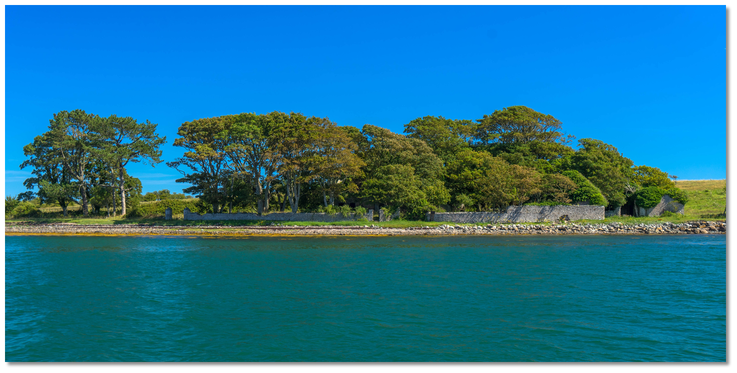 The remains of Pawle Island's small farmstead
Image: Michael Harpur
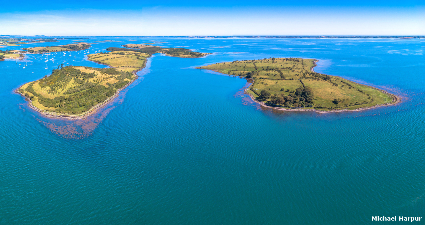
Pawle Island is a small uninhabited 49 acres island located off the western shore of Strangford Lough close southwest of Islandmore. It is privately owned and no landings may take place above the high water mark without permission. Located on the opposite side of Islandmore Close to the resources of Ringhaddy Cruising Club, located in Ringhaddy Sound, a provides a remote sequestered anchorage in an area of outstanding beauty.
The anchorage lies between Islandmore and Pawle Island and was historically known as Sliddery Bay but now is often referred to as Pawle Sound. It offers excellent protection and holding.
How to get in?
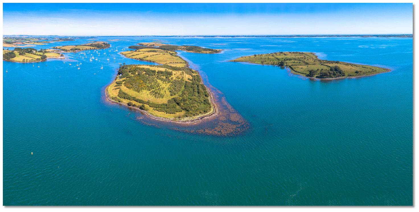 Ringhaddy Sound within Islandmore and Pawle Island
Image: Michael Harpur
 Use the approaches, tidal timings, the run up The Narrows and onward to Killyleagh, on the Lough's western shore, as covered in the Entering and exiting Strangford Lough route description. Closer approaches are available in the Ringhaddy Sound entry. Break off the route and pass midway into the gap between Pawle Island and Eaglehill Point at the southern end of Islandmore. Slowly sound it as it shallows 100 metres in from a line joining the two points of the islands.
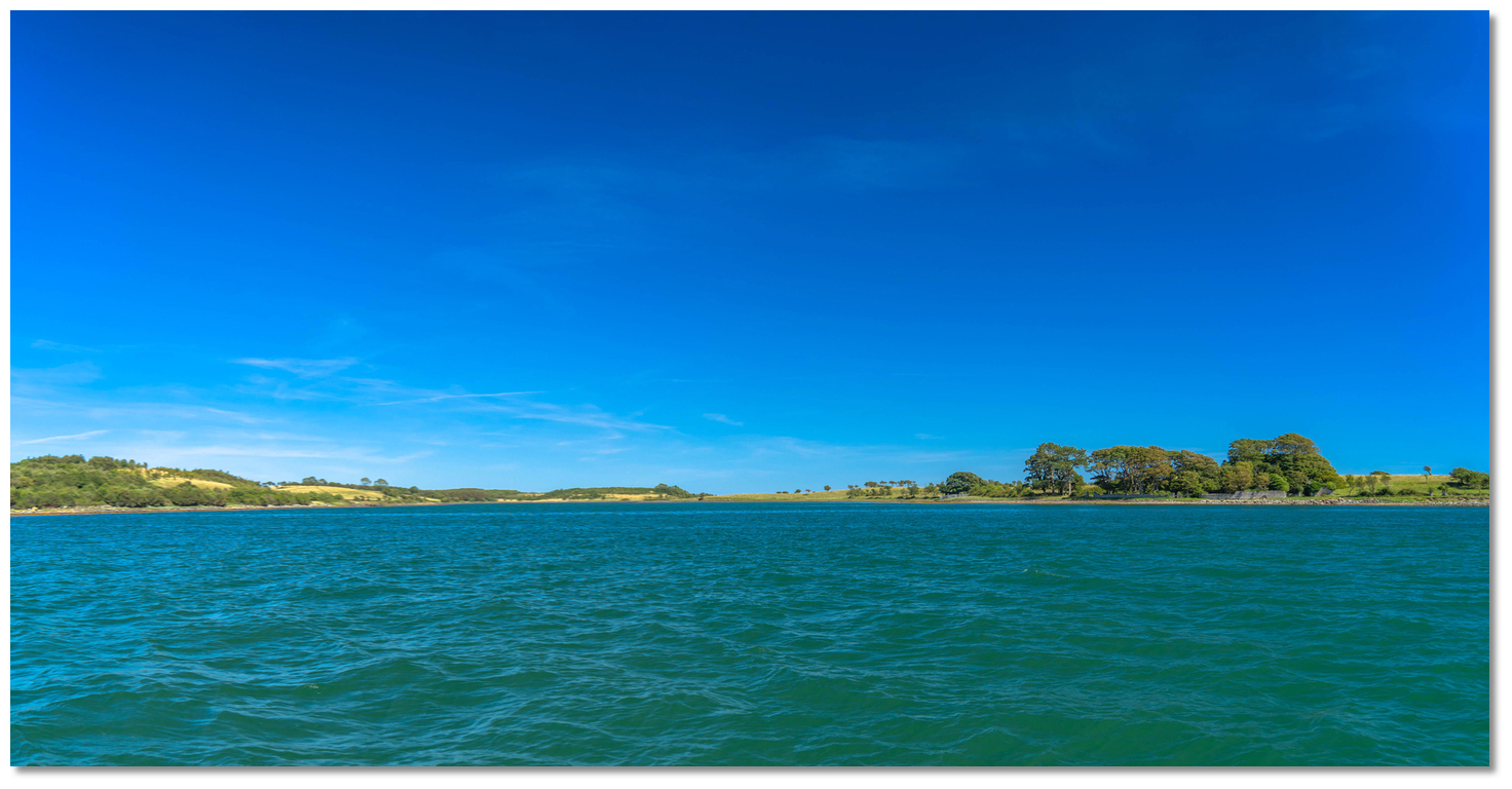 Approaching the anchorage between Islandmore and Pawle Island
Image: Michael Harpur
The best anchor area is relatively close to the shore where good mud holding will be found. Expect up to 2 knots of current on Springs.Why visit here?
Pawle island, pronounced 'pole island', most likely took its name from St Paul. Small islands like this offered isolation from society to those seeking solace and a sense of being closer to god and they were in widespread use.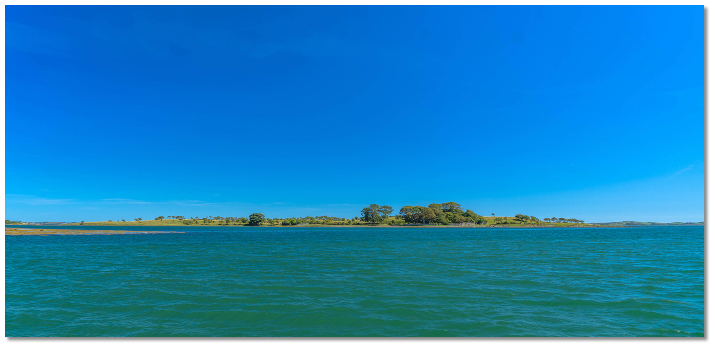 Pawle Island as seen around Islandmore's Eaglehill Point
Image: Michael Harpur
It would have been an ideal location for a hermitage offering ample food via fish traps and shellfish and a freshwater source that enabled self-sufficiency, along with island isolation.
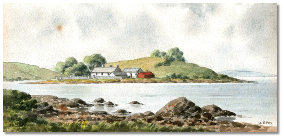 19th-century depiction of the Pawl Island farmstead
Image: Public Domain
It is owned today by a farmer who would prefer no unauthorised use but is reportedly open to requests to land. As the island is a very pleasant picnic location it is well worth seeking permission. Those who obtain permission should take a stroll to the top of the hill behind the house which offers a spectacular panoramic view of the southern half of Strangford Lough. Those who do not land can enjoy relaxing in the cockpit keeping an eye on boats coming in and out of Ringhaddy Sound.
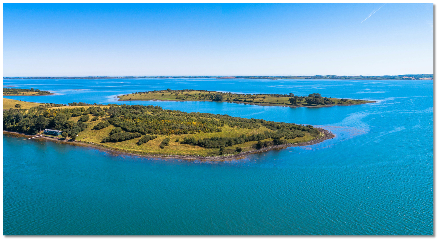 Pawle Island as seen over the southern end of Islandmore
Image: Michael Harpur
From a boating point of view, this is a very pleasant out-of-the-way anchorage that offers very good protection in a beautiful natural setting. It may also be called upon as a tide-wait for Ringhaddy Sound or a place to avoid any discomfort experienced in the Sound with wind-over-tide during strong northerlies.
What facilities are available?
There are no facilities at Pawle Island. Visitors are welcome to use the amenities of water and power on the pontoons of Ringhaddy Cruising Club.Any security concerns?
Never an issue known to have occurred at this remote anchorage.With thanks to:
Brian Crawford, local Strangford Lough boatman of many decades. eOceanic would like to thank Quoile Yacht Club for hosting our survey boat during the survey of Strangford Lough.
About Pawle Island
Pawle island, pronounced 'pole island', most likely took its name from St Paul. Small islands like this offered isolation from society to those seeking solace and a sense of being closer to god and they were in widespread use.
Pawle Island as seen around Islandmore's Eaglehill PointImage: Michael Harpur
It would have been an ideal location for a hermitage offering ample food via fish traps and shellfish and a freshwater source that enabled self-sufficiency, along with island isolation.
19th-century depiction of the Pawl Island farmsteadImage: Public Domain
It is owned today by a farmer who would prefer no unauthorised use but is reportedly open to requests to land. As the island is a very pleasant picnic location it is well worth seeking permission. Those who obtain permission should take a stroll to the top of the hill behind the house which offers a spectacular panoramic view of the southern half of Strangford Lough. Those who do not land can enjoy relaxing in the cockpit keeping an eye on boats coming in and out of Ringhaddy Sound.
Pawle Island as seen over the southern end of IslandmoreImage: Michael Harpur
From a boating point of view, this is a very pleasant out-of-the-way anchorage that offers very good protection in a beautiful natural setting. It may also be called upon as a tide-wait for Ringhaddy Sound or a place to avoid any discomfort experienced in the Sound with wind-over-tide during strong northerlies.
Other options in this area
Click the 'Next' and 'Previous' buttons to progress through neighbouring havens in a coastal 'clockwise' or 'anti-clockwise' sequence. Alternatively here are the ten nearest havens available in picture view:
Coastal clockwise:
Simmy Island - 0.6 miles SSWEast Down Yacht Club - 1 miles SSW
Don O’Neill Island - 1.1 miles S
Holm Bay - 1.3 miles S
Killyleagh - 1.7 miles SSW
Coastal anti-clockwise:
Ringhaddy Sound - 0.3 miles NNWWhite Rock Bay - 1.6 miles N
Ballydorn and Down Cruising Club - 1.9 miles NNW
Kircubbin - 2.7 miles NE
Ballyhenry Bay - 2.4 miles SE
Navigational pictures
These additional images feature in the 'How to get in' section of our detailed view for Pawle Island.


| Detail view | Off |
| Picture view | On |
Add your review or comment:
Please log in to leave a review of this haven.
Please note eOceanic makes no guarantee of the validity of this information, we have not visited this haven and do not have first-hand experience to qualify the data. Although the contributors are vetted by peer review as practised authorities, they are in no way, whatsoever, responsible for the accuracy of their contributions. It is essential that you thoroughly check the accuracy and suitability for your vessel of any waypoints offered in any context plus the precision of your GPS. Any data provided on this page is entirely used at your own risk and you must read our legal page if you view data on this site. Free to use sea charts courtesy of Navionics.