

Newcastle Harbour is located on the northeastern coast of Ireland, about midway between the entrances to Carlingford and Strangford Loughs and the western shore of Dundrum Bay. It is a small drying harbour that is used by small fishing boats and leisure craft. The harbour is only suitable for vessels that can take to the bottom and being small is only practical for vessels of up to about ten metres. Larger craft may anchor outside and/or temporarily come alongside on a rise of the tide.
The harbour offers good protection except in strong southeast, through east, to northeast winds that cause a heavy scend. Access to the harbour is straightforward on a sufficient rise except in any developed conditions from the above directions.


Keyfacts for Newcastle Harbour


Last modified
September 14th 2022 Summary* Restrictions apply
A good location with straightforward access.Facilities


Nature


Considerations


 +44 7923 642 125
 nycltd@hotmail.co.uk
Position and approaches

Expand to new tab or fullscreen
Haven position
 54° 11.874' N, 005° 53.078' W
This is in the middle of the enclosed harbour.
What is the initial fix?
The following Newcastle Initial Fix will set up a final approach:
 54° 11.831' N, 005° 51.087' W


What are the key points of the approach?
Offshore details are available in eastern Ireland’s Coastal Overview for Strangford Lough to Dublin Bay  .
.
.- Pass to the south of the two Ballykinlar Firing Range Buoys.
- Keep clear of the sewage works outfall situated immediately southeast of the harbour.
- Steer to the north of the harbour and enter from the north.
Not what you need?
Click the 'Next' and 'Previous' buttons to progress through neighbouring havens in a coastal 'clockwise' or 'anti-clockwise' sequence. Below are the ten nearest havens to Newcastle Harbour for your convenience.
Ten nearest havens by straight line charted distance and bearing:
- Dundrum Harbour - 3.8 nautical miles NNE
- Annalong Harbour - 5.4 nautical miles S
- Kilkeel Harbour - 9.1 nautical miles SSW
- Killough Harbour - 9.3 nautical miles ENE
- Ardglass Harbour (Phennick Cove Marina) - 10.5 nautical miles ENE
- Greencastle - 12.3 nautical miles SW
- Quoile - 12.8 nautical miles NE
- Rostrevor - 12.9 nautical miles WSW
- Killowen - 13 nautical miles SW
- Salt Island (Southwest) - 13.4 nautical miles NE
These havens are ordered by straight line charted distance and bearing, and can be reordered by compass direction or coastal sequence:
- Dundrum Harbour - 3.8 miles NNE
- Annalong Harbour - 5.4 miles S
- Kilkeel Harbour - 9.1 miles SSW
- Killough Harbour - 9.3 miles ENE
- Ardglass Harbour (Phennick Cove Marina) - 10.5 miles ENE
- Greencastle - 12.3 miles SW
- Quoile - 12.8 miles NE
- Rostrevor - 12.9 miles WSW
- Killowen - 13 miles SW
- Salt Island (Southwest) - 13.4 miles NE


What's the story here?
 Newcastle Harbour at low water
Image: Michael Harpur
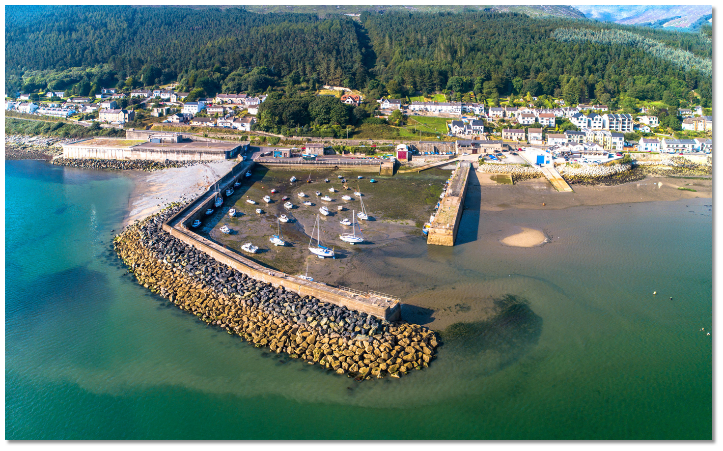
The resort town of Newcastle is located at the head of Dundrum Bay and at the foot of Donard, the highest of the Mourne Mountains. It is a sizable town with a population of about 7,500, known for its sandy beach, golf courses, forest walks and mountain climbs. The town's small artificial and tidal boat harbour is situated close to the south protected by two substantial breakwaters.
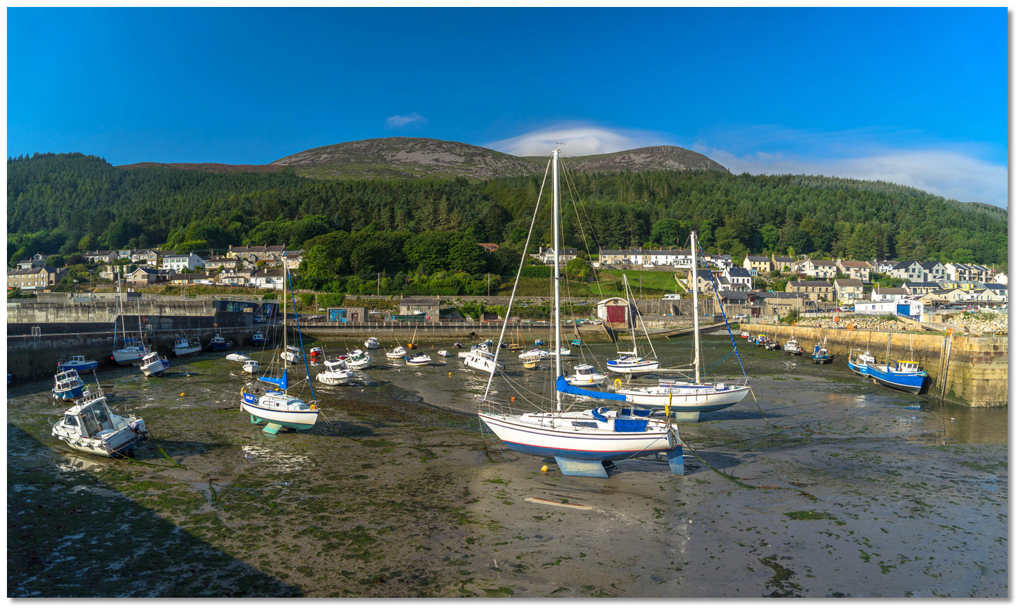 Local boats in the harbour
Image: Michael Harpur
The harbour area dries out completely at low water, even on neap tides, and in places p to +1 metre. Nevertheless, it offers an attractive berth for vessels that can take to its clean sandy bottom. Likewise, those who want to come alongside for a short time will find a serviceable pier with a sufficient rise of tide.
How to get in?
 Newcastle Harbour in the west end of Dundrum Bay and at the foot of Donard
Image: Michael Harpur
 Seaward approaches are detailed in eastern Ireland’s coastal overview for Strangford Lough to Dublin Bay . Apart from the well-marked Ballykinlar Firing Range, marked by two yellow oval buoys, marked "DZ", and a sewage works marked by an outfall buoy close east of the harbour, the southern half of Dundrum Bay is clear of any dangers.
 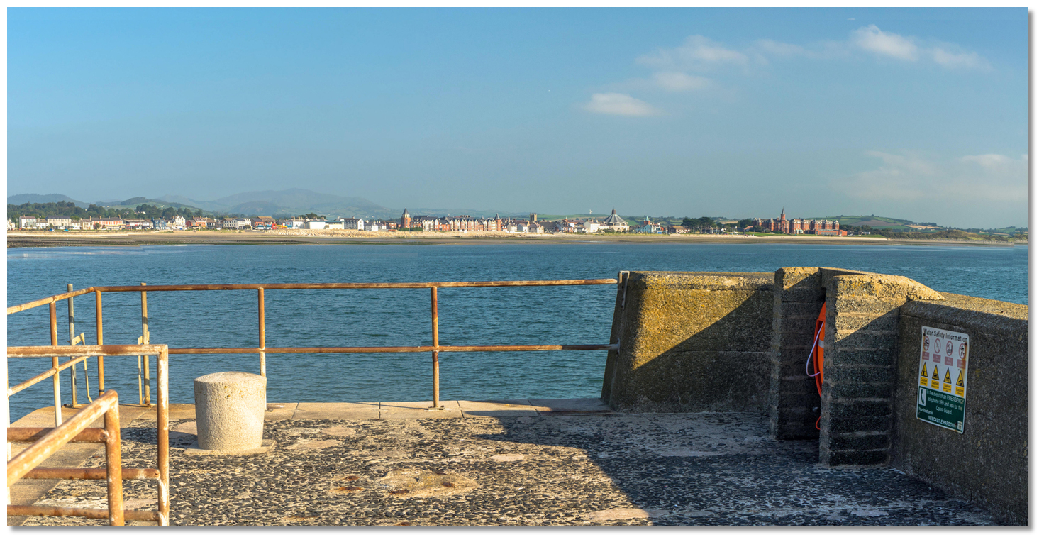 Newcastle shorefront as seen from the head of the pier
Image: Michael Harpur
The red brick Victorian Slieve Donard Hotel building in the town is conspicuous from seaward and the harbour, located ¾ of a mile south at the foot of the mountains, with church spires between will be easily picked out.
 Approach the harbour entrance from the north
Image: Michael Harpur
 From the Initial Fix, track in westward for a little over a mile to the harbour. Keep clear of the sewage works outfall that is situated immediately southeast of the harbour on the two-metre contour. It extends out 240 metres to the east of the harbour and is scarcely covered at low water.
 The entrance to Newcastle Harbour is wide
Image: Michael Harpur
The harbour entrance is located between the heads of the north and south breakwaters which opens to the north. As the harbour draws near, steer to position the vessel immediately north of the entrance so the approach is steering south.
 The harbour area has many local moorings, angling boats and small leisure boats
Image: Michael Harpur
Pass through the entrance keeping well clear of the South Pier. Rock armour, covered at high water, extends 15 metres out from the north footing of the South Pier and continues around its sea-facing aspect.
 The harbour’s longest serviceable berth at the end of the North Pier
Image: Michael Harpur
Vessels carrying any draft should anchor off outside, or temporarily come alongside inside. The harbour’s best short-term berth will be found at the outer end of the north pier between the steps and the head of the pier. 2.7 metres is available here during high water neaps over a sand bottom. But be prepared to move if there is any water here as pleasure boats, offering trips around the bay, use this extensively as it is the harbour’s longest serviceable berth for them to take on and set down passengers. The full length of the North Wall
Image: Michael Harpur
Those planning to settle in and dry out should not use this as it is much sought after even at night as many fishing boats berth here so as to be ready to depart on an early tide.
 Boats alongside the south wall
Image: Michael Harpur
This makes the south wall, or further in along the north wall, better drying locations. With regard to a specific position, it is advisable to take advice from the harbour master, should one be appointed by the council, or at least a local mariner.
 The hard compacted sand bottom can be walked oer
Image: Michael Harpur
The other alternative is to stand off the walls and anchor off in the harbour as the hard sand bottom can be walked upon without getting muddy.
Why visit here?
Newcastle, or 'an Caisleán Nua' in Irish, derives its name from an Anglo-Norman castle established on a bridging point at the mouth of the Shimna River settlement. The late 16th-century castle saw the gradual decline of the old Anglo-Norman settlements in Down and the increasing influence of the Gaelic Magennises, the Lords of Iveagh. In the 1580s Felix Magennis completed a substantial tower house on the site of the original fort. This was to be his seaside residence and the 'new castle' lent the area its name. Newcastle c.1860 - 1883
Image: National Library of Ireland on The Commons
Much of the subsequent development took place around the harbour and foreshore at the southern end of the town and was largely driven by Mourne Granit. Harvesting the granite situated alongside the wilder granite topography of the Mournes has been an integral part of Mourne life for thousands of years. Transported on horse carts from mountain quarries to the stone merchants of Annalong, shaping Mourne granite had been a historical supplementary income for the local farmers. The industry however substantially took off in Newcastle towards the end of the 18th century when more sophisticated ships enabled the large-scale export of dressed stone. The harbour was created in the 1820s to provide a loading point for the granite which had become world famous at this point.
 Newcastle seaside amusements c.1870-1890
Image: National Library of Ireland on The Commons
 Newcastle River and view over Newcastle c.1865-1914
Image: National Library of Ireland on The Commons
At this time this was only a small village of some 160 houses mostly occupied by fishing families and granite workers, much the same size as Glenarm in the Glens of Antrim. The majority of the houses were simply thatched and whitewashed cottages, but there were also some two-storey slated houses. There was a small Methodist meeting-house, a police barracks, a Post Office, plus a handful of shops and public houses. The trade of the port included the export of oats, barley and potatoes of which large quantities were sent to Dublin and Liverpool. But after the arrival of the railway, in 1869, the town's development took a sudden novel turn in the Victorian and Edwardian eras.
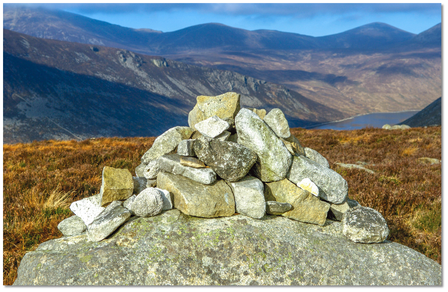 Mourne mountain granite used as a trail marker
Image: Tourism Ireland
The Victorians were in no doubt about what was on the end of the line. The dramatic mountain setting, the strong contrasts between the mountains, the flat dune landscape fronted by a 5km strand of golden sand, and the series of river valleys radiating inland from the town. A very attractive seaside destination was suddenly accessible and Newcastle started to develop as a resort. Percy French’s very famous 1896 ballad 'The Mountains of Mourne' captured perfectly the scenic blend of ocean, sky and hillside:
With people here workin' by day and by night
They don't sow potatoes, nor barley, nor wheat
But there's gangs of them diggin' for gold in the street
At least when I asked them that's what I was told
So I just took a hand at this diggin' for gold
But for all that I found there I might as well be
Where the Mountains of Mourne sweep down to the sea.
The construction of the Slieve Donard Hotel in 1897 added to the momentum and although the railway eventually closed in 1948 the town’s seaside expansion was set.
 Percy French memorial on the promenade
Image: Tourism Ireland
Percy French’s song become an anthem to the Irish of both London and to Newcastle as well it might be set at the foot of where the Mourne Mountains sweep down to the sea. The town is the nearest point to Slieve Donard (852 m/ 2,796 ft), which dominates the range and is both the highest peak in the Mournes and all of Ulster. The mountain is named after Saint Donard, a follower of Saint Patrick who founded a monastery at Maghera, north of Newcastle. According to tradition, he was appointed by Saint Patrick to guard the surrounding countryside from the mountain summit. He is supposed not to have died, but to have become a 'perpetual guardian'. At the summit, there is a cairn and a small stone tower, which was built as a shelter along the Mourne Wall that passes over the mountain's southern and western shoulders.
 Newcastle today
Image: Tourism Ireland
Today Newcastle is a service centre for the surrounding rural hinterland, a commuter settlement and a holiday and retirement resort. The town continues to derive its trade from the Mournes and the pleasant stretch of sandy beach that fronts the town. It has become the largest seaside resort in County Down that attracts droves of trippers from Belfast on public holidays and summer weekends. In recent decades the town has received multimillion-pound makeovers that have turned it into a disarmingly subtle resort.
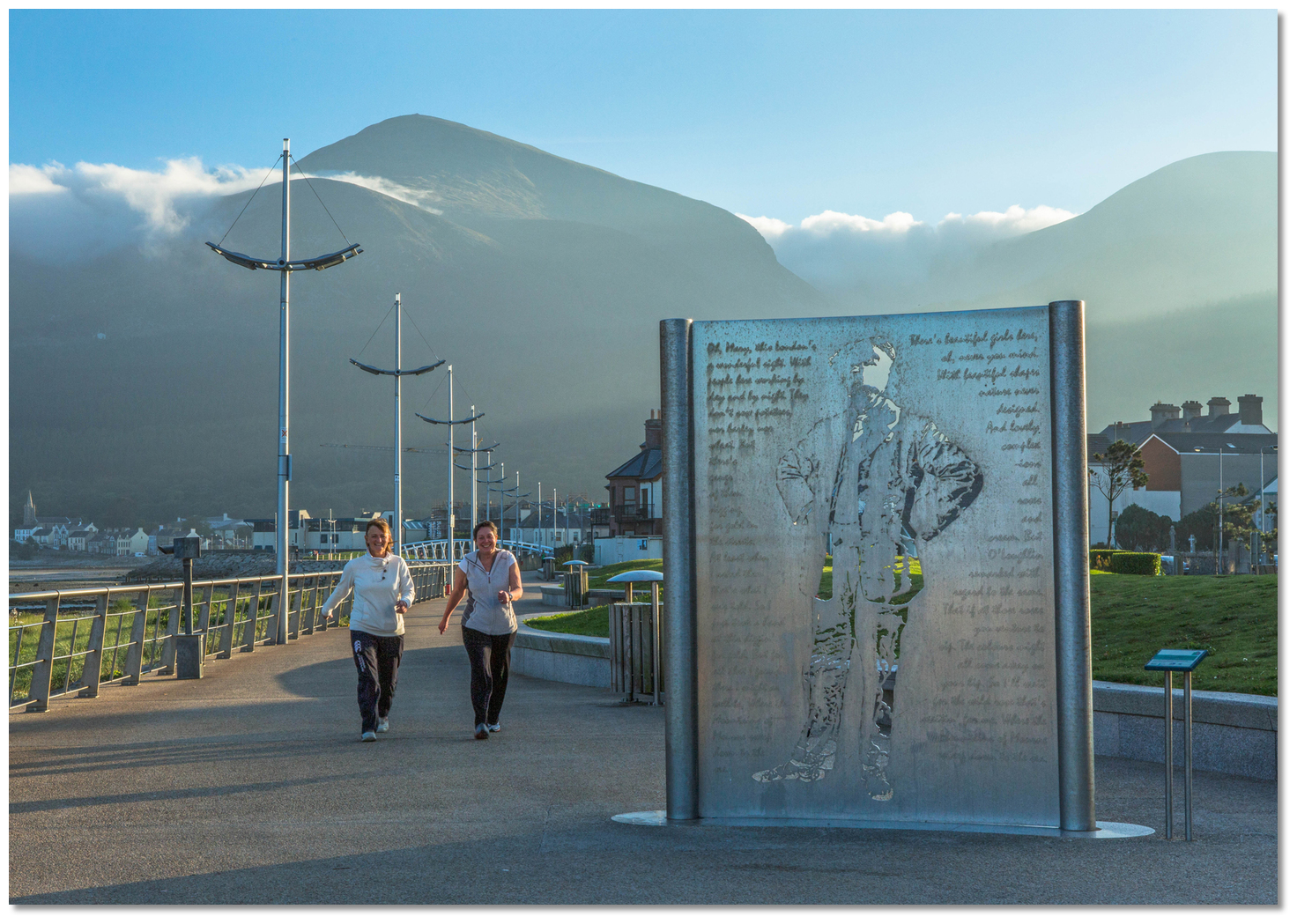
 One of Newcastle's seafront promenade sculpture
Image: Eric Jones via CC BY-SA 2.0
The investments can be seen in the contemporary sculpture-studded, kilometre-long seafront promenade with an elegant footbridge over the River Shimna fronts the town. Along this is a fountain that commemorates the songwriter Percy French. Adjacent to this is a 3km long (2mile) stretch of cool restaurants, art galleries, independent shops, antique emporia, chic cafés, and ice-cream boutiques on its long energizing stretch of waterfront. But you will still find old-fashioned amusement arcades, fast-food outlets and ‘kiss-me-quick-hat’ souvenir-store strip fun fairs, and children’s play areas to serve up a little seaside resort nostalgia.
Image: Tourism Ireland
But this seaside arcade characteristic was more than overpowered by the Mournes area of outstanding natural beauty. In this respect, the stunning Mournes have a lot to offer. Close to the town, there are plenty of straightforward hikes that require no special equipment and have obvious tracks that lead to the more scenic parts.
 The Mourne Mountains
Image: Tourism Ireland
There is the Mourne Coastal Footpath along the shoreline that is deservedly popular, and Donard Park is a pretty public park situated at the foot of Slieve Donard next to the Glen River. Indeed it is a nice walk from Newcastle town centre to the park along the pathways that surround the River Glen. Two miles inland from Newcastle, along the Bryansford Road, is Tollymore Forest Park. This 630 hectares park with the Shimna River flowing through it, offers a variety of trails with pleasant scenery.
 Newcastle as seen from Slieve Donard
Image: Eric Jones via CC BY-SA 2.0
The town and its setting contain several listed buildings, archaeological monuments and sites of nature conservation interest. It retains many examples of late 19th-century architecture, associated with its development as a resort, particularly on Main Street and on South Promenade and King Street. A visit to the Newcastle tourist office, or the Mourne Countryside Centre, will provide excellent information.
 Horse riding on Newcastle beach
Image: Tourism Ireland
Golfing enthusiasts may be tempted by Newcastle's Royal County Down championship golf course, which has a reputation as one of the most challenging links courses worldwide. It has played host to events such as the 2007 Walker Cup and 2006 Ladies British Open Amateur Championship. Amateurs might prefer to take advantage of the golf driving range at Donard Park, which also provides many sports pitches.
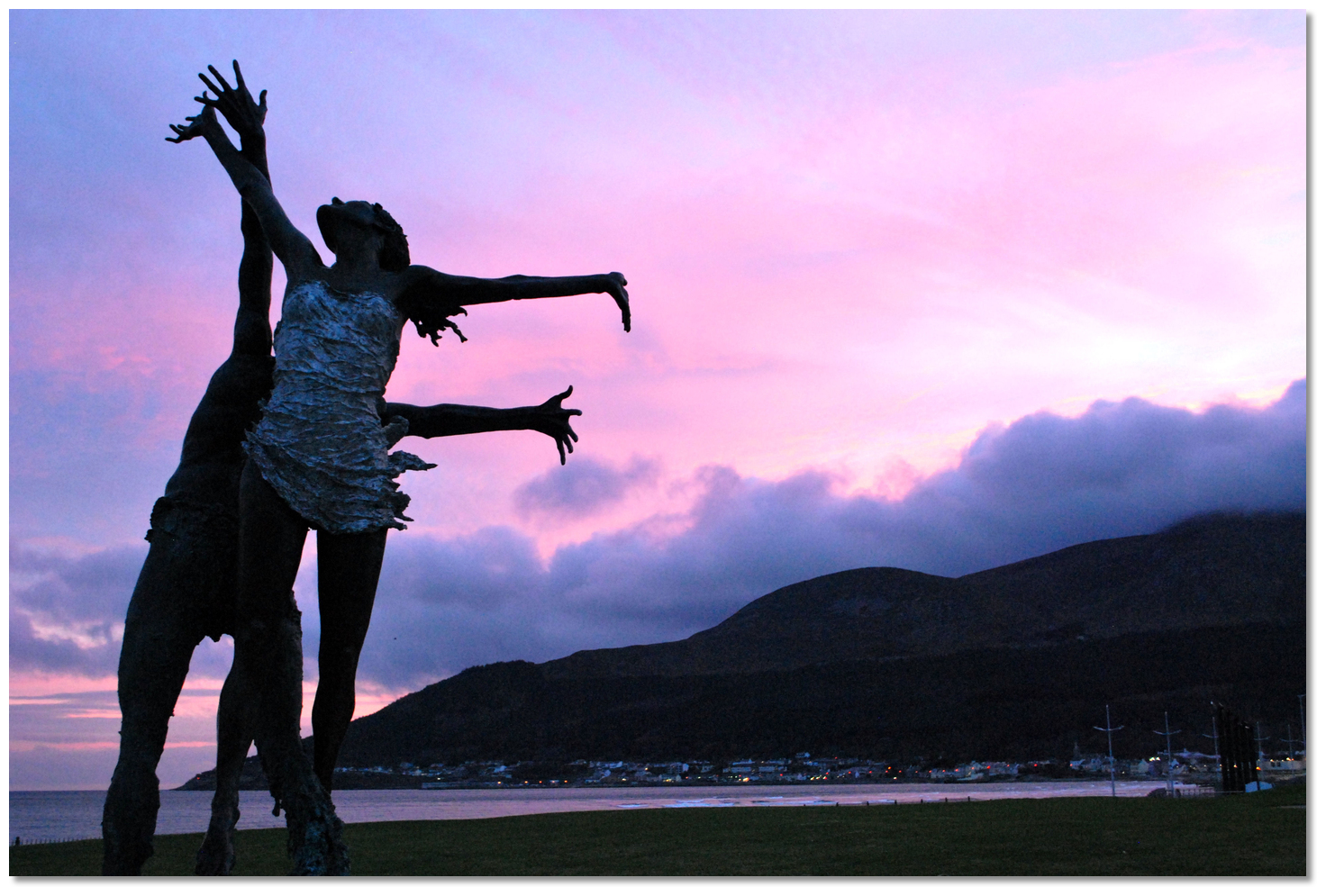 Sunset behind a sculpture on the promanade
Image: Willie Carville
Those who want more serious walking or climbing needless to say have a wide range of further opportunities dispersed throughout the range. The obvious climbing choice immediately to hand is Slieve Donard which Newcastle is closest to. Visitors can hike to the summit from various starting points in and around Newcastle. The ascent is relatively easy on a well-marked trail but it is stiff enough and shouldn’t be attempted without proper walking boots, waterproofs and a map and compass. The views are wonderful, making the trek uphill, well worth the effort. The views across the mountain landscape and Dundrum Bay are quite spectacular. On a good day, the view from the top extends to the hills of Donegal, the Wicklow Mountains, the coast of Scotland, the Isle of Man and even the hills of Snowdonia in Wales.
 The sun setting behind the Mournes
Image: Tourism Ireland
From a boating perspective, this could only be described as a good berth for vessels that can take to the hard. The harbour is much quieter playing host to some small fishing, pleasure craft and a sailing club just above the slips.
 Newcastle Harbour provides access to many shoreline activities
Image: Michael Harpur
When the welcoming club, provisioning and access to the magnificent Mourne Mountains are added, it truly warrants serious consideration for any coastal cruiser passing along this coast. Also, the old resort has its advantages for the cruising family. The Newcastle Centre and Tropicana Complex on the promenade offer indoor activities with swimming pools, water slides and playgrounds that might be useful for an inevitable rainy day.
What facilities are available?
The town of Newcastle stretches along the shore to the north of the harbour. With a population of almost seven and a half thousand, there is a wide selection of shops, restaurants, pubs and cafes available. Hence almost all provisions and necessities can be obtained including fuel and a post office. The harbour has toilets and facilities for waste disposal and a harbour master is available between April and September. Newcastle Sailing Club clubhouse
Image: Michael Harpur
The Newcastle Sailing Club clubhouse and dinghy park is situated beside the harbour on the main road to Killkeel. The clubhouse itself is normally only open during racing or club events. It also has premises beside the RNLI house where there is a concrete slip for launching dinghies at high water, plus showers when open. There is another small launching slip 200 metres north of the harbour.
Newcastle is located approximately 30 miles from Belfast, along the A24 road, and approximately 85 miles from Dublin. Downpatrick is about 12 miles away and it has its own Coach/Bus Station (+44 28 4372 2296) on Railway Street at the eastern end of Main Street - a couple of hundred yards east of the promenade. Buses 20 and 20A run to Newcastle from Belfast’s Europa BusCentre (1¼ hours, at least hourly) via Dundrum. Bus 240 takes the inland route from Newry to Newcastle (50 minutes, seven daily Monday to Friday, six Saturday, four Sunday) and continues to Downpatrick.
The very helpful tourist office is close by at 10-14 Central Promenade (July & Aug Mon-Sat 10 am-7 pm, Sun 2-7 pm; rest of year Mon-Sat 10 am -5 pm; +44 28 4372 2222). The nearest major railway Station is in Newry just over 20 miles away. Newcastle is about 30 miles from Belfast International Airport and over 85 miles from Dublin Airport taking approximately 2 hours of travelling time.
Any security concerns?
Never an issue known to have occurred in Newcastle Harbour. However in an open harbour normal security provisions should be adhered to.With thanks to:
Fred Curran, Custodian of Ardglass Marina. Photography with thanks to Eric Jones, Henry Clark, Ardfern and Albert Bridge.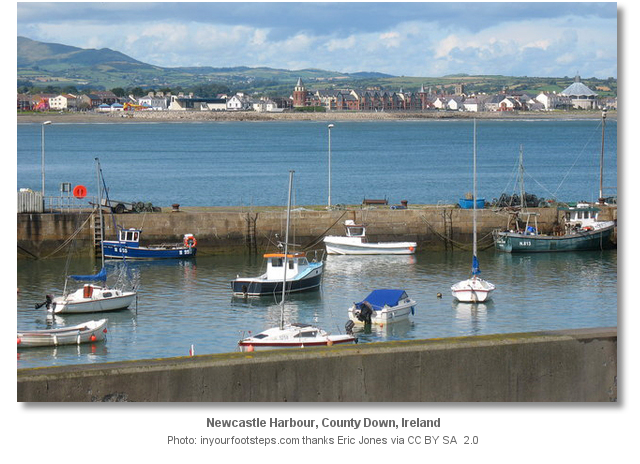


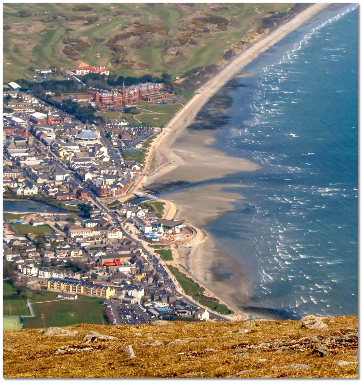
An aerial overview of Newcastle
About Newcastle Harbour
Newcastle, or 'an Caisleán Nua' in Irish, derives its name from an Anglo-Norman castle established on a bridging point at the mouth of the Shimna River settlement. The late 16th-century castle saw the gradual decline of the old Anglo-Norman settlements in Down and the increasing influence of the Gaelic Magennises, the Lords of Iveagh. In the 1580s Felix Magennis completed a substantial tower house on the site of the original fort. This was to be his seaside residence and the 'new castle' lent the area its name.
Newcastle c.1860 - 1883Image: National Library of Ireland on The Commons
Much of the subsequent development took place around the harbour and foreshore at the southern end of the town and was largely driven by Mourne Granit. Harvesting the granite situated alongside the wilder granite topography of the Mournes has been an integral part of Mourne life for thousands of years. Transported on horse carts from mountain quarries to the stone merchants of Annalong, shaping Mourne granite had been a historical supplementary income for the local farmers. The industry however substantially took off in Newcastle towards the end of the 18th century when more sophisticated ships enabled the large-scale export of dressed stone. The harbour was created in the 1820s to provide a loading point for the granite which had become world famous at this point.
Newcastle seaside amusements c.1870-1890Image: National Library of Ireland on The Commons
Newcastle River and view over Newcastle c.1865-1914Image: National Library of Ireland on The Commons
At this time this was only a small village of some 160 houses mostly occupied by fishing families and granite workers, much the same size as Glenarm in the Glens of Antrim. The majority of the houses were simply thatched and whitewashed cottages, but there were also some two-storey slated houses. There was a small Methodist meeting-house, a police barracks, a Post Office, plus a handful of shops and public houses. The trade of the port included the export of oats, barley and potatoes of which large quantities were sent to Dublin and Liverpool. But after the arrival of the railway, in 1869, the town's development took a sudden novel turn in the Victorian and Edwardian eras.
Mourne mountain granite used as a trail markerImage: Tourism Ireland
The Victorians were in no doubt about what was on the end of the line. The dramatic mountain setting, the strong contrasts between the mountains, the flat dune landscape fronted by a 5km strand of golden sand, and the series of river valleys radiating inland from the town. A very attractive seaside destination was suddenly accessible and Newcastle started to develop as a resort. Percy French’s very famous 1896 ballad 'The Mountains of Mourne' captured perfectly the scenic blend of ocean, sky and hillside:
With people here workin' by day and by night
They don't sow potatoes, nor barley, nor wheat
But there's gangs of them diggin' for gold in the street
At least when I asked them that's what I was told
So I just took a hand at this diggin' for gold
But for all that I found there I might as well be
Where the Mountains of Mourne sweep down to the sea.
The construction of the Slieve Donard Hotel in 1897 added to the momentum and although the railway eventually closed in 1948 the town’s seaside expansion was set.
Percy French memorial on the promenadeImage: Tourism Ireland
Percy French’s song become an anthem to the Irish of both London and to Newcastle as well it might be set at the foot of where the Mourne Mountains sweep down to the sea. The town is the nearest point to Slieve Donard (852 m/ 2,796 ft), which dominates the range and is both the highest peak in the Mournes and all of Ulster. The mountain is named after Saint Donard, a follower of Saint Patrick who founded a monastery at Maghera, north of Newcastle. According to tradition, he was appointed by Saint Patrick to guard the surrounding countryside from the mountain summit. He is supposed not to have died, but to have become a 'perpetual guardian'. At the summit, there is a cairn and a small stone tower, which was built as a shelter along the Mourne Wall that passes over the mountain's southern and western shoulders.
Newcastle todayImage: Tourism Ireland
Today Newcastle is a service centre for the surrounding rural hinterland, a commuter settlement and a holiday and retirement resort. The town continues to derive its trade from the Mournes and the pleasant stretch of sandy beach that fronts the town. It has become the largest seaside resort in County Down that attracts droves of trippers from Belfast on public holidays and summer weekends. In recent decades the town has received multimillion-pound makeovers that have turned it into a disarmingly subtle resort.
One of Newcastle's seafront promenade sculptureImage: Eric Jones via CC BY-SA 2.0
The investments can be seen in the contemporary sculpture-studded, kilometre-long seafront promenade with an elegant footbridge over the River Shimna fronts the town. Along this is a fountain that commemorates the songwriter Percy French. Adjacent to this is a 3km long (2mile) stretch of cool restaurants, art galleries, independent shops, antique emporia, chic cafés, and ice-cream boutiques on its long energizing stretch of waterfront. But you will still find old-fashioned amusement arcades, fast-food outlets and ‘kiss-me-quick-hat’ souvenir-store strip fun fairs, and children’s play areas to serve up a little seaside resort nostalgia.
Image: Tourism Ireland
But this seaside arcade characteristic was more than overpowered by the Mournes area of outstanding natural beauty. In this respect, the stunning Mournes have a lot to offer. Close to the town, there are plenty of straightforward hikes that require no special equipment and have obvious tracks that lead to the more scenic parts.
The Mourne MountainsImage: Tourism Ireland
There is the Mourne Coastal Footpath along the shoreline that is deservedly popular, and Donard Park is a pretty public park situated at the foot of Slieve Donard next to the Glen River. Indeed it is a nice walk from Newcastle town centre to the park along the pathways that surround the River Glen. Two miles inland from Newcastle, along the Bryansford Road, is Tollymore Forest Park. This 630 hectares park with the Shimna River flowing through it, offers a variety of trails with pleasant scenery.
Newcastle as seen from Slieve DonardImage: Eric Jones via CC BY-SA 2.0
The town and its setting contain several listed buildings, archaeological monuments and sites of nature conservation interest. It retains many examples of late 19th-century architecture, associated with its development as a resort, particularly on Main Street and on South Promenade and King Street. A visit to the Newcastle tourist office, or the Mourne Countryside Centre, will provide excellent information.
Horse riding on Newcastle beachImage: Tourism Ireland
Golfing enthusiasts may be tempted by Newcastle's Royal County Down championship golf course, which has a reputation as one of the most challenging links courses worldwide. It has played host to events such as the 2007 Walker Cup and 2006 Ladies British Open Amateur Championship. Amateurs might prefer to take advantage of the golf driving range at Donard Park, which also provides many sports pitches.
Sunset behind a sculpture on the promanadeImage: Willie Carville
Those who want more serious walking or climbing needless to say have a wide range of further opportunities dispersed throughout the range. The obvious climbing choice immediately to hand is Slieve Donard which Newcastle is closest to. Visitors can hike to the summit from various starting points in and around Newcastle. The ascent is relatively easy on a well-marked trail but it is stiff enough and shouldn’t be attempted without proper walking boots, waterproofs and a map and compass. The views are wonderful, making the trek uphill, well worth the effort. The views across the mountain landscape and Dundrum Bay are quite spectacular. On a good day, the view from the top extends to the hills of Donegal, the Wicklow Mountains, the coast of Scotland, the Isle of Man and even the hills of Snowdonia in Wales.
The sun setting behind the MournesImage: Tourism Ireland
From a boating perspective, this could only be described as a good berth for vessels that can take to the hard. The harbour is much quieter playing host to some small fishing, pleasure craft and a sailing club just above the slips.
Newcastle Harbour provides access to many shoreline activitiesImage: Michael Harpur
When the welcoming club, provisioning and access to the magnificent Mourne Mountains are added, it truly warrants serious consideration for any coastal cruiser passing along this coast. Also, the old resort has its advantages for the cruising family. The Newcastle Centre and Tropicana Complex on the promenade offer indoor activities with swimming pools, water slides and playgrounds that might be useful for an inevitable rainy day.
Other options in this area
Click the 'Next' and 'Previous' buttons to progress through neighbouring havens in a coastal 'clockwise' or 'anti-clockwise' sequence. Alternatively here are the ten nearest havens available in picture view:
Coastal clockwise:
Annalong Harbour - 3.3 miles SKilkeel Harbour - 5.7 miles SSW
Greencastle - 7.6 miles SW
Killowen - 8.1 miles SW
Rostrevor - 8 miles WSW
Coastal anti-clockwise:
Dundrum Harbour - 2.4 miles NNEKillough Harbour - 5.8 miles ENE
Ardglass Harbour (Phennick Cove Marina) - 6.5 miles ENE
Kilclief Bay - 9.1 miles NE
Cross Roads - 9.3 miles NE
Navigational pictures
These additional images feature in the 'How to get in' section of our detailed view for Newcastle Harbour.


| Detail view | Off |
| Picture view | On |
An aerial overview of Newcastle
Add your review or comment:
Please log in to leave a review of this haven.
Please note eOceanic makes no guarantee of the validity of this information, we have not visited this haven and do not have first-hand experience to qualify the data. Although the contributors are vetted by peer review as practised authorities, they are in no way, whatsoever, responsible for the accuracy of their contributions. It is essential that you thoroughly check the accuracy and suitability for your vessel of any waypoints offered in any context plus the precision of your GPS. Any data provided on this page is entirely used at your own risk and you must read our legal page if you view data on this site. Free to use sea charts courtesy of Navionics.