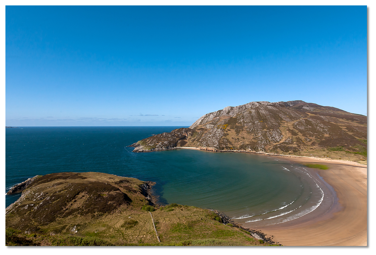
The small bay offers an exposed anchorage, being shallow almost out to its entrance points, but is serviceable in conditions from north round through east to the south. However, in the case of the latter quadrant, it can be exposed to the swell which sometimes rolls up the Lough. Being unencumbered by outlying hazards it has straightforward access night and day, at all stages of the tide and in all reasonable conditions.

Keyfacts for Crummie's Bay
Facilities


Nature


Considerations

Protected sectors
Approaches


Shelter


Last modified
July 10th 2021 Summary
A tolerable location with straightforward access.Facilities


Nature


Considerations

Position and approaches
Expand to new tab or fullscreen
Haven position
 55° 12.228' N, 007° 32.885' W
this is the position of the anchorage in the bay
What is the initial fix?
The following Lough Swilly Initial Fix will set up a final approach:
 55° 17.800' N, 007° 35.030' W
 What are the key points of the approach?
Offshore details are available in northwestern Ireland’s coastal overview for Erris Head to Malin Head  . A set of waypoints to assist when running up lough can be found in the Lough Swilly route
  .
.
 . A set of waypoints to assist when running up lough can be found in the Lough Swilly route
  .
.Not what you need?
Click the 'Next' and 'Previous' buttons to progress through neighbouring havens in a coastal 'clockwise' or 'anti-clockwise' sequence. Below are the ten nearest havens to Crummie's Bay for your convenience.
Ten nearest havens by straight line charted distance and bearing:
- Dunree Bay - 0.7 nautical miles SSE
- Scraggy Bay - 2.1 nautical miles SSW
- Lenan Bay - 2.3 nautical miles NNE
- Portsalon - 2.4 nautical miles W
- Macamish Bay - 4 nautical miles SSE
- Pincher Bay - 5 nautical miles NW
- Buncrana - 5.5 nautical miles SSE
- Rathmullan - 6.6 nautical miles S
- The Lough Swilly Marina - 7.4 nautical miles SSE
- Mulroy Bay - 9 nautical miles W
These havens are ordered by straight line charted distance and bearing, and can be reordered by compass direction or coastal sequence:
- Dunree Bay - 0.7 miles SSE
- Scraggy Bay - 2.1 miles SSW
- Lenan Bay - 2.3 miles NNE
- Portsalon - 2.4 miles W
- Macamish Bay - 4 miles SSE
- Pincher Bay - 5 miles NW
- Buncrana - 5.5 miles SSE
- Rathmullan - 6.6 miles S
- The Lough Swilly Marina - 7.4 miles SSE
- Mulroy Bay - 9 miles W
Chart
What's the story here?
 Crummies Bay as seen from Dunree Fort
Image: Greg Clarke via CC BY-SA 2.00
Crummie Bay is entered to the north of Dunree Head and Illan Horadivna Rock and is almost completely surrounded by the mainland where the Owenerk River estuary gently discharges into the Lough splitting the beach in two. The cliffs on the mainland offer some protection from the east, but the bay is exposed to westerly winds and to the swell which rolls into the Lough which can make life uncomfortable when moored.
The head of the bay gently shelves from between the points of the entrance where the 5 metres contour resides.
 Illan Horadivna Rock marking the bay's southern entrance point
Image: Michael Dibb via CC BY-SA 2.0
How to get in?
 Approaches to the Lough Swilly can be found in northwestern Ireland’s coastal overview for Erris Head to Malin Head
  . A set of waypoints to assist with the run up the lough as far as Fanad can be found in the Lough Swilly route
  . The entire length of Lough Swilly is marked with various easily identified navigation lights along the main deepwater shipping channel. The fairway is about 3½ miles wide at its entrance from which it gradually narrows to a width of 2½ miles at Crumnie Bay opposite Ballymastocker Bay.
 Anchor according to draft between the bay's entrance point according to wind and conditions in excellent sand holding. Land by dinghy on the beach.
 Why visit here?
Anciently known as An Port Bán from the Irish an Phoirt Bháin meaning port of the white lea-ground, it has been called Crummies Bay since Napoleonic times. The beach at the head of the bay is also known as Dunree Beach. Crummies Bay as seen from Dunree Fort at dusk
Image: Greg Clarke via CC BY-SA 2.00
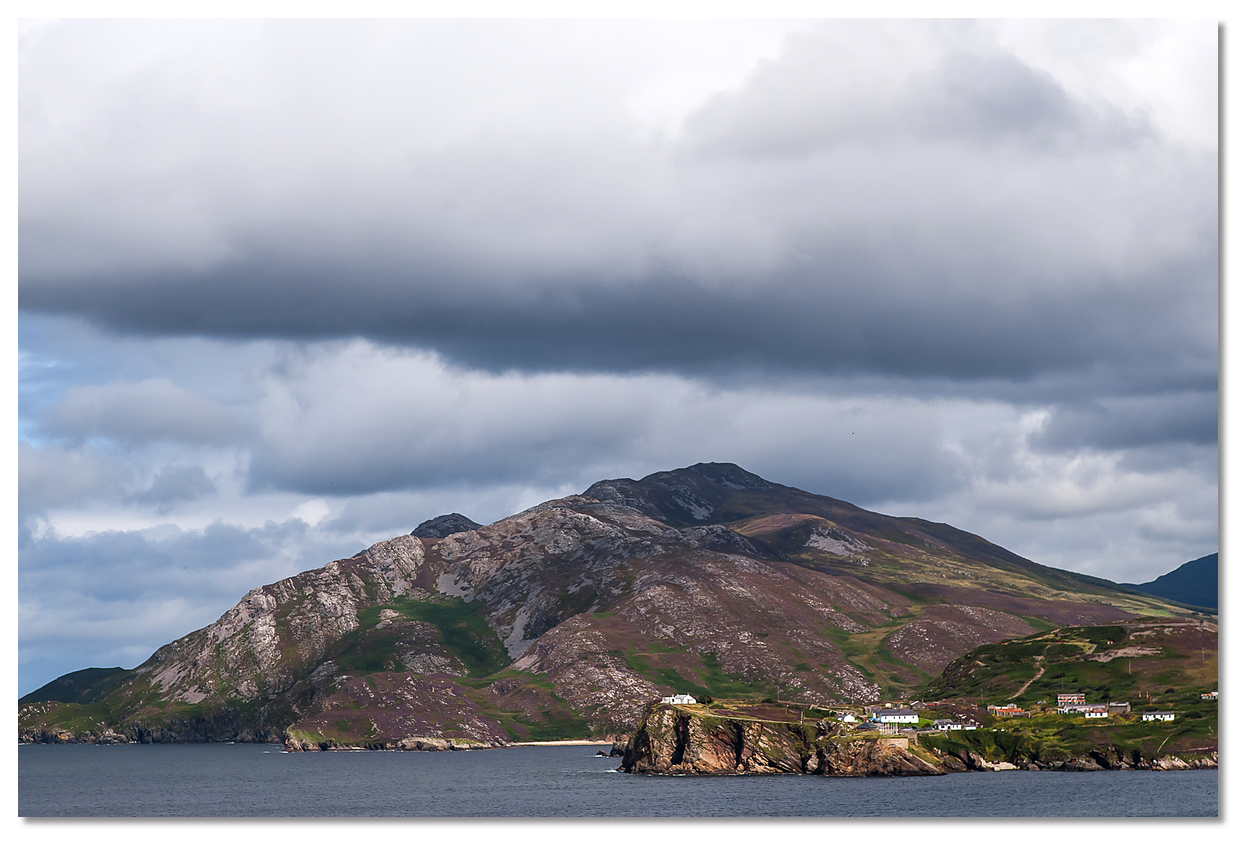
Crummies Bay is a delightful little cove open to the west and nestled between Dunree Head and the Urris Hills with a deep white sandy beach that is perfect to land a dinghy upon. There are no facilities at this location and that is its joy, a lovely horseshoe shaped bay in its natural state with steep rocky hills at both sides, which most likely you will have all to yourself. Don't be surprised if you see rock climbers on the cliffs surrounding Crummie's Bay as this is one of the must-visit locations for this activity.
From a sailing perspective, the scenic little cove is ideal for a quiet and tranquil picnic on the beach, with an opportunity to explore further along the shoreline. It is ideal for a boat with a family to let loose and safely explore.
What facilities are available?
There are no facilities at this remote location.With thanks to:
Graham Wilkinson.
Crummies Bay, Lough Swilly, Donegal, Ireland
Image: eOceanic thanks Greg Clarke via CC BY-SA 2.00

Crummies Bay as seen with the Urris Hills and Dunree Head
Image: eOceanic thanks Greg Clarke via CC BY-SA 2.00
Add your review or comment:
Please log in to leave a review of this haven.
Please note eOceanic makes no guarantee of the validity of this information, we have not visited this haven and do not have first-hand experience to qualify the data. Although the contributors are vetted by peer review as practised authorities, they are in no way, whatsoever, responsible for the accuracy of their contributions. It is essential that you thoroughly check the accuracy and suitability for your vessel of any waypoints offered in any context plus the precision of your GPS. Any data provided on this page is entirely used at your own risk and you must read our legal page if you view data on this site. Free to use sea charts courtesy of Navionics.


 Dunree Beach
