
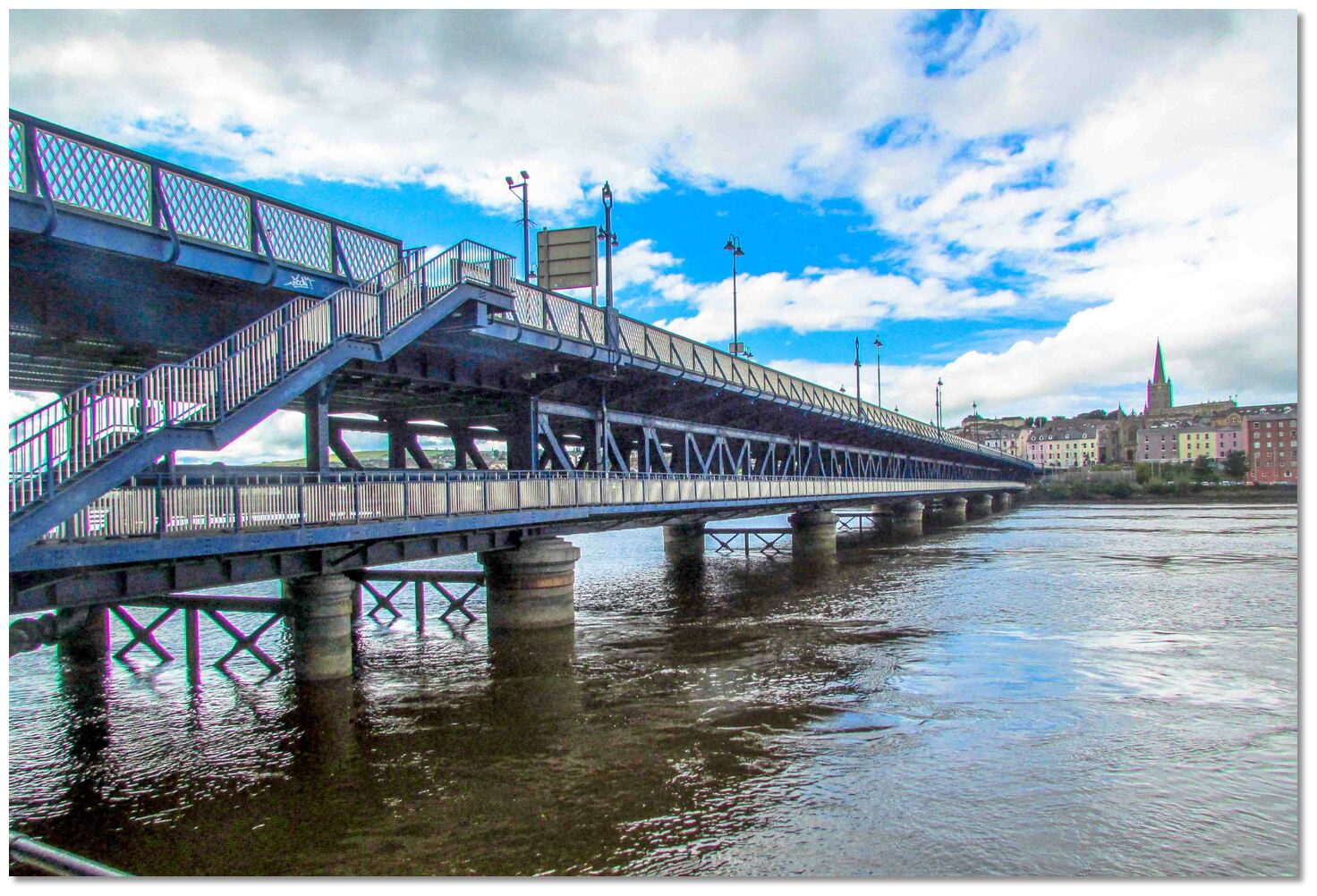
_county_derry_ireland_The Peace Bridge, Derry~Londonderry_master(1).jpg)
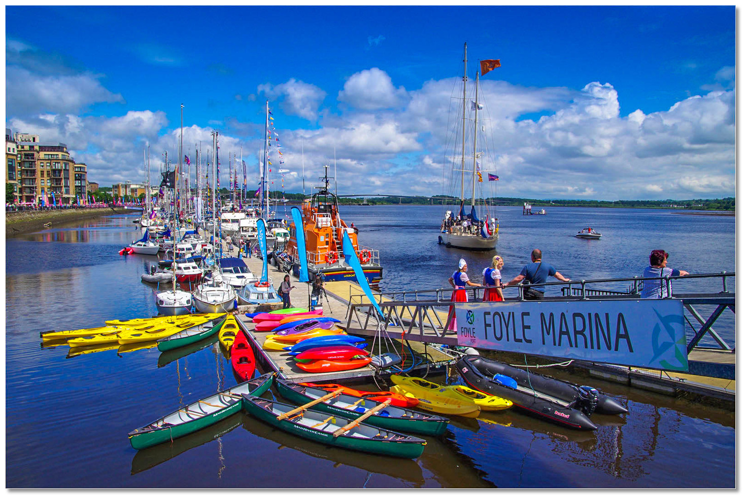
Foyle Port Marina is situated on the north coast of Ireland at the centre of Londonderry or Derry city, located nineteen miles inland on the River Foyle and reached through the Lough Foyle estuary. It provides pontoon berths adjacent to all the facilities of Northern Ireland’s second-largest city.
Foyle Port Marina provides complete protection and shelter from all conditions. The well-marked commercial shipping channel, supported by a lighthouse with sectored light, provides safe access in all reasonable conditions, night and day. Although tidal streams are occasionally strong they abate as a vessel progresses inside the Lough making the pontoon approachable at all states of the tide.

Keyfacts for Foyle Port Marina (Derry City)


Summary
A completely protected location with safe access.


Nature


Considerations


 HM
HM HM
HMPosition and approaches

Haven position
 55° 0.421' N, 007° 19.063' W
This is the north-eastern end of the River Foyle Marina pontoon.
What are the initial fixes?
The following waypoints will set up a final approach:(i) Lough Foyle North Channel Initial Fix
 55° 14.155' N, 006° 53.700' W
One mile east of Inishowen Head and 400 metres northwest of Red Tuns Light (port hand) Buoy F1. R.3s. It is set on the 222°T line of bearing of the Martello tower on Magilligan Point that leads into the North Channel.
(ii) Lough Foyle South Channel Initial Fix
55° 11.760' N, 006° 57.084' WMidway between the shore and the southern edge of the Tuns Bank in the narrowest part of the South Channel in approximately 10 metres of water.


What are the key points of the approach?
 .
.- Lough Foyle may be entered via its well-marked commercial North Channel or the unmarked South Channel that passes between the Macgilligan beaches and the Tuns Bank. The latter provides a convenient daytime shortcut from the east and may be advantageous on an ebb tide.
- Within the lough, follow the well-marked commercial channel leading along its northwest shoreline to the mouth of the River Foyle.
- Continue upriver to pass under the Foyle Bridge and proceed to the city.
Not what you need?
- Culmore Bay - 3.1 nautical miles NE
- The Lough Swilly Marina - 7.3 nautical miles NW
- Buncrana - 8.8 nautical miles NW
- Rathmullan - 9 nautical miles NW
- Macamish Bay - 10.6 nautical miles NW
- Ramelton - 11.4 nautical miles W
- Scraggy Bay - 13.2 nautical miles NW
- Dunree Bay - 13.5 nautical miles NW
- Carrickarory Pier - 13.8 nautical miles NE
- Crummie's Bay - 14.2 nautical miles NW
- Culmore Bay - 3.1 miles NE
- The Lough Swilly Marina - 7.3 miles NW
- Buncrana - 8.8 miles NW
- Rathmullan - 9 miles NW
- Macamish Bay - 10.6 miles NW
- Ramelton - 11.4 miles W
- Scraggy Bay - 13.2 miles NW
- Dunree Bay - 13.5 miles NW
- Carrickarory Pier - 13.8 miles NE
- Crummie's Bay - 14.2 miles NW


What's the story here?
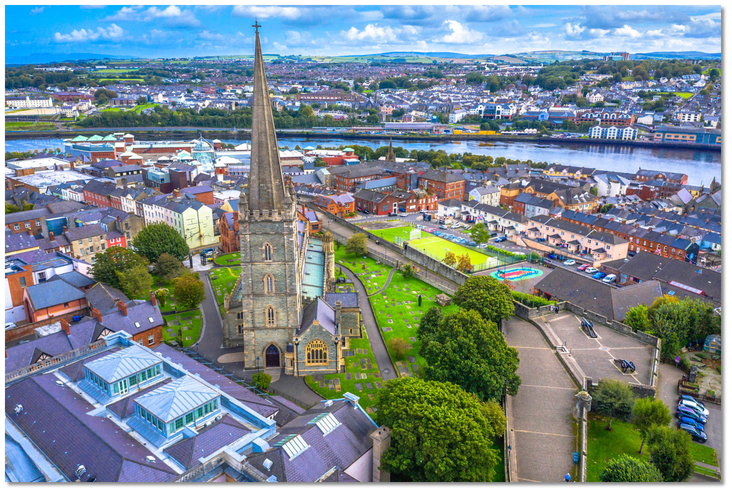
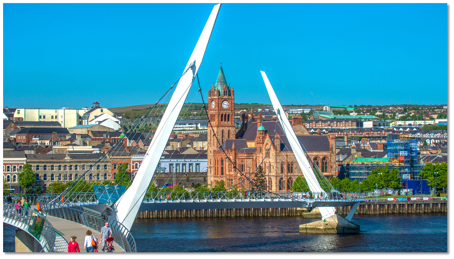
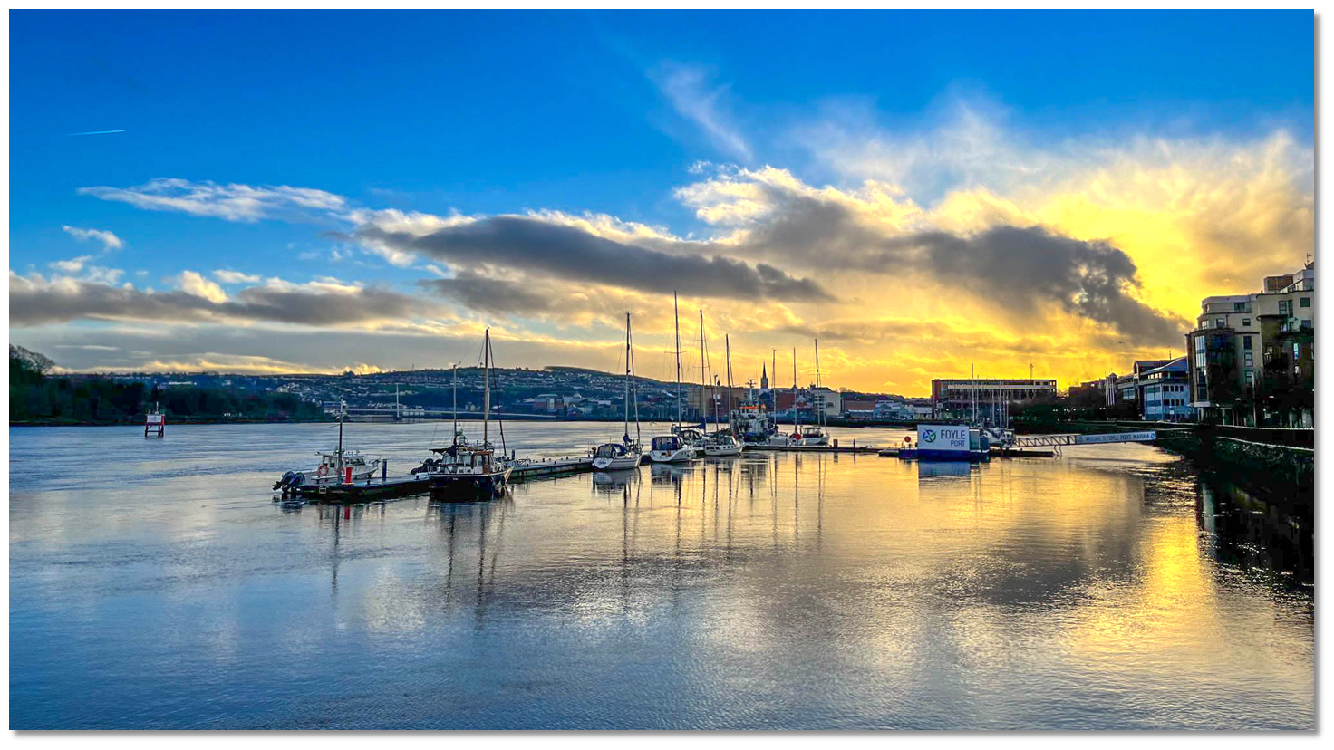
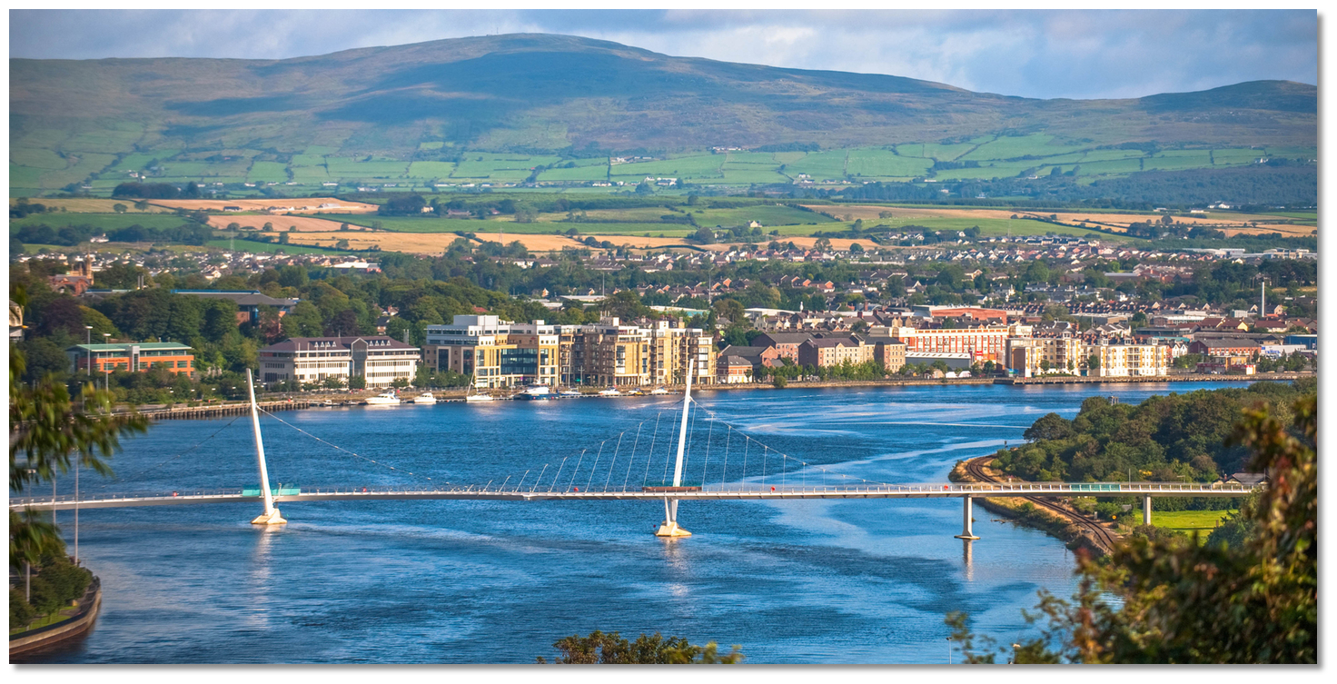 Derry and the Foyle Port Marina as seen from upriver of the Peace Bridge
Image: Tourism NI
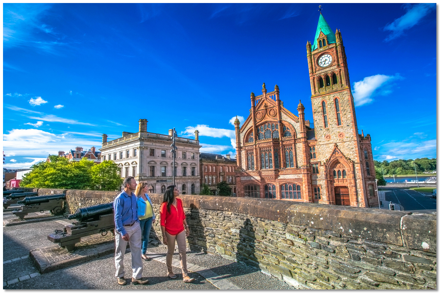
Derry, officially Londonderry, with a population of almost 85,000 is the second-largest city in Northern Ireland and the fifth-largest city on the island of Ireland. It is the most important city and port along this coast and the old walled city that lies on the west bank is renowned for having one of the finest 17th Century Walled cities in Europe. The city now covers both banks, Cityside on the west and Waterside on the east which is spanned by two road bridges and one footbridge. It is situated on the River Foyle, about 19 miles inland and is reached through Lough Foyle.
 Foyle Port Marina
Image: © Brian Mason
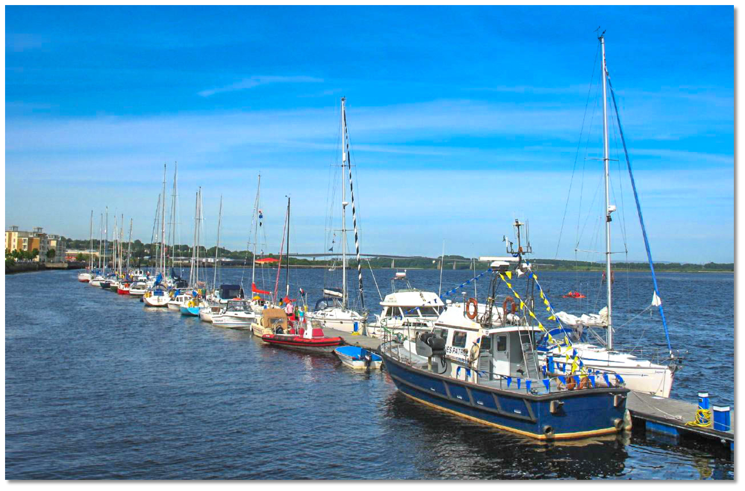
The city welcomes visiting boats to Foyle Port Marina alongside the west side of the harbour at the heart of the city. Foyle Port Marina has a least depth of 6 metres LAT in the approaches and a masthead height restriction of 31 metres HAT by the Foyle Bridge situated 1¼ miles downriver of the city. The marina consists of 3 pontoons with the outer pontoons having up to 7 metres on the outside and 5 metres on the inside at low water.
 Foyle Port Marina with Foyle Bridge seen 1¼ miles downriver
Image: James Burke via CC BY-SA 2.0
All visiting vessels must contact Harbour Radio prior to the approach,
 Ch. 14 [Harbour Radio],
  +44 (0)28 7186 0555/+44 (0)28 71 860313 NUMBER(24 hours). As Foyle Port Marina is entirely unmanned all bookings are handled through the completion of their online Foyle Port Marina Reservation
  form.
form. The harbour office will direct visiting boats, including day users, to stop at the harbour office at Foyle Port Lisahally situated close to the mouth of the Foyle River. Here harbour dues and marina berths are arranged, paid for and the access keys, plus tokens for shore power provided.
It is possible to anchor anywhere in Lough Foyle, well clear of the channel. Vessels of any airdraft will not be able to pass beyond the marina as the Peace Bridge and the Craigavon Bridge spans the Foyle at the city centre. Low airdraft vessels can continue upriver for 16 miles to Strabane.
How to get in?
 Inishowen Head and the high ground behind as seen from the east
Image: James Stringer via CC BY 2.0
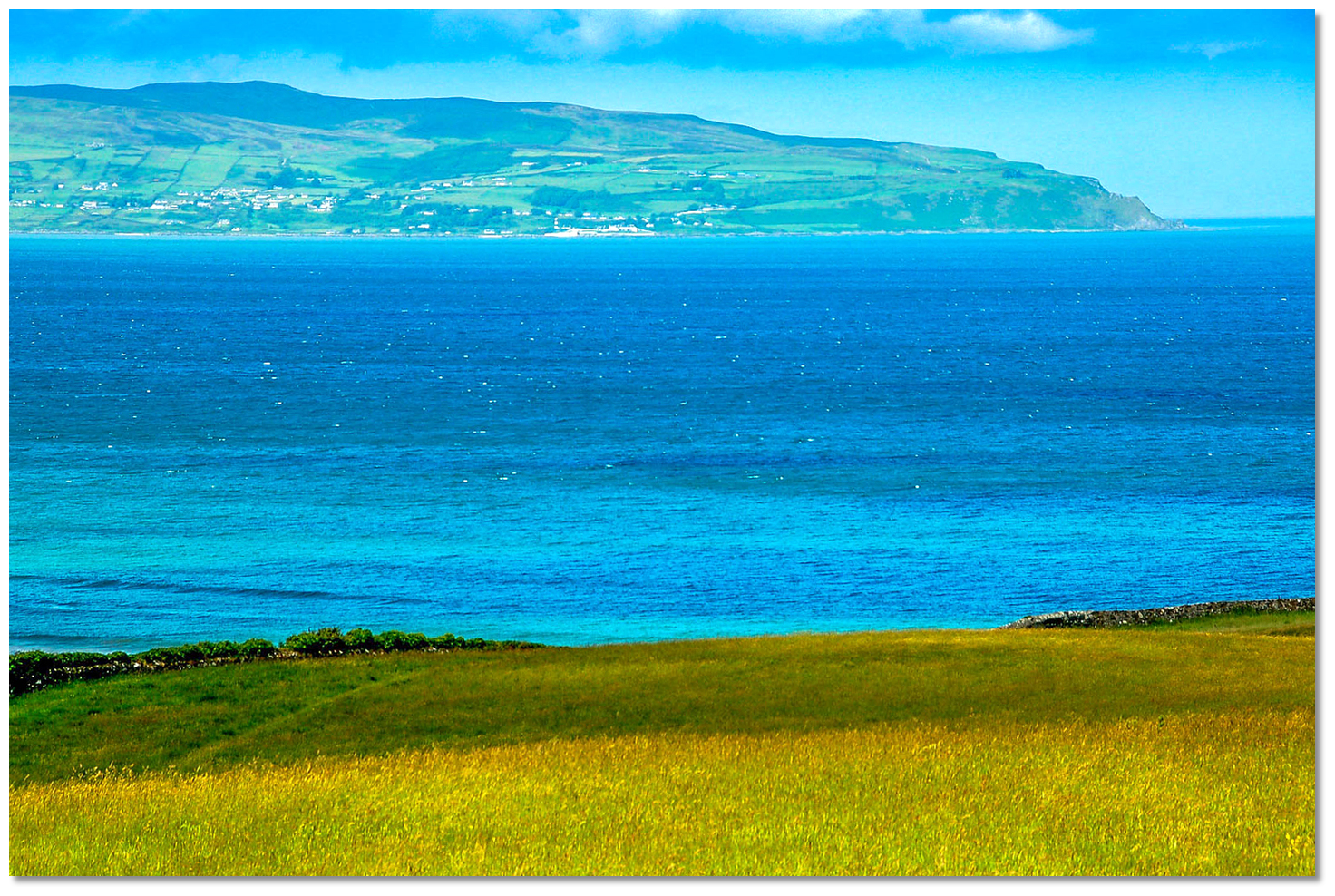
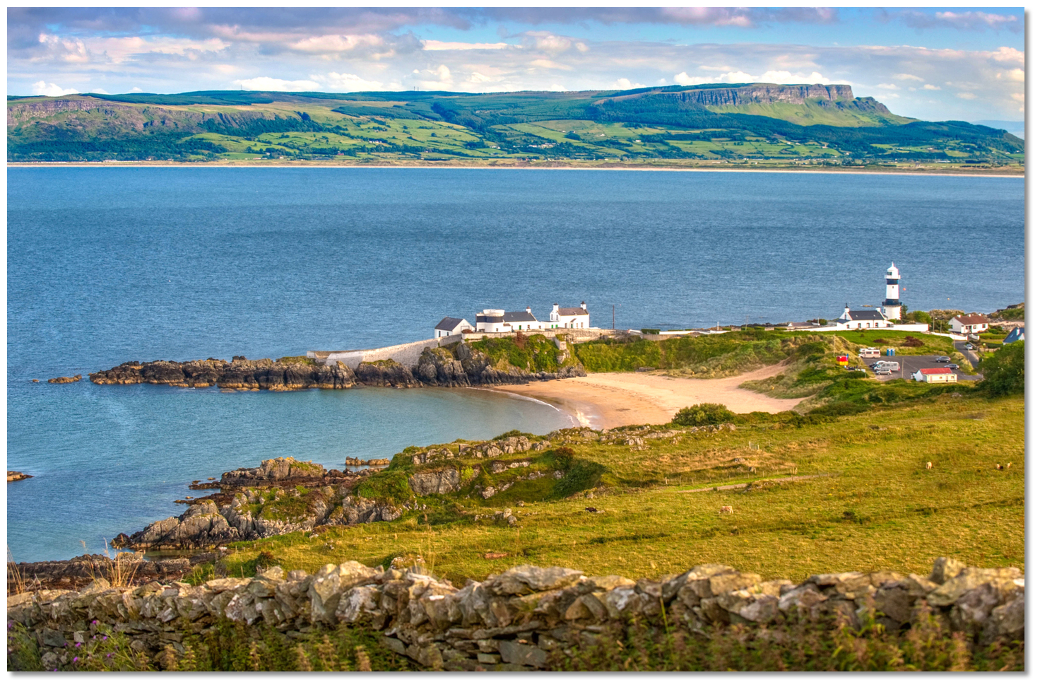
 Offshore details are available in northeast Ireland’s coastal overview for Malin Head to Strangford Lough . Vessels converging on Lough Foyle will find Inishowen Head conspicuous for many miles to seaward. The head’s abrupt precipice is free from dangers extending more than 300 metres offshore and it is well marked. The mountain range extending southwestward from Inishowen Head along the northern side of Lough Foyle has several peaks with elevations in excess of 300 metres. A ½ mile south of the head is Dunagree Point, on which stands Inishowen Light.
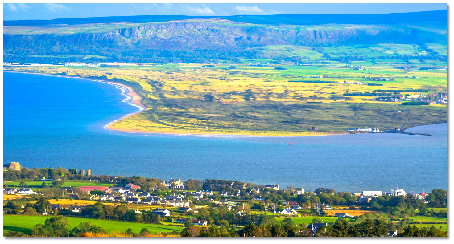 Greencastle facing Magilligan Point across the entrance
Image: Andrew Hurley via CC BY-SA 2.0
Likewise, the opposite distinctive 384 metres high scarp of Binevenagh, standing inshore of the low sandy Magilligan promontory, will be seen for many miles out to sea.
All visiting vessels must contact Harbour Radio prior to the approach,
Ch. 14 [Harbour Radio], +44 (0)28 71 860555/+44 (0)28 71 860313 NUMBER(24 hours). Whilst operating in the Lough Foyle area a listening watch should be maintained on the primary Foyle VHF Channel 14.  Vessels approaching from the northwest will require careful advance planning to round Malin Head, Ireland’s northernmost point. Here the mainland shoreline is bold, jagged, fringed by outlying rocks, and there are outlying rocky island groups amidst the Atlantic Ocean colliding with the runs of the Irish coastal tides.
 Once passed Glengad Head, less than 10 miles southeast of Malin Head, the coast to Inishowen Head around which Lough Foyle approached, is steep-to and free from danger. 20 metres of water will be found a ¼ of a mile off and a berth of 300 metres off the shore clears all dangers in this area. Vessels approaching from the west or north will naturally feed into the North Channel.
 Vessels approaching from the east will find few hazards from the entrance to Lough Foyle as far east as Portrush. There are some outlying rocks after Portstewart, but there are no hidden dangers beyond a quarter of a mile from the shoreline. A berth of at least 600 metres will keep a vessel well clear of this.
 From Portstewart, the shoreline is composed of rocky precipices rising to Mount Benevenagh’s 396-metre summit a short distance inland. For the final 9 miles leading to the low and sandy promontory of Magilligan Point, the entire coastline is fronted by magnificent sandy beaches of Downhill, Castlerock and Benone. With the exception of the Tuns Bank, this passage is clear of any danger 400 metres offshore of the shoaling beach. The prison at Magilligan is brightly lit and visible at night well out to sea. The charted military firing range is seldom used and unlikely to prevent boat movements along the coast.
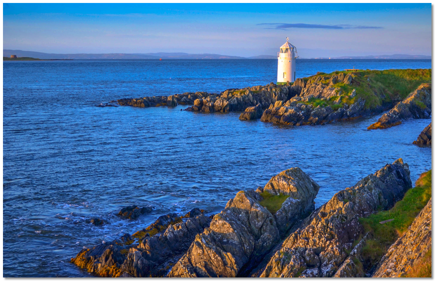
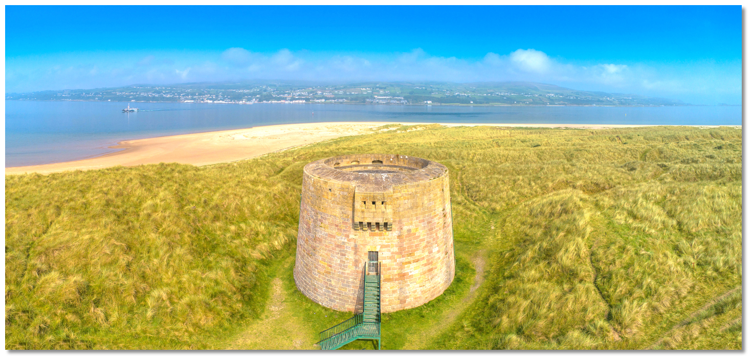 Magilligan Point's Martello Tower makes for an unmistakable seamark
Image: Michael Harpur
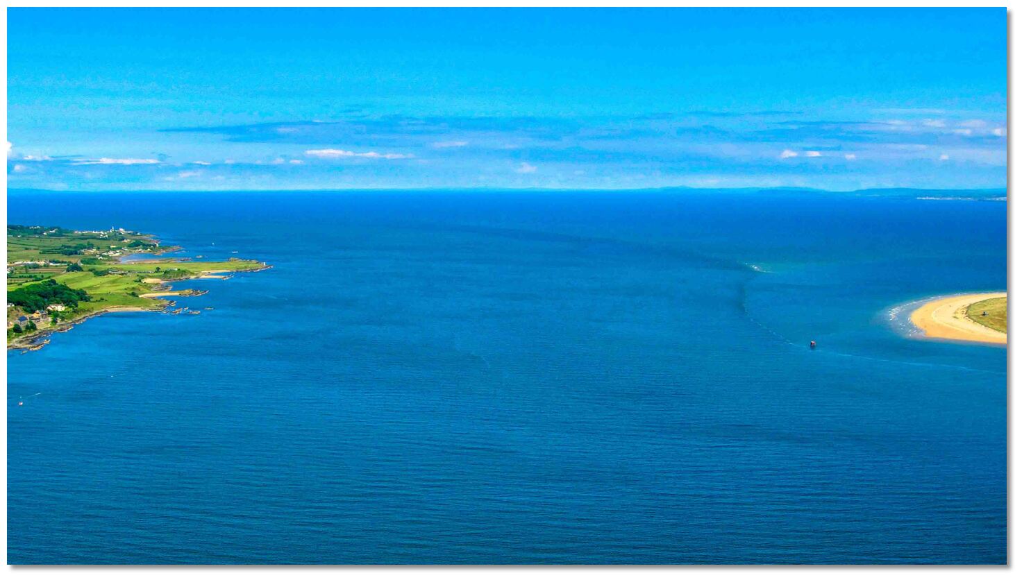
There are two approaches to Lough Foyle and they are on either side of the Tuns Bank. The Tuns Bank is the single danger in the approaches to Lough Foyle. It is a shallow triangular bank that extends 3 miles in a north-easterly direction from Magilligan shore, the east point of the entrance. Its highest part is near the southern edge which is steep-to on the west side. Some years this ridge dries to as much as 1 metre and other years it remains covered, but its position is fixed. It runs nearly parallel to the opposite Inishowen shore with, at the very least, breakers making its location visible. Its northeast tip is marked by a port-hand buoy with depths of 2 to 3 metres of water for the vast majority of the distance out to this mark.
 The entrance with the Tuns Bank just visible
Image: © Andrew Bailey
The access channels circumvent the Tuns bank northward and south of it with an initial fix provided for each option:
Vessels approaching from the west round to the north, at night, in poor visibility or in heavy onshore weather will find the North Channel provides the safer approach to Lough Foyle. For vessels approaching from the east, the South Channel avoids heading out to the Tuns Buoy so that an inshore approaching vessel, from Portrush or the River Bann for instance, can save several miles. It is also an attractive option passing close along the pretty shoreline.
The South Channel is also convenient for vessels attempting to enter against the ebb with offshore winds. The tide can attain up to 3.5 knots at springs in the narrows between Greencastle and Magilligan Point. Moreover, in a strong north-to-northeast blow over the ebb a steep 'wind over tide' sea rises that can extend up to 2 miles to seaward of Inishowen Head. This makes the South Channel an alternative approach to avoid this, even for vessels approaching from the north and northwest. This adverse tide can be further minimised by anchoring off Magilligan Strand to await the flood before entering.
 Inishowen Light standing on Dunagree Point
Image: Tourism Ireland
 From the North Channel Initial Fix steer for the Lough Foyle Buoy, a safe water pillar buoy located 2 miles to the northeast of Inishowen Head.
Lough Foyle Buoy - L Fl 10s position: 55° 15.322’N, 006° 52.616’W
Once Inishowen Head is abeam, make for the Lough Foyle North Channel initial fix. This is set close to the Tuns buoy and tracks in southwestward on the 222° T line of bearing of the Magilligan Point Martello tower.
Tuns Buoy - F1 R 3 position: 55° 14.004’N, 006° 53.440’W
Inishowen Lighthouse is situated a ½ mile south of Inishowen Head on Dunagree Point.
Inishowen - Lighthouse Fl (2) WRG 10s2 8m 18/14M position: 55° 13.556’N, 006° 55.749’W
Locally known as Shrove or Stroove Lighthouse it is a substantial white tower with two black bands. By night Inishowen Lighthouse provides a sectored light for the commercial channel as follows; White 211° to 249° T over the approach from the northeast and the fairway buoy, R14M 249° to 360° T over the Tuns Bank to the east, G14M from 197 to 211° T to the north. There is a smaller disused lighthouse that is white with one black band situated close northeast of Inishowen Lighthouse and about midway along the rocky Dunagree headland.
Image: Andrew Hurley via CC BY-SA 2.0
Continuing south in this channel leads past unlit Metal Man, a green and white triangular metal beacon on Bluick Rock, that is passed to starboard.
 The Warren Lighthouse
Image: Andrew Hurley via CC BY-SA 2.0
Then opposite the Tuns Bank shallowest section is the Warren Lighthouse, 1¼ miles to the southwest of Inishowen Lighthouse, on the north side of the entrance. This is a white round tower with a green abutment showing a visible white light 232°-061° T.
Warren - Lighthouse Fl.W.1.5s 11m 4M position: 55° 12.600’N, 006° 57.100’W
From the South Channel Initial Fix come inshore from the east and approach along the coast at a distance off of about 600 metres whilst making for the Lough Foyle South Channel initial fix. 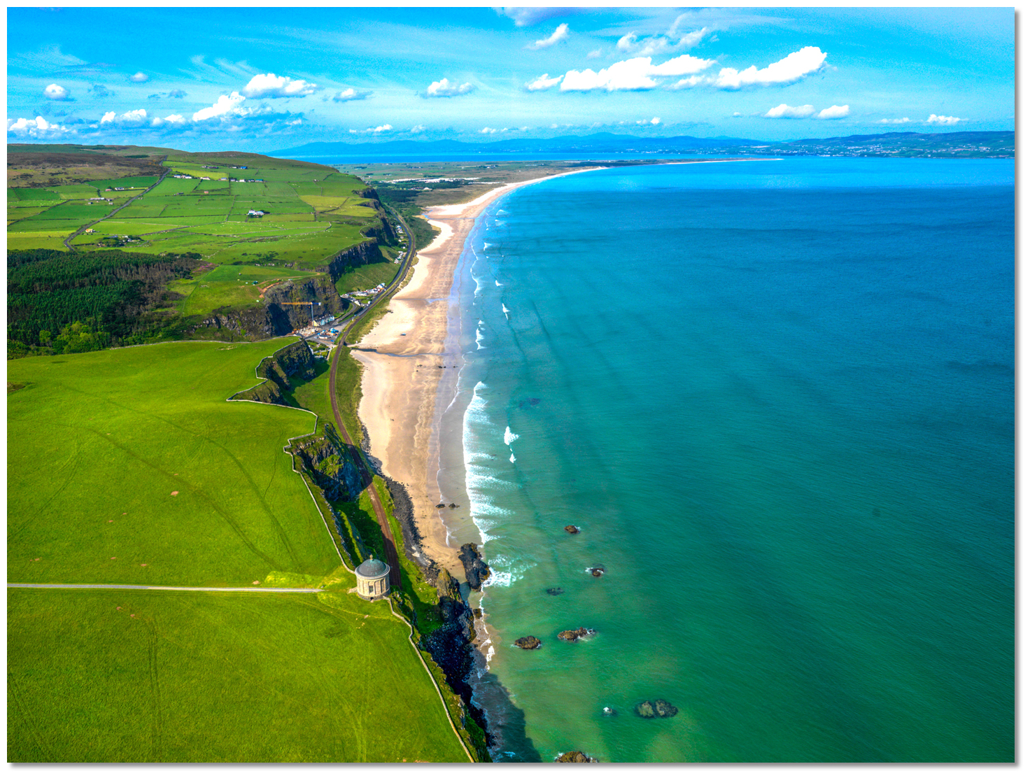 Follow the magnificent beaches of Downhill, Castlerock and Benone
 to the South Channel
Image: Tourism Ireland
This is situated in the narrowest part of the South Channel, about midway between Benone Strand on the shore and the southern edge of the Tuns Bank, in approximately 10 metres of water. About a ½ mile before Magilligan, come closer inshore to a distance off of 400 metres, to make way through the final cut south of the Tuns Bank.
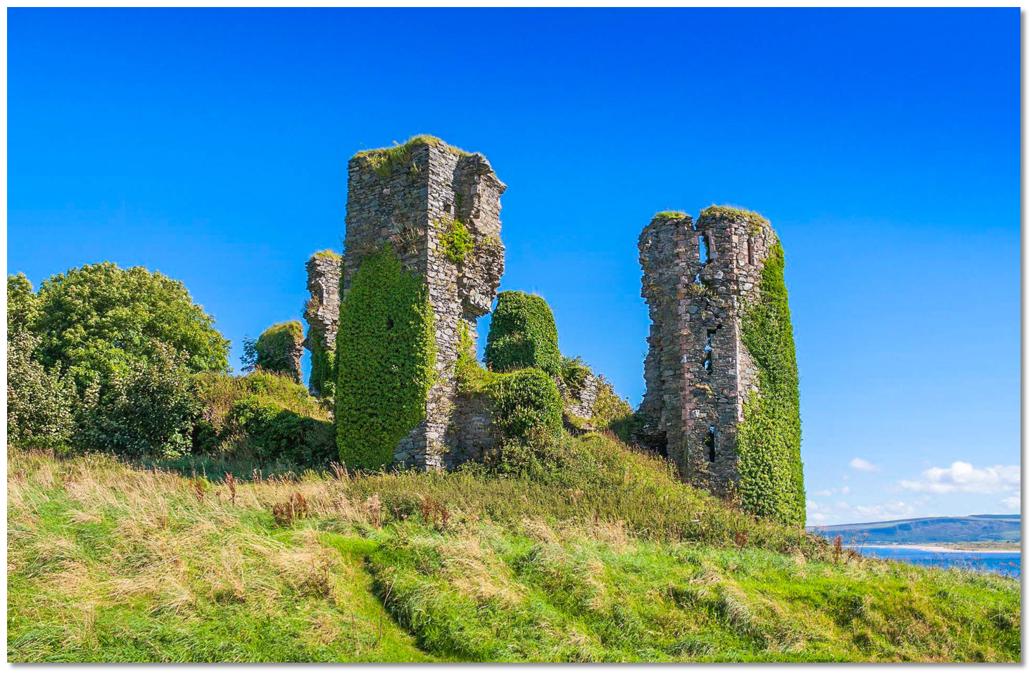 Northburgh Castle ruin
Image: Andreas F. Borchert via CC BY-SA 4.0
The ruins of Northburgh Castle, close north of Greencastle, in line with the radio mast on Crockaulin summit above, about 2 miles west by northwest above, on circa 300° T provide a leading line of bearing through the South Channel. The castle, however, is overwhelmed by ivy making it difficult to identify. It may be best identified by the gap it makes in the surrounding Greencastle housing.
Once Magilligan Point is abeam it is safe to turn and proceed into Lough Foyle between Macgilligan Point and the Inishowen shore.
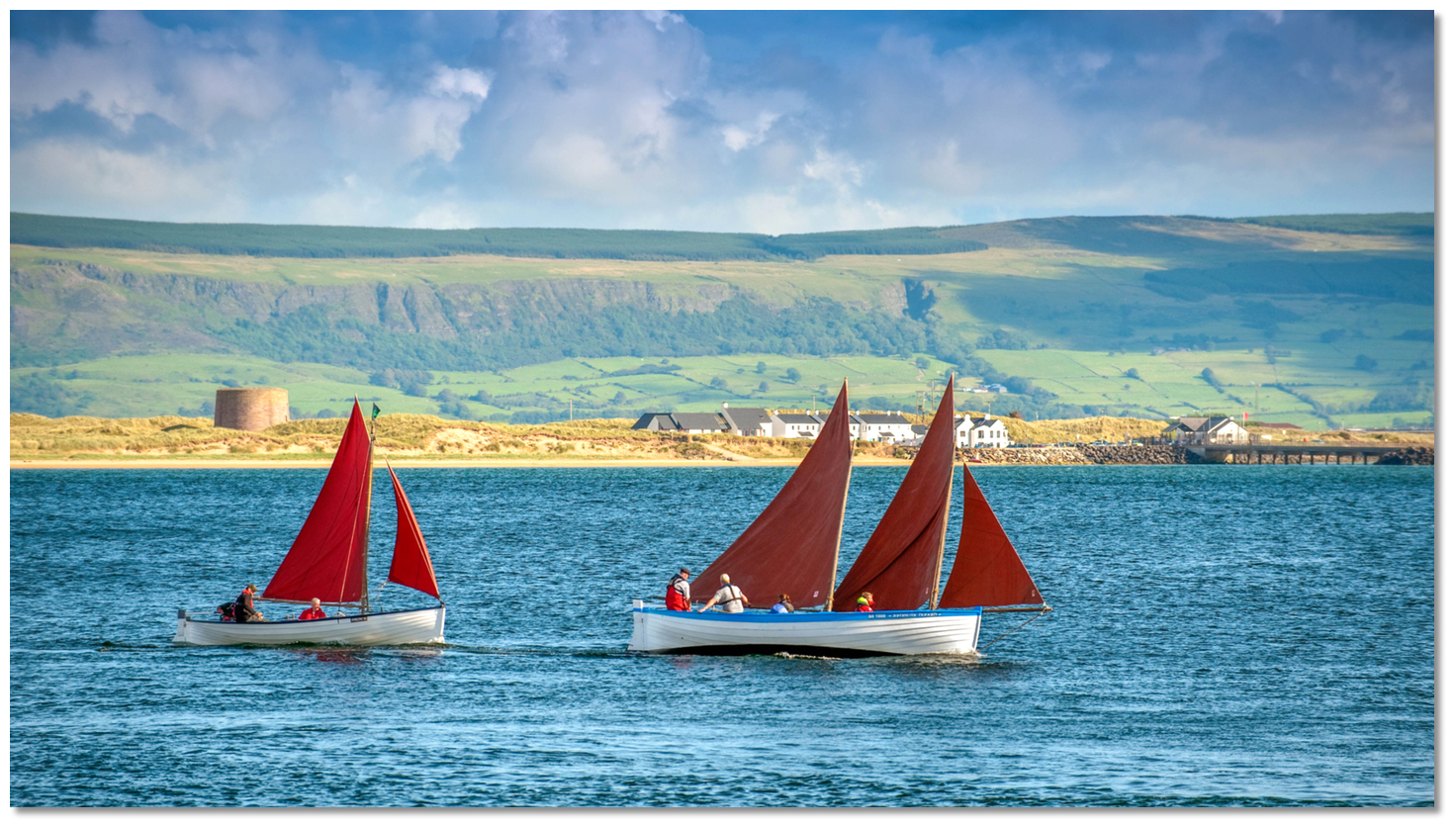 Small boats entering Lough Foyle
Image: Tourism NI
Lough Foyle is then entered between Magilligan Point and the Inishowen shore. Magilligan Point's shape is subject to change depending on the level of storm activity in the preceding winter. But its easternmost point and the navigable channel is securely marked by a light beacon situated to the west of the point.
Image: Michael Harpur
Though the point changes each year the pile structure has always been a reliable mark for its extremity and keeping 200 metres out from it clears all dangers. Shallow patches extend 200 metres southwest of the marker and again 800 metres west by southwest beyond and within the lough so don't be lured inshore south of the point.
Magilligan Point - Red pile structure Q.R. 7m 4M position: 55° 11.730´N, 006° 58.055´W
Greencastle Harbour on the northwest side shows a light Fl R 3s.
Lough Foyle is 13 miles long, 6 miles wide and largely occupied by shallows. A commercial channel leads along its northwest shoreline to the mouth of the River Foyle. The Lough marks the border between the jurisdictions of Northern Ireland and the Republic of Ireland. Upon entry, it is simply a matter of following the northwest shoreline for 3 miles to Moville and Carrickarory Pier area for the first section of the passage. There is plenty of room but leisure craft should navigate the channel to the starboard side in and out.
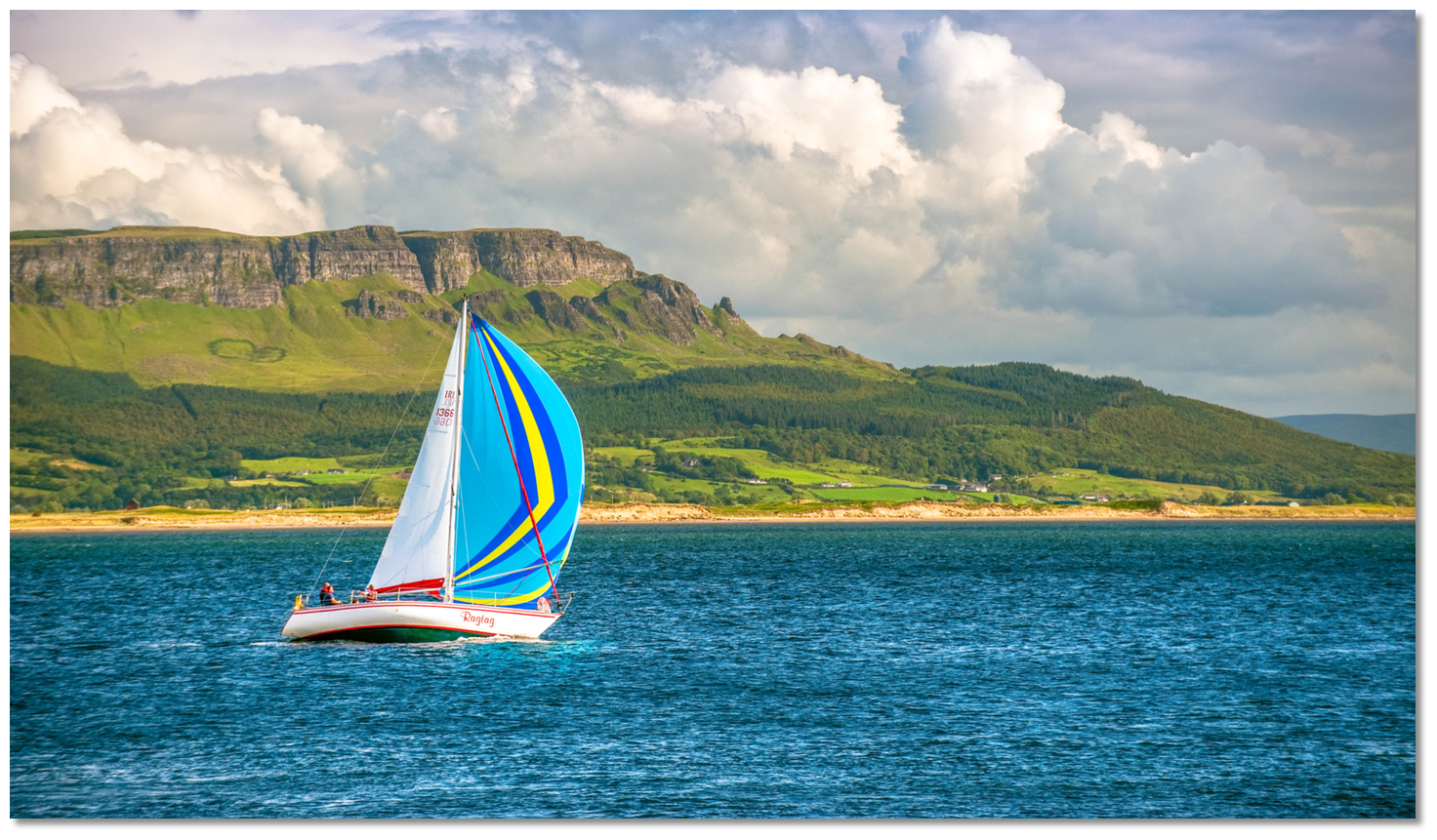 Yacht proceeding up Lough Foyle
Image: Tourism NI
The havens of the southeast shoreline are Magilligan Point
 , Derry and Culmore Bay are in Northern Ireland. Close north of Culmore Point the border meets the lough shore where the havens of the northwest shoreline of Carrickarory Pier , Moville , Greencastle , Silver Strand , Cornashamma Bay , White Bay and Portnocker are in the Republic.
From abreast of Greencastle to Moville, the channel runs between McKenny’s Bank and the Inishowen shore. The channel here is a ½ mile wide with at least 12 metres deep. The northeast head of McKinney's Bank is marked by a pile structure that must be passed to port.
McKinney's Bank - Red pile structure Fl.R. 5s position: 55° 11.285´ N, 007° 00.070´ W
Image: Ed Beard via CC ASA 4.0
Stand off the Inishowen shoreline in the latter part of the passage as the Moville Bank extends from the shore. Keeping the Inishowen lighthouse open of Greencastle astern, will comfortably clear the Moville Bank until the Moville Bank Light structure is identified. This is a white house on green piles 13 metres in height that is situated on the bank’s outer reach. The Moville Bank Light structure should be passed to starboard.
Moville Light beacon – Fl WR. 2.5s 11m 4M position: 55°11.993'N, 007°02.129'W
From here proceed to pass between the Inishowen shoreline and the North Middle Bank. This bank is marked on its northeastern head by the Saltpans marker, 5 Red piles and a white superstructure, which should be passed on its north side or to port.
Saltpans – Red Pile Structure Fl.R. 2.5s 4m 3M 55° 10.520´ N, 007° 03.140´ W
Continue on following the prolific markers to enter the West Channel to the north of The Great Bank that leads to Lisahally and the Foyle River estuary. This then continues along between the north shore and Great Bank, tracking between the port and starboard hand pile beacons Fl R and Fl G for a distance of about 7½ miles to a position southeast of Culmore Point Light beacon.
During this run transiting boats should take care not to impede commercial traffic in the channel. In its narrowest sections, it reduces to 50 metres wide making it a highly restricted waterway for commercial traffic. Large vessels will be channel bound, have right of way and have no capability to manoeuvre. Pleasure craft will find plenty of deep water close to the marks but should not stray outside the lines of the beacons as the depth reduces rapidly on either side of the marks.
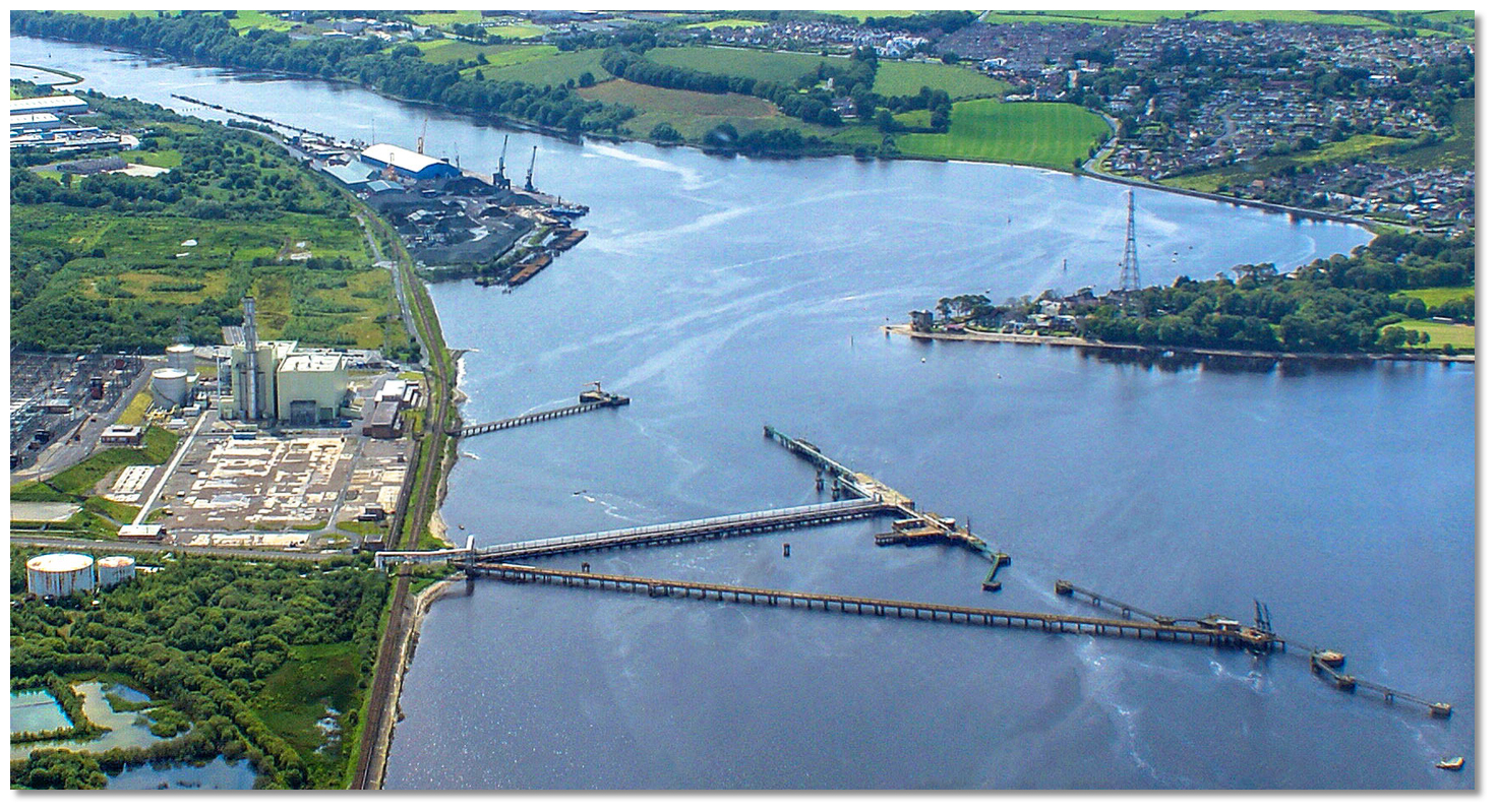 Culmore point and the ESB and LSS Jetties with Lisahally behind
Image: Clifford Payne via ASA 3.0
Culmore Point Light beacon is a green round tower with a black base that stands at the entrance to Culmore Bay and the River Foyle. A conspicuous spire, situated 1,500 metres to the west of the point will be seen on approach. A 95-metre high power pylon carrying an overhead power cable across the river, close east of the point, restricts the river’s safe overhead clearance to 39 metres here.
Culmore Point - Fl Q.W. 6m 3M position: 55° 02.780´N, 007° 15.245´ W
On the east side of the river, the ESB Jetty will be seen and then the Lisahally Terminal commercial sections of the port at the mouth of the Foyle River. Derry city quays are no longer used for commercial traffic and all commercial shipping is catered for here including berthing arrangements for the unmanned Foyle Port Marina.
To pick up the pontoon access card and arrange payment come alongside at the Fish Quay pontoon at the southwest end of the Lisahally Terminal. The office is situated on the quay less than 100 metres from here.
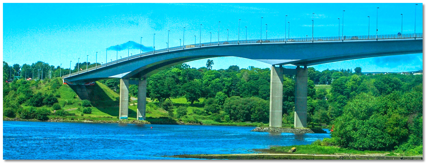 The Foyle Bridge
Image: Lindy Buckley via CC BY 2.0
Once berthing arrangements have been attended to the final stretch to the city quays is via the Foyle River with wooded banks on either side. The channel tends in a south-westerly direction for 3 miles and has a least width of 91 metres, half the amount available at the pontoon area, and is very well marked. The Foyle Bridge, with a clearance of 31 metres HAT, spans the river just under 2 miles to the southwest of Lisahally. The city cathedral, on the summit of the hill, is a conspicuous landmark from the river and may be seen from most parts of Lough Foyle.
A speed restriction of 6 knots applies generally in the River Foyle, reducing to a limit of 4 knots in the vicinity of the visitor pontoon, and tidal streams are fairly strong in parts of the river.
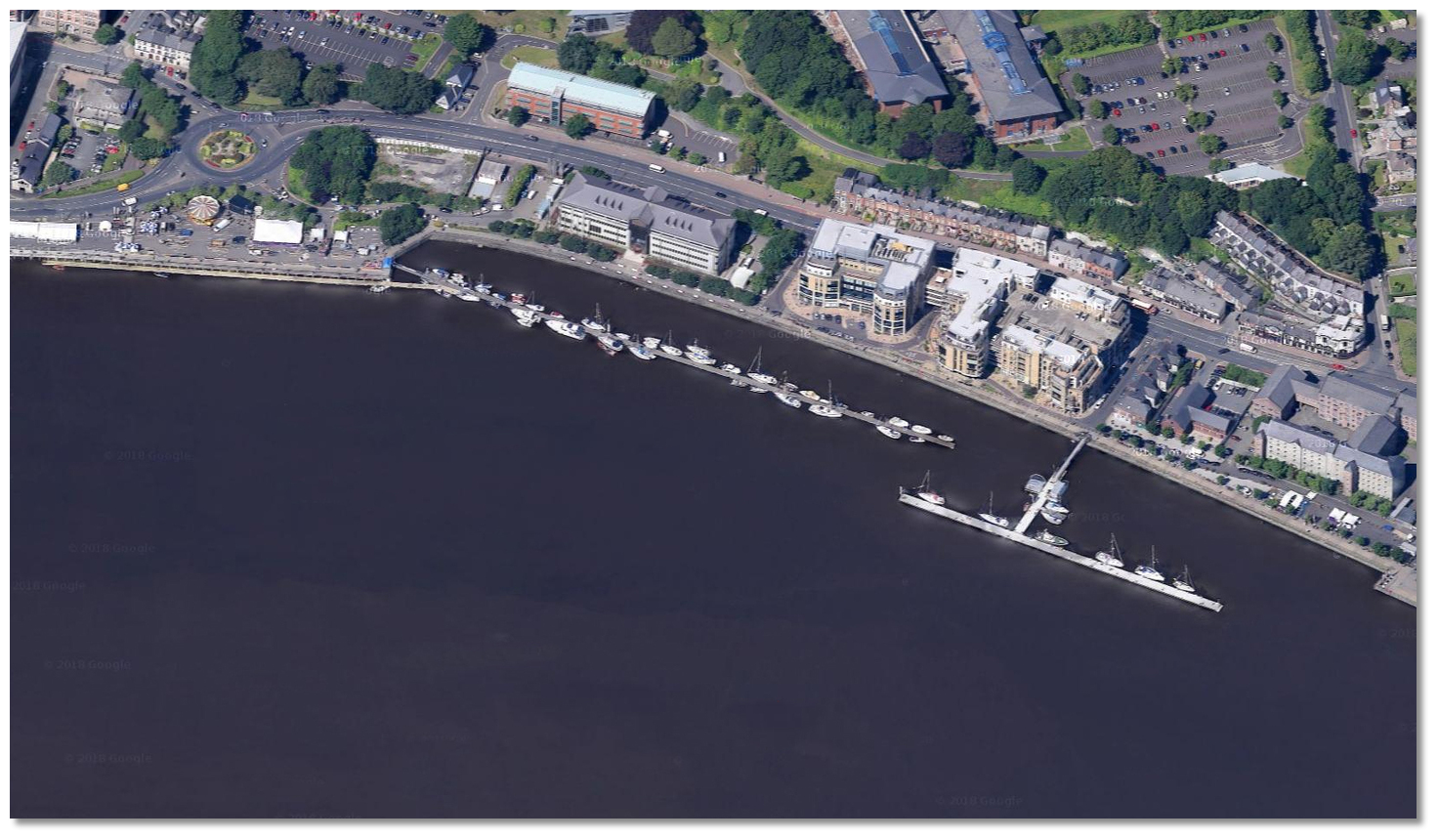 Foyle Port Marina on the west bank of the river
Image: Google
The Foyle Port Marina is situated on the west side of the harbour below the new Peace Bridge. It is made up of two pontoons and an inner one alongside the quay. Berth as directed by the Harbour Office. After heavy rain or on spring tides the currents at the pontoon can be considerable as the tide ebbs. Boats can be thrown against the pontoon so it is advisable to moor securely with a full complement of well-placed fenders.
 The Peace Bridge and lower Craigavon Bridge in the backdrop upriver
Image: Tourism NI
A ½ mile upriver from the Foyle Port Marina, the Peace Bridge and a further ½ mile to the south is The Craigavon Bridge which have restricted air drafts of 3.7 and 1.2 metres respectively. The Craigavon Bridge is particularly low.
 Craigavon Bridge
Image: Tom Bastin via CC BY 2.0
It was built, in 1933, with a lower deck that carried a railway line for freight wagons that was discontinued in 1968. Vessels that can pass under these bridges will find the River Foyle navigable to Strabane.
Why visit here?
Derry, officially Londonderry, is a city that is subject to a naming dispute between Irish nationalists and unionists. But which came first, Derry or Londonderry? Well, neither. The element Derry is derived from the commonly used Irish word 'doire' meaning 'oak grove' and in this case 'Daire Calgaich' meaning 'oak-grove' or 'oak-wood' of 'Calgach'. The old Irish 'daire' was difficult to pronounce and it was anglicised to the present Derry.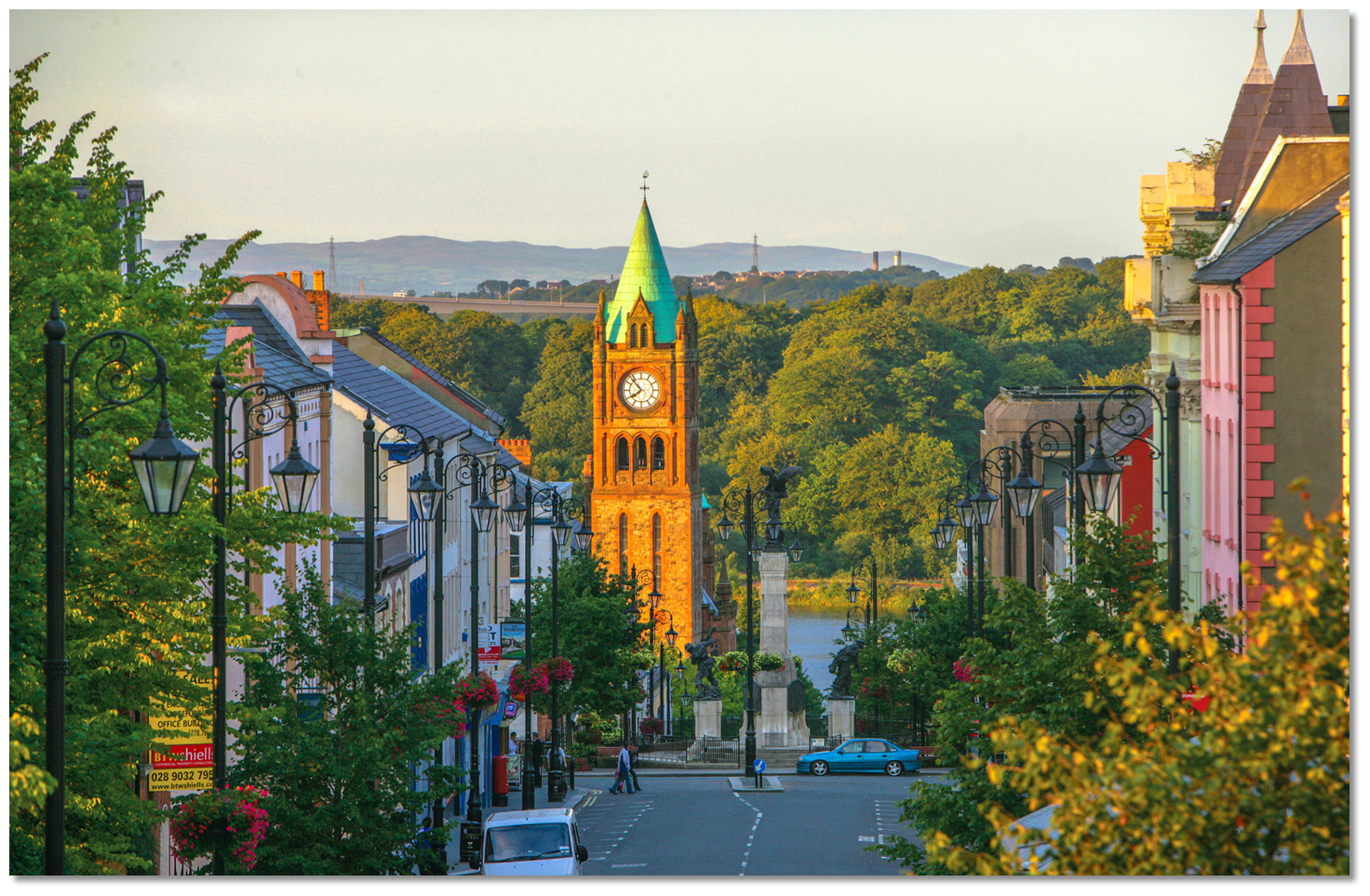 Derry takes its name from the Irish Daire meaning 'oak-grove'
Image: Tourism NI
Though the town's historical references primarily date back to the 6th century, the location was inhabited for thousands of years beforehand. The region is thought to be one of the longest-continuously inhabited places in Ireland. It acquired its name in about 540 AD when Donegal's famous St Colmcille, or Columba, founded a monastery in an oak grove on top of the hill. The 'oak grove', 'Daire Calgaich' was provided by the local king 'Calgaich' on the east side of the River Foyle and hence his name was attached. St Colmcille would soon depart to spread Christianity to present-day Scotland but his monastery remained in the hands of the federation of Columban churches. This community would become a beacon of light and learning throughout Europe. In time St Colmcille's name would supplant the name of the original local king and the area name is spelt in modern Irish 'Doire Cholmchille' or 'Doire'.
 St Columb cathedral which was built from 1628 to 1633 inside the city walls
Image: Tourism NI
Derry would be primarily known as a monastic settlement until as late as the 11th century after which a settlement and harbour started to develop. It became strategically important during the Tudor conquest of Ireland. After the 'Flight of the Earls', the county was open to King James I's Plantation drive. In 1610 A dozen wealthy City of London Guilds, who represented London's merchants, agreed to build a new city on the Foyle in return for its land and resources. The corporation brought in large populations of English, as opposed to Scottish elsewhere, and set about building a town for them.
 The old City Walls
Image: Tourism NI
This is how Derry was started, in 1613, and the first stoned were for the city walls around the hill to protect their investment from the surrounding, displaced and hostile Irish locals. They then began to build the city within the walls, which would be the first planned city in Ireland having its first stages completed by 1619. This was all originally constructed on an island as a channel of the Foyle wrapped around it. The channel would occasionally dry to a bog and hence the Bogside acquired its name.
 St Columb cathedral inside the walls of the old city
Image: Tourism NI
The castle was robustly built to defend the plantation of settlers from the local Irish insurgents who did not welcome the occupation. The central diamond within the walled city had four gates. It was thought to be so good a defensive design that it was subsequently copied many times in the colonies of British North America. The initial town charter defined the city as the area extending 6.1 km, 3 miles, from the centre. It was during this Ulster Plantation that the name 'London' was added to its original name of 'Derry'. This was intended to reflect the establishment of the old walled city by the London guilds.
 The formidable city walls
Image: Keith Ewing via CC BY SA 3.0
As aforementioned, this makes 'Derry' or 'Londonderry' a particularly unusual city in that its very name is open to debate. Londonderry is the official name according to the city's 1662 Royal Charter and it was reaffirmed by a 2007 High Court decision. However, the city is more commonly known as 'Derry'. The shorter 'Derry' is certainly preferred by nationalists, the Republic of Ireland reference it as such and in everyday conversation, 'Derry' is frequently used by Unionists. Unionists however prefer 'Londonderry' and all UK official material, charts etc. and signposts are 'Londonderry', if many of them, even today, have the 'London' part spray-painted out.
 The breath of the walls as seen at an entrance
Image: Peter Reed via CC BY SA 3.0
And it gets worse, to get past this naming difficulty it became known as Derry/Londonderry, and also the other way around Londonderry/Derry which had others calling it 'slashtown'. What's more, Derry is also known by the nickname 'Maiden City' in Unionist circles because its sturdy ramparts held out against many fierce attacks and were never breached. If that was not enough the tourist board sidestepped the entire centuries-old imbroglio by calling it another name 'LegenDerry'. However when you ask a local what the name of the city is, don’t be surprised to get a response along the lines of… 'I don't care what you call it, as long as you don't try to tell me what to call it' which just about sums up the stalemate.
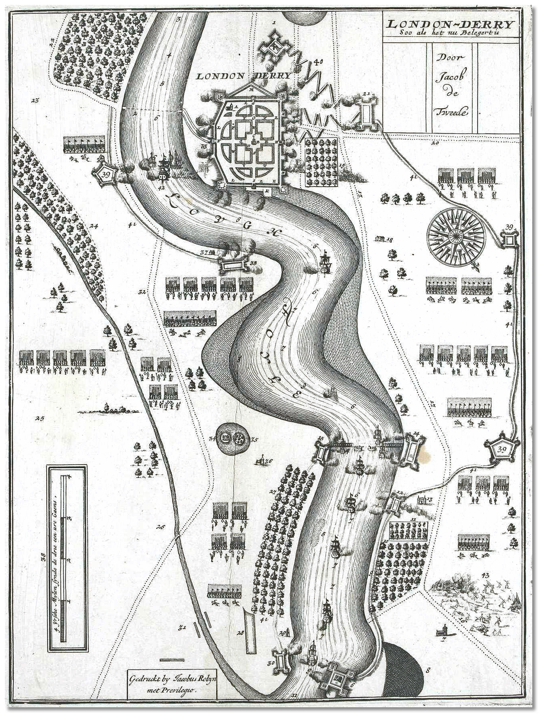 Map of the 1689 siege as part of the struggle between James II and William
III
Image: CC0
The most famous of the city's battles were during the Glorious Revolution and the 1689 'Siege of Derry'. This occurred during the Williamite War in Ireland and involved a pre-emptive lockdown of the city gates in December 1688 followed by a violent defensive action lasting from 18 April to 28 July 1689. By this time only Derry and nearby Enniskillen were the only Williamite strongholds remaining nationally. The siege began after King James rode to within 300 yards of the walls and demanded the surrender of the city. Legend has it that every man, woman, and child in the city rushed to the walls and shouted, "No surrender!" and the city's defenders fired at him. James would ask three more times and be rebuffed on each occasion. The ensuing siege lasted 105 days and the besieged were reduced to eating dogs, cats, and laundry starch to survive.
 The Guildhall as seen from the walls
Image: Tourism NI
Derry was finally relieved by Royal Navy ships that broke through a heavily defended boom across the Foyle at Culmore. By then it is thought 8,000 of the estimated population of 30,000 had died. Nevertheless, they held out and their victory helped to secure the British throne for the Protestant King William III. The siege is annually commemorated in August by the Apprentice Boys of Derry. This and many other victories make Derry one of the very few European cities not to be overrun, and the only one with walls that remain completely intact.
 The walls had significant firepower to drive off its attackers
 Image: Peter Reed via CC BY SA 3.0
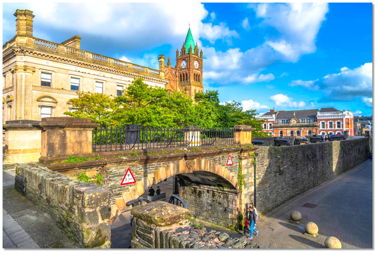
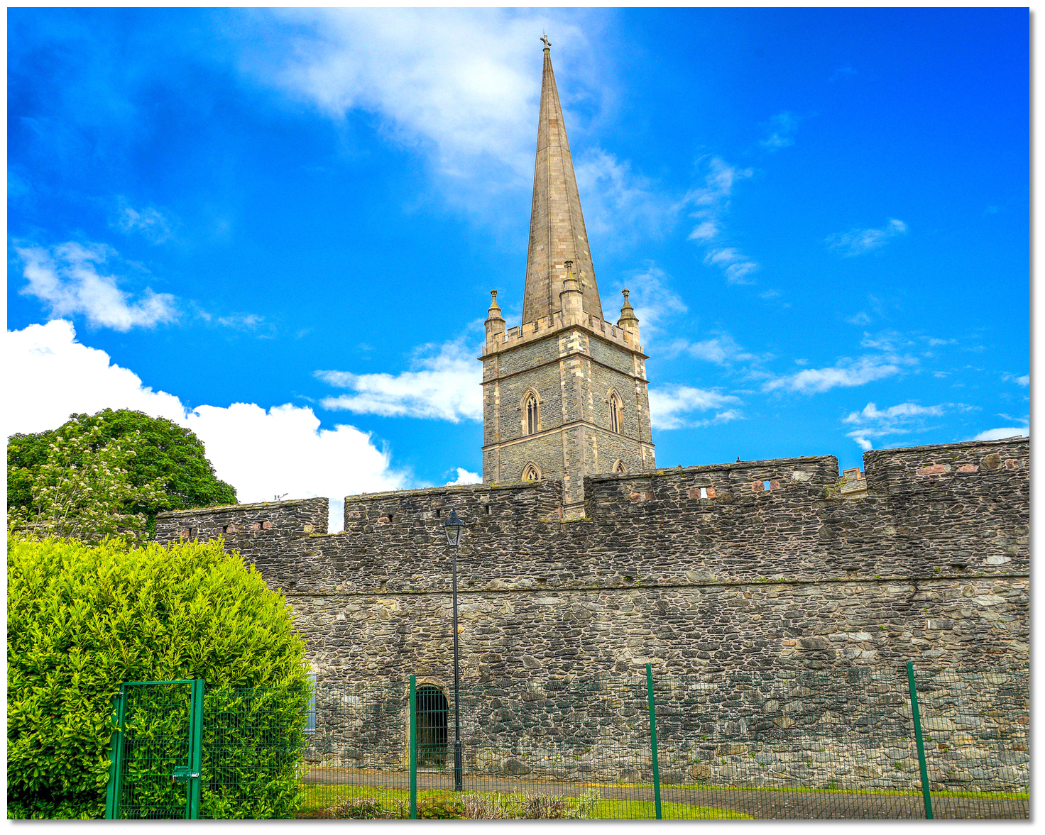
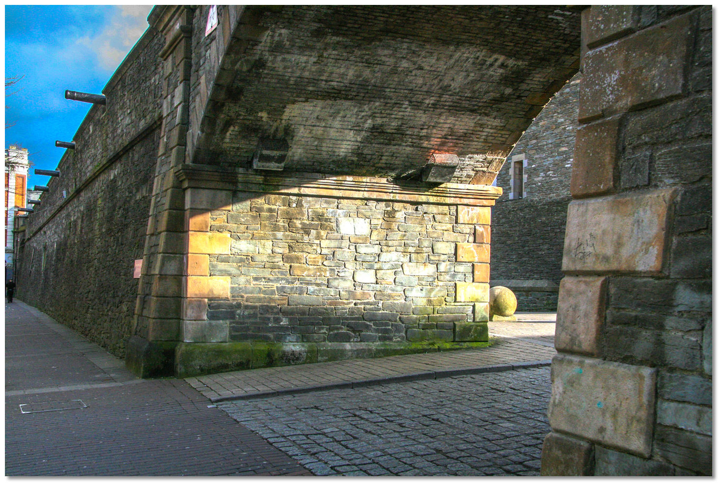
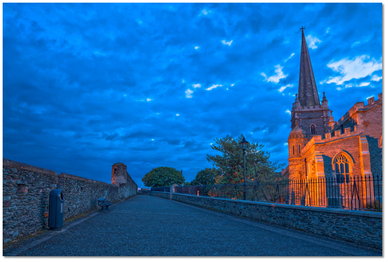
Derry remains to this day Ireland's only completely walled city and one of the finest examples of a walled city in Europe. The walls vary in height and width, from 4 to 12 metres, are 1.5 km in circumference and are interspersed with a series of eight town gates, of which four are original. Today they are regarded with almost holy reverence by the Unionists community and by providing a walkway around the old inner city they enable a visitor to connect with Derry's rich history.
 The Guildhall as seen out through the gate of the old wall town
Image: Tourism NI
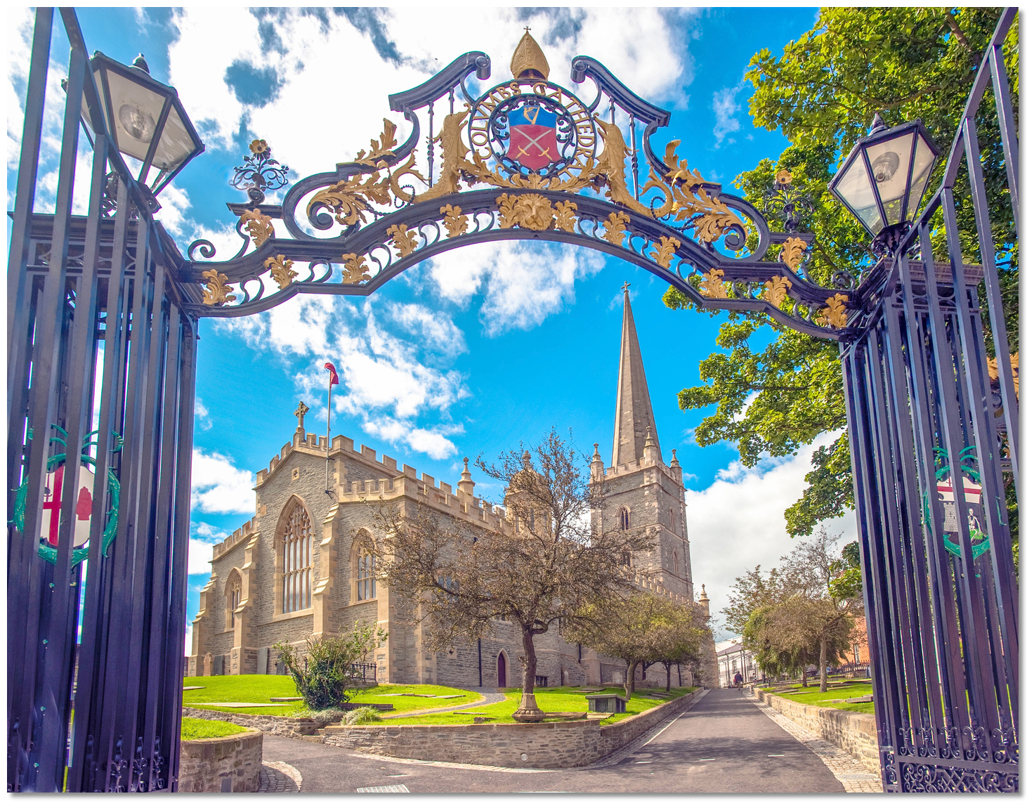
Inside the modern city preserves its 17th-century Renaissance-style street plan of four main streets radiating from a central Diamond to the original four town gates. The city's oldest surviving building was constructed within a couple of decades of the walls. This is the cathedral of St Columb which was built from 1628 to 1633 in a style called 'Planter’s Gothic' and it is visible from most parts of Lough Foyle. The church was the first Protestant cathedral built in the United Kingdom after the Reformation and to this day houses the largest and oldest bells, dating from the 1620s, in Ireland. In the porch of the cathedral is a stone that records completion with the inscription: "If stones could speake, then London's prayse should sound, Who built this church and cittie from the grounde.".
 Hands Across the Divide
Image: Tourism NI
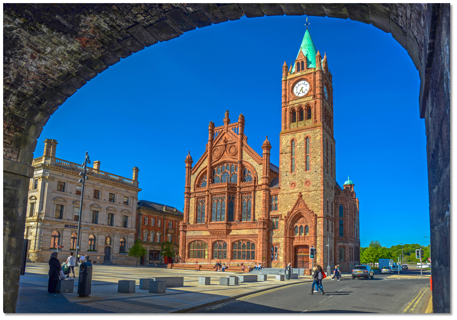
The building played an important part in the defence of the city during the siege. Cannons were mounted on its roof, and the original spire was scavenged for lead to melt into cannon shot. It has memorials and relics from the siege today and most visitors come to see the keys that locked the four main gates of the city during the siege. The Catholic Church of Saint Columba's Long Tower, which began life on a much smaller scale in 1783, stands close to the south. The Market House inside the city was destroyed during the Siege of Derry. It was replaced by the Guildhall with its pretty square which was built outside the walls and completed in 1890.
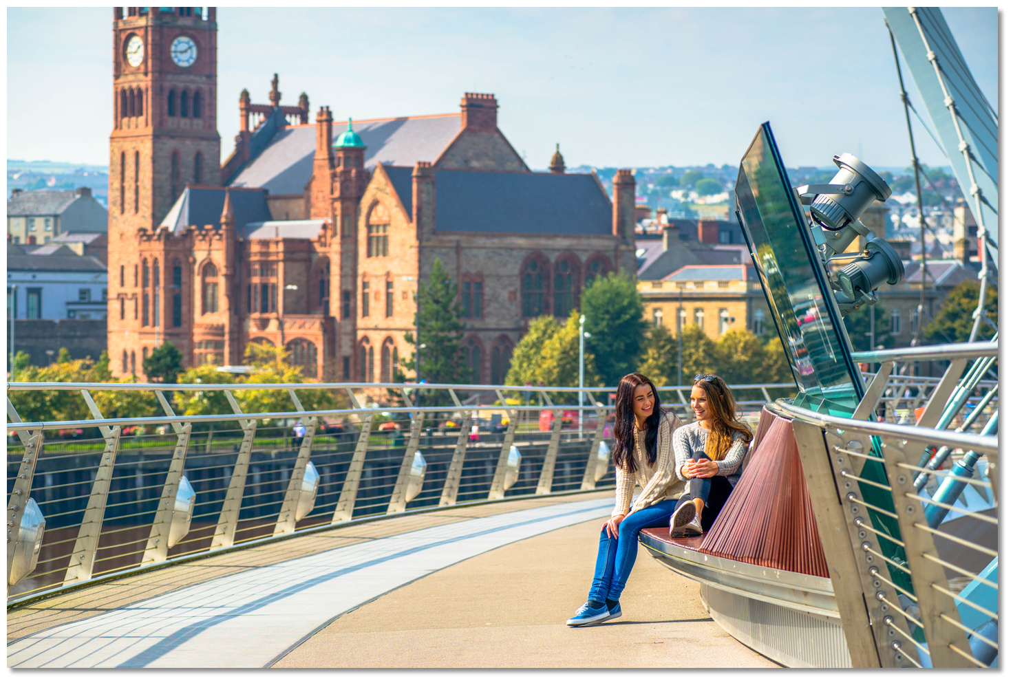
 The Peace Bridge
Image: Tourism NI
In succeeding centuries the city prospered, expanding beyond the walls and across the river. Industries like shirt making and whisky distilling flourished while the port became a leading centre of international trade. The city remained a focal position in the important events of Irish history. From the plantation to the sieges to the mass emigration to America, Australia and Liverpool. During the 18th century, many thousands of emigrants left the quaysides to start a new life in North America. They transplanted their traditions to new territories. The city remained in the thick of it in the 19th century with it being the centre for supporting the Atlantic Covoys and seeing the surrender of U-Boats at Lisahally in WW2. The city played its part in the civil rights movement of the 1960s and experienced its share of conflict and tragedy during 'The Troubles' culminating in 'Bloody Sunday'. By 1980 a third of the buildings within the walls had been damaged or destroyed.
 The city is today a University campus with a unique fusion of Irish and British
culture
Image: Tourism NI
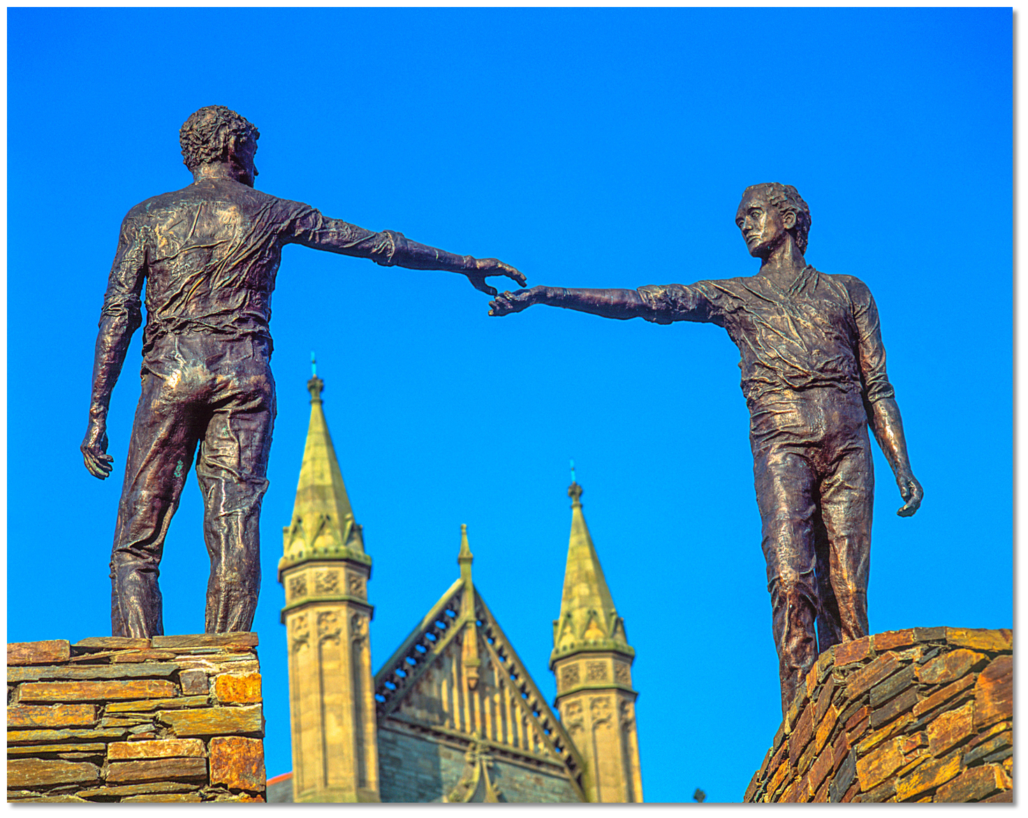
Yet the people's spirit was undefeated and the reconciliation is celebrated in sculptures such as Hands Across the Divide, a sculpture of two figures extending their hands. Likewise, the cycle and footbridge called the Peace Bridge intended to connect and improve relations between the largely unionist Waterside on the east bank with the largely nationalist Cityside on the west bank. With the return of peace, the city reinvented itself again as a regional city, a University campus, a fusion of Irish and British culture and an international tourist destination.
 The walls at dusk
 Image: Nicolas Raymond via CC BY SA 3.0
Most of the life of the city now takes place outside of its walls, but stunning vistas are not the exclusive preserve of the ramparts. The modern city that extended to cover both banks of the river is characterised by a distinctly hilly topography with the River Foyle forming a deep valley on either side. Here streets of fine Georgian and Victorian buildings sit side by side with gaily painted Victorian-fronted shops, cafes and pubs, on a series of streets that stream down to the Foyle. This makes the city of Derry a place of very steep streets and sudden, startling views.
 Derry's old walls at night
 Image: Tourism NI
With so much history there is much here to intrigue the visitor. This colourful and varied cultural heritage may be embraced in many museums, including a Victorian-style museum dedicated to the city's maritime heritage, that is set alongside sites of interest in and around the city. With Cityside, on the west, and Waterside, on the east, connected by the footbridge all of this is situated within easy walking distance of the Foyle Pontoon. Furthermore, the berth is situated in the heart of the historic city with many other attractions including restaurants, pubs and a vibrant shopping centre close at hand.
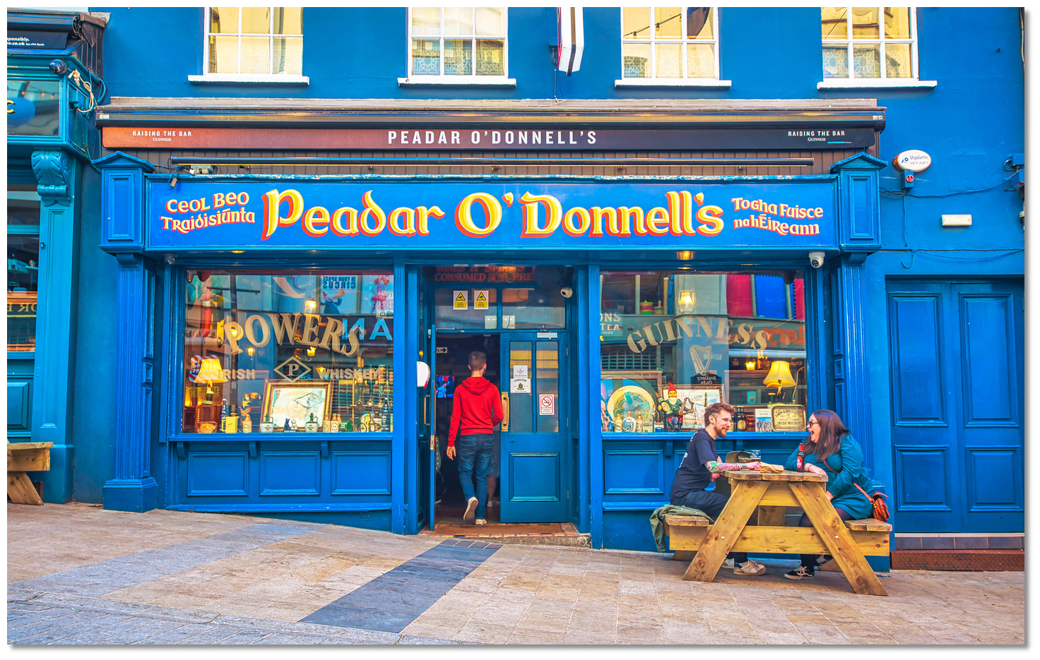 Derry Pub Peadar O'Donnell's
Image: Tourism NI
From a boating perspective, Foyle Port Marina offers complete protection with excellent provisioning and transport connections. The deeply historic city would be a compelling and contrasting berth on any coastline, but none more so than on the margins of the rugged and solitary north coast of Ireland.
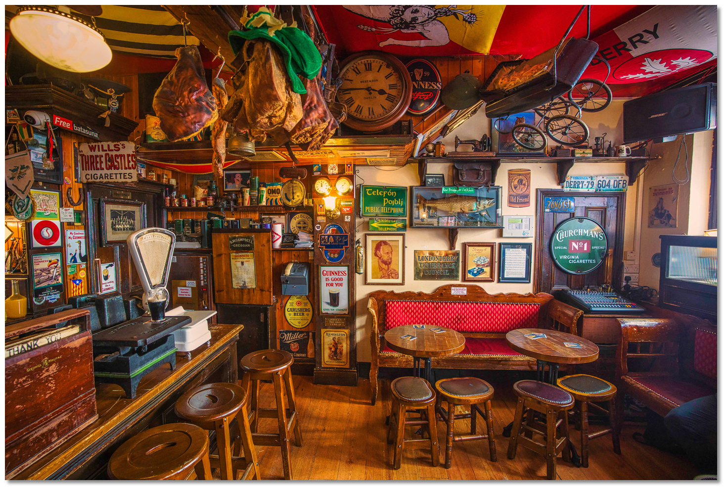 Derry offers the coastal cruiser a safe snug berth in all conditions
(Peadar O'Donnell's interior)
Image: Tourism NI
Not only is it a spectacular historic city but it is also an ideal and secure gateway to explore the North Antrim Coast and Donegal's ruggedly beautiful Inishowen Peninsula either by sea or land.
 Sunset Foyle Port Marina
Image: © Pete Murray
Despite its long trek from the sea it truly offers the coastal cruiser a unique and varied set of unmissable opportunities.
What facilities are available?
There is electricity, waste reception facilities, water and showers on the pontoon. Launderette, provisions, petrol, ‘luggable’ diesel, and bottle gas are all available on Strand Road, a short walk from the pontoon; with bulk diesel by arrangement at Lisahally. The city has marine engineering, a yacht chandlery, but no boatyard.The pontoon is a short walk from the city centre with all the facilities to serve an urban population of 90,000, and a wider population of 237,000 within 32 km of the city. Thus it has a wide variety of excellent restaurants, bars, shopping, and all other facilities to offer.
Transport connections are very good as the location serves as a transport hub for nearby counties Donegal and Tyrone as well as Derry City itself. All buses depart from the city centre Foyle Street Bus Station to destinations throughout Ireland including a daily half-hourly service to Belfast. Northern Ireland Railways (N.I.R.) have a single route from Londonderry railway station, on the Waterside, to Belfast. City of Derry airport is the main regional airport with year round scheduled flights to UK, Republic of Ireland and Europe offered by Aer Arann and Ryanair. Further flight options are available via Belfast International Airport, the main regional airport, and George Best Belfast City Airport, which are accessible by bus and train.
Any security concerns?
Pontoon access is restricted to key holders only. CCTV monitors the area 24 hours a day controlled by the Harbour Office.With thanks to:
Bill McCann, Londonderry Harbour Master.A number of small vessels escorting the Clipper Derry Londonderry out of the city.
A short promotional video by the Northern Ireland tourist board.
About Foyle Port Marina (Derry City)
Derry, officially Londonderry, is a city that is subject to a naming dispute between Irish nationalists and unionists. But which came first, Derry or Londonderry? Well, neither. The element Derry is derived from the commonly used Irish word 'doire' meaning 'oak grove' and in this case 'Daire Calgaich' meaning 'oak-grove' or 'oak-wood' of 'Calgach'. The old Irish 'daire' was difficult to pronounce and it was anglicised to the present Derry.
Derry takes its name from the Irish Daire meaning 'oak-grove'Image: Tourism NI
Though the town's historical references primarily date back to the 6th century, the location was inhabited for thousands of years beforehand. The region is thought to be one of the longest-continuously inhabited places in Ireland. It acquired its name in about 540 AD when Donegal's famous St Colmcille, or Columba, founded a monastery in an oak grove on top of the hill. The 'oak grove', 'Daire Calgaich' was provided by the local king 'Calgaich' on the east side of the River Foyle and hence his name was attached. St Colmcille would soon depart to spread Christianity to present-day Scotland but his monastery remained in the hands of the federation of Columban churches. This community would become a beacon of light and learning throughout Europe. In time St Colmcille's name would supplant the name of the original local king and the area name is spelt in modern Irish 'Doire Cholmchille' or 'Doire'.
St Columb cathedral which was built from 1628 to 1633 inside the city wallsImage: Tourism NI
Derry would be primarily known as a monastic settlement until as late as the 11th century after which a settlement and harbour started to develop. It became strategically important during the Tudor conquest of Ireland. After the 'Flight of the Earls', the county was open to King James I's Plantation drive. In 1610 A dozen wealthy City of London Guilds, who represented London's merchants, agreed to build a new city on the Foyle in return for its land and resources. The corporation brought in large populations of English, as opposed to Scottish elsewhere, and set about building a town for them.
The old City WallsImage: Tourism NI
This is how Derry was started, in 1613, and the first stoned were for the city walls around the hill to protect their investment from the surrounding, displaced and hostile Irish locals. They then began to build the city within the walls, which would be the first planned city in Ireland having its first stages completed by 1619. This was all originally constructed on an island as a channel of the Foyle wrapped around it. The channel would occasionally dry to a bog and hence the Bogside acquired its name.
St Columb cathedral inside the walls of the old cityImage: Tourism NI
The castle was robustly built to defend the plantation of settlers from the local Irish insurgents who did not welcome the occupation. The central diamond within the walled city had four gates. It was thought to be so good a defensive design that it was subsequently copied many times in the colonies of British North America. The initial town charter defined the city as the area extending 6.1 km, 3 miles, from the centre. It was during this Ulster Plantation that the name 'London' was added to its original name of 'Derry'. This was intended to reflect the establishment of the old walled city by the London guilds.
The formidable city wallsImage: Keith Ewing via CC BY SA 3.0
As aforementioned, this makes 'Derry' or 'Londonderry' a particularly unusual city in that its very name is open to debate. Londonderry is the official name according to the city's 1662 Royal Charter and it was reaffirmed by a 2007 High Court decision. However, the city is more commonly known as 'Derry'. The shorter 'Derry' is certainly preferred by nationalists, the Republic of Ireland reference it as such and in everyday conversation, 'Derry' is frequently used by Unionists. Unionists however prefer 'Londonderry' and all UK official material, charts etc. and signposts are 'Londonderry', if many of them, even today, have the 'London' part spray-painted out.
The breath of the walls as seen at an entranceImage: Peter Reed via CC BY SA 3.0
And it gets worse, to get past this naming difficulty it became known as Derry/Londonderry, and also the other way around Londonderry/Derry which had others calling it 'slashtown'. What's more, Derry is also known by the nickname 'Maiden City' in Unionist circles because its sturdy ramparts held out against many fierce attacks and were never breached. If that was not enough the tourist board sidestepped the entire centuries-old imbroglio by calling it another name 'LegenDerry'. However when you ask a local what the name of the city is, don’t be surprised to get a response along the lines of… 'I don't care what you call it, as long as you don't try to tell me what to call it' which just about sums up the stalemate.
Map of the 1689 siege as part of the struggle between James II and WilliamIII
Image: CC0
The most famous of the city's battles were during the Glorious Revolution and the 1689 'Siege of Derry'. This occurred during the Williamite War in Ireland and involved a pre-emptive lockdown of the city gates in December 1688 followed by a violent defensive action lasting from 18 April to 28 July 1689. By this time only Derry and nearby Enniskillen were the only Williamite strongholds remaining nationally. The siege began after King James rode to within 300 yards of the walls and demanded the surrender of the city. Legend has it that every man, woman, and child in the city rushed to the walls and shouted, "No surrender!" and the city's defenders fired at him. James would ask three more times and be rebuffed on each occasion. The ensuing siege lasted 105 days and the besieged were reduced to eating dogs, cats, and laundry starch to survive.
The Guildhall as seen from the wallsImage: Tourism NI
Derry was finally relieved by Royal Navy ships that broke through a heavily defended boom across the Foyle at Culmore. By then it is thought 8,000 of the estimated population of 30,000 had died. Nevertheless, they held out and their victory helped to secure the British throne for the Protestant King William III. The siege is annually commemorated in August by the Apprentice Boys of Derry. This and many other victories make Derry one of the very few European cities not to be overrun, and the only one with walls that remain completely intact.
The walls had significant firepower to drive off its attackers Image: Peter Reed via CC BY SA 3.0
Derry remains to this day Ireland's only completely walled city and one of the finest examples of a walled city in Europe. The walls vary in height and width, from 4 to 12 metres, are 1.5 km in circumference and are interspersed with a series of eight town gates, of which four are original. Today they are regarded with almost holy reverence by the Unionists community and by providing a walkway around the old inner city they enable a visitor to connect with Derry's rich history.
The Guildhall as seen out through the gate of the old wall townImage: Tourism NI
Inside the modern city preserves its 17th-century Renaissance-style street plan of four main streets radiating from a central Diamond to the original four town gates. The city's oldest surviving building was constructed within a couple of decades of the walls. This is the cathedral of St Columb which was built from 1628 to 1633 in a style called 'Planter’s Gothic' and it is visible from most parts of Lough Foyle. The church was the first Protestant cathedral built in the United Kingdom after the Reformation and to this day houses the largest and oldest bells, dating from the 1620s, in Ireland. In the porch of the cathedral is a stone that records completion with the inscription: "If stones could speake, then London's prayse should sound, Who built this church and cittie from the grounde.".
Hands Across the DivideImage: Tourism NI
The building played an important part in the defence of the city during the siege. Cannons were mounted on its roof, and the original spire was scavenged for lead to melt into cannon shot. It has memorials and relics from the siege today and most visitors come to see the keys that locked the four main gates of the city during the siege. The Catholic Church of Saint Columba's Long Tower, which began life on a much smaller scale in 1783, stands close to the south. The Market House inside the city was destroyed during the Siege of Derry. It was replaced by the Guildhall with its pretty square which was built outside the walls and completed in 1890.
The Peace BridgeImage: Tourism NI
In succeeding centuries the city prospered, expanding beyond the walls and across the river. Industries like shirt making and whisky distilling flourished while the port became a leading centre of international trade. The city remained a focal position in the important events of Irish history. From the plantation to the sieges to the mass emigration to America, Australia and Liverpool. During the 18th century, many thousands of emigrants left the quaysides to start a new life in North America. They transplanted their traditions to new territories. The city remained in the thick of it in the 19th century with it being the centre for supporting the Atlantic Covoys and seeing the surrender of U-Boats at Lisahally in WW2. The city played its part in the civil rights movement of the 1960s and experienced its share of conflict and tragedy during 'The Troubles' culminating in 'Bloody Sunday'. By 1980 a third of the buildings within the walls had been damaged or destroyed.
The city is today a University campus with a unique fusion of Irish and Britishculture
Image: Tourism NI
Yet the people's spirit was undefeated and the reconciliation is celebrated in sculptures such as Hands Across the Divide, a sculpture of two figures extending their hands. Likewise, the cycle and footbridge called the Peace Bridge intended to connect and improve relations between the largely unionist Waterside on the east bank with the largely nationalist Cityside on the west bank. With the return of peace, the city reinvented itself again as a regional city, a University campus, a fusion of Irish and British culture and an international tourist destination.
The walls at dusk Image: Nicolas Raymond via CC BY SA 3.0
Most of the life of the city now takes place outside of its walls, but stunning vistas are not the exclusive preserve of the ramparts. The modern city that extended to cover both banks of the river is characterised by a distinctly hilly topography with the River Foyle forming a deep valley on either side. Here streets of fine Georgian and Victorian buildings sit side by side with gaily painted Victorian-fronted shops, cafes and pubs, on a series of streets that stream down to the Foyle. This makes the city of Derry a place of very steep streets and sudden, startling views.
Derry's old walls at night Image: Tourism NI
With so much history there is much here to intrigue the visitor. This colourful and varied cultural heritage may be embraced in many museums, including a Victorian-style museum dedicated to the city's maritime heritage, that is set alongside sites of interest in and around the city. With Cityside, on the west, and Waterside, on the east, connected by the footbridge all of this is situated within easy walking distance of the Foyle Pontoon. Furthermore, the berth is situated in the heart of the historic city with many other attractions including restaurants, pubs and a vibrant shopping centre close at hand.
Derry Pub Peadar O'Donnell'sImage: Tourism NI
From a boating perspective, Foyle Port Marina offers complete protection with excellent provisioning and transport connections. The deeply historic city would be a compelling and contrasting berth on any coastline, but none more so than on the margins of the rugged and solitary north coast of Ireland.
Derry offers the coastal cruiser a safe snug berth in all conditions(Peadar O'Donnell's interior)
Image: Tourism NI
Not only is it a spectacular historic city but it is also an ideal and secure gateway to explore the North Antrim Coast and Donegal's ruggedly beautiful Inishowen Peninsula either by sea or land.
Sunset Foyle Port MarinaImage: © Pete Murray
Despite its long trek from the sea it truly offers the coastal cruiser a unique and varied set of unmissable opportunities.
Other options in this area
Coleraine - 14.6 miles ENE
Seatons Marina - 14.3 miles ENE
The Lower River Bann - 13.5 miles ENE
Portrush Harbour - 15.9 miles ENE
Carrickarory Pier - 8.5 miles NE
Moville - 8.9 miles NE
Greencastle - 10.1 miles NE
Silver Strand - 10.7 miles NE
Navigational pictures
These additional images feature in the 'How to get in' section of our detailed view for Foyle Port Marina (Derry City).


| Detail view | Off |
| Picture view | On |
A number of small vessels escorting the Clipper Derry Londonderry out of the city.
A short promotional video by the Northern Ireland tourist board.
Add your review or comment:
Nick Kelly wrote this review on Jun 8th 2014:
There are now three showers on the first pontoon, though one out of order (June2014), and another hot/cold. NB - fill up with water before you arrive. Water is charged for at an extortionate rate. If you need water, you might be best to consider a different stopping point.
Average Rating: UnratedPlease log in to leave a review of this haven.
Please note eOceanic makes no guarantee of the validity of this information, we have not visited this haven and do not have first-hand experience to qualify the data. Although the contributors are vetted by peer review as practised authorities, they are in no way, whatsoever, responsible for the accuracy of their contributions. It is essential that you thoroughly check the accuracy and suitability for your vessel of any waypoints offered in any context plus the precision of your GPS. Any data provided on this page is entirely used at your own risk and you must read our legal page if you view data on this site. Free to use sea charts courtesy of Navionics.