

Quoile is located on the northeast coast of Ireland within Strangford Lough’s southwestern corner and at the head of the Quoile River estuary. It offers a very good river anchorage with the option of picking up well-maintained moorings or coming alongside the Quoile Yacht club pontoon in a highly attractive location.
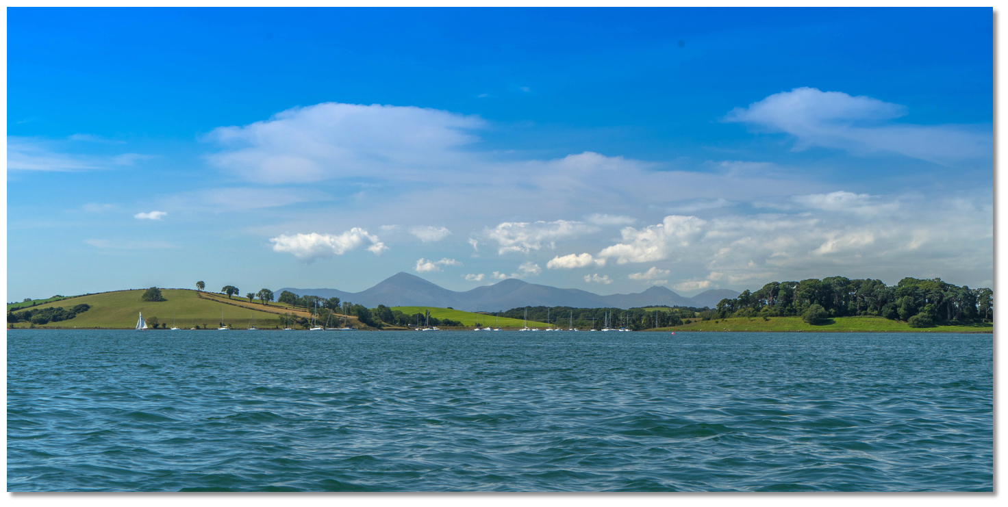
Inside the Quoile River, akin to many of the islands and snug creeks on the western shore, a vessel will find complete protection. Quoile offers good protection for conditions from west to northwest. The Lough's enclosed body of water provides sheltered sailing in all weather, all tides and ample marks to make daylight navigation straightforward.

Keyfacts for Quoile


Summary* Restrictions apply
A completely protected location with attentive navigation required for access.


Nature


Considerations


 quoileyachtclub.com/
Position and approaches

Haven position
 54° 22.233' N, 005° 40.318' W
In the middle of the anchorage between Castle and Gibbs islands.
What are the initial fixes?
The following waypoints will set up a final approach:(i) Quoile River Initial Fix
 54° 23.614' N, 005° 38.195' W
300 metres east of Town Rock off Killyleagh. This is a distinctive red cylindrical brick pillar marker lit with a sectored light, Fl(2)WRG.5s6M, leading between Barrel and Skate rocks.
(ii) Killyleagh Initial Fix
54° 23.573' N, 005° 37.537' WBetween Barrel and Skate Rocks that are marked by perches. It is set upon the useful transit marked on the Admiralty chart keeping Portaferry pier open upon Chapel Island.


What are the key points of the approach?
 . Details for vessels approaching from the south are available in eastern Ireland’s Coastal Overview for Strangford Lough to Dublin Bay . Details of the approaches, tidal timings, the run up The Narrows and onward to Killyleagh, on the Lough's western shore, are covered in the Entering and exiting Strangford Lough route description.
Not what you need?
- Moore’s Point - 0.7 nautical miles NE
- Salt Island (Southwest) - 0.7 nautical miles ENE
- Brandy Bay (North Salt Island) - 0.9 nautical miles NE
- Salt Island (South) - 1 nautical miles ENE
- Killyleagh - 1.8 nautical miles NNE
- Jackdaw Island - 2.3 nautical miles ENE
- Holm Bay - 2.5 nautical miles NNE
- Between Jackdaw & Chapel Island - 2.6 nautical miles ENE
- East Down Yacht Club - 2.8 nautical miles NNE
- Chapel Island - 2.8 nautical miles ENE
- Moore’s Point - 0.7 miles NE
- Salt Island (Southwest) - 0.7 miles ENE
- Brandy Bay (North Salt Island) - 0.9 miles NE
- Salt Island (South) - 1 miles ENE
- Killyleagh - 1.8 miles NNE
- Jackdaw Island - 2.3 miles ENE
- Holm Bay - 2.5 miles NNE
- Between Jackdaw & Chapel Island - 2.6 miles ENE
- East Down Yacht Club - 2.8 miles NNE
- Chapel Island - 2.8 miles ENE


What's the story here?
 Quoile Yacht Club on Castle Island at the navigational head of the River Quoile
Image: Michael Harpur
The Quoile River takes a southwest direction from Killyleagh toward Downpatrick which it historically serviced. This was until the tidal barrier was established at Hare Island in 1956 adjacent to the position of the Quoile Yacht Club to prevent flooding. For its 2-mile course to the tidal barrier, where navigation ceases, the River Quoile has good depths and good anchorages particularly so on the final approaches to the club. At its head is Quoile Yacht Club which is located on Castle Island, to the south of Gibb's Island and immediately below the tidal barrier.
 The Quoile Yacht Club pontoon
Image: Michael Harpur
The Club provides visitors with the warmest of welcomes. Their three yellow visitor moorings are checked annually and are located on the final approaches between Gibb's and Castle Island. These are available by a donation of £15 [2022] per night. The club's 50-metre-long pontoon lies behind Castle Island, is accessible at all states of the tide and has 3 metres LAT. It is also available by arrangement with the club and visitors will be asked to make a payment of £25 [2022] per night to berth alongside.
 The Quoile Yacht Club pontoon at low water springs
Image: Michael Harpur
The pontoon can be very busy at weekends but space can usually be found during weekdays. Please give preference to Quoile Yacht Club members. Boats on the pontoon cannot be left unattended overnight. Contact the club by
 info@quoileyc.com, Club Web Form
  or
or  +44 (0)28 4461 2266.
  Yacht anchored close outside the approaches to the Quoile Yacht Club
Image: Michael Harpur
Although Quoile affords complete protection, there may be a little chop with very strong northeasterly gales, which at most would give a bumpy night. Likewise, if it is blowing hard, the club might ask a vessel to move to a mooring to take the pressure off.
How to get in?
 The run up the river from Strangford Lough to the Quoile Yacht Club
Image: Michael Harpur
 Details of the approaches, tidal timings, the run up The Narrows and onward to Killyleagh, on the Lough's western shore, are covered in the Entering and exiting Strangford Lough route description.
Image: Michael Harpur
This is situated 400 metres east of Killyleagh's Town Rock beacon and is an equal distance, of a ½ mile, from both Barrel and Skate rocks. Town Rock is a highly distinctive red brick pillar marker, that looks not unlike the Rook chess piece. At night it is lit with a sectored light, Fl(2)WRG.5s6M, with the white light sector leading between Barrel and Skate rocks.
_and_green_island_(right).jpg) Town Rock with Skate Rock uncovered (top left), and Green Island (right)
Town Rock with Skate Rock uncovered (top left), and Green Island (right)Image: Michael Harpur
The most dangerous for a vessel entering/exiting the Lough is the Skate Rock which is very much in the way of a direct path from the Narrows to Killyleagh and the Quoile River entrance. It uncovers at four hours ebb and normally has a pole. The racing Mark K is also normally moored close south of it.
 Town Rock with Don O'Neill Island in the backdrop and Barrell Rock dry
Image: Michael Harpur
Barrel Rock uncovers at low water and normally has a perch. The racing Mark 4 buoy is also moored close to its north side. A useful transit to pass between the Barrel and Skate rocks is to keep Portaferry pier open upon Chapel Island astern.
 The entrance to the River Quoile as seen from Killyleagh
Image: Michael Harpur
 From the Quoile River Initial Fix the path takes a west-southwest direction on a bearing of 210° T for a distance of approximately 1 mile. This leads through the middle of the river estuary passing Green Island to port.
  Green Island as seen from the River Quoile
Image: Michael Harpur
Stand off the shoreline when approaching Green Island as Bradly Rock, normally marked by a pole, lies a ¼ of a mile directly south of the pontoon head 200 metres out from the shore near Nickey's Point.
_with_moores_point_and_salt_and_green_islands_opposite.jpg) The low lying Rat Island (middle) with Moore's Point and Salt and Green islands
The low lying Rat Island (middle) with Moore's Point and Salt and Green islandsopposite
Image: Michael Harpur
By this point, Salt Island will become readily apparent a ½ mile southwest of Green Island with Moore’s Point on the opposite north shore. Steer to pass midway Salt Island with Moore’s Point.
 Castle Island and Gibb's Island overlooked by The Mournes
Image: Michael Harpur
When approaching Salt Island look upriver for the highly distinctive Gibbs Island that stands close off the north shore and opposite Castle Island. It is one of the few islands within the Lough to have trees with its’ collection of mature Scot’s Pine, resembling a sprig of broccoli.
 The run to the northmost point of Gores Island
Image: Michael Harpur
Steer for the centre of the trees passing north to the tiny low-lying Rat Island that lies between Gores Island and Salt Island on the southeast side of the river.
 The Toad Stone perch with the Strangford Stone on the north shore in the
backdrop
Image: Michael Harpur
Then turn to pass close to the north point of Gore’s Island picking up the Toad Stone perch off the north side of the river. This is the first mark to pick up and it stands opposite Gores Island's northmost point and a speed marker buoy close offshore.
Toad Stone perch - position: 54° 22.460’N, 005° 40.030’W
 Gores Island's northmost point with the speed marker buoy
Image: Michael Harpur
Leave the starboard Toad Stone perch, which has deep water up to the mark, to the north (starboard) and pass between it and the speed buoy laying off Gore’s Island.
 The Scotsman at low water
Image: Michael Harpur
The next iron beacon, The Scotsman, is situated about a ¼ of a mile southwest of the Toad Stone perch, and it is also left to the north (passed to starboard). The Scotsman with a crow's nest type structure on top marks the southern end of the Scotsman Pladdy and it should be given a wide berth.
 Yacht anchored in the Quoile River close downriver of the club
Image: Michael Harpur
It is possible to anchor anywhere in this area or to the south of The Scotsman. Or to proceed westwards between Gibbs Island and Castle island to the club pontoon.
 The pole marking the shallows off of Castle Island at low water
Image: Michael Harpur
A pole marks the shallows off of Castle Island which must be passed on its north side (to port) between it and Gibbs Island.
 The first two of the three visitor buoys off Castle Island
Image: Michael Harpur
It is possible to anchor anywhere in the approaches clear of local moorings. But the historic anchorage has decades of moorings on the bottom upon which to foul. It is therefore advisable to use a tripping line and only anchor at the perimeter of the mooring area between Castle and Gibbs islands. 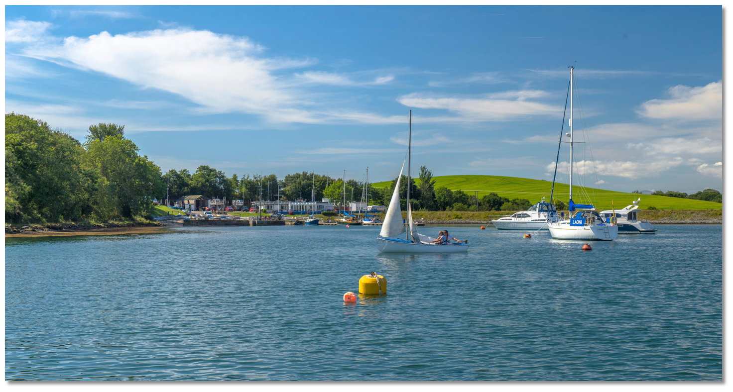 Visitor buoy on the approaches to Quoile Yacht Club
Image: Michael Harpur
The three yellow visitor moorings can be freely picked up and a distinctive tree in the middle of Castle Island is a good mark for the location of the middle of the moorings.
 The channel into the pontoon
Image: Michael Harpur
Alternatively, berth alongside the Quoile Yacht Club pontoon situated on Castle Island to port, and in through the moorings. There is a marked channel leading into the pontoon that lies between a small buoy with an east topmark on the port side marking the shallows extending from the east side. On the opposite side is a small Pladdy that steps out from the western shore situated about 30 metres northwest from the end of the pontoon.
 The rocky head of the Pladdy showing at low water springs
Image: Michael Harpur
This Pladdy is the primary concern as it has a rocky head. It is marked by a tall pole and a short one about a metre outside. Pass through the moorings, and then between the east cardinal topmark buoy and the Pladdy marked by the perch to the pontoon.
 Approaching Quoile Yacht Club pontoon
Image: Michael Harpur
Berth as directed by the club alongside the pontoon.
Why visit here?
Quoile takes its name from the Irish 'an caol', meaning 'the narrow'. This refers to the river's narrow routes cutting between islands as it descends from Ballynahinch, some ten miles away, and meanders south before looping up northwards through Downpatrick and flowing into the Lough. St Patrick Statue on Slieve Patrick, Downpatrick
Image: Tourism NI
The town's history reaches back to the early Bronze Age. Two roundhouses were excavated on the current Meadowlands Housing Estate, one measured over 4 metres in diameter and contained a hearth in the centre and the other roundhouse was over seven metres across. There is also archaeological evidence of a Neolithic undefended settlement on Cathedral Hill on the southwest side of the hilltop that dominates the town today.
The first part of the town's name would come from a later fort, 'dún' in Irish that was later anglicised to 'down', which once stood on the hill. Ptolemy, about the year AD 130, includes it (in Latin) as 'Dunum' in his list of towns in Ireland. References of an attack on 'Dun Lethglaise' were recorded for the year A.D. 496 (or 498) that refer to a take-over of the site, possibly by the Dal Fiatach. The name 'Dun Lethglaise', then 'Dún Dá Lethglas', in turn gave way, in the 13th century, to the present name of 'Dún Phádraig' from its long association with the national saint who commenced his mission to bring Christianity to Ireland from the immediate surrounds.
 St Patricks Church at nearby Saul the site of his first church
Image: Tourism NI
St Patrick's burial at Downpatrick is described in the Annals of the Four Masters following his death nearby at Saul in A.D. 493, but there is no indication that an early monastery was established to commemorate his name and mission. Down Cathedral was later constructed on this spot where he was believed to have been buried. The first mention of a Downpatrick abbot is in A.D. 780. Alas after this, the abbots are recorded at frequent intervals on account of their deaths and the destruction of the monastery by Viking raiders in A.D. 825, 942 and 989.
 A stone marking the burial place of St Patrick at Down Cathedral.
Image: August Schwerdfeger via CC BY 4.0
This open ecclesiastical town was the first objective that was easily taken by the Norman Knight John de Courcy early in 1177. In 1183, he brought in some Benedictines from the abbey of St. Werburgh in Chester (today Chester Cathedral) in England and built a cathedral friary for them at Downpatrick. The town was never the administrative centre for the earldom as that role was assumed by Carrickfergus that was more centrally located within the then political territory. Downpatrick, however, was well situated to act as a strategic bridgehead in the early years of the Anglo-Norman colony in Ulster. The Lecale peninsula was well protected by its encircling tidal estuaries and marshlands, and its many inlets and creeks provided natural harbours, ensuring good communication by sea with Dublin and its extended hinterland.
 Celtic Stone Cross Down Cathedral
Image: Tourism NI
Although Ardglass, was the Lecale's main port, customs were still being levied at the port of Downpatrick in 1375 which had by then become the Lecale's urban centre and the administrative head of the area. Much of this trade was with northwestern England, where Downpatrick's main religious houses already had close ties with Chester, Barrow-in-Furness and Carlisle. But political instability from the mid-14th century inhibited the Lecale and Downpatrick could not escape the raids and open warfare that accompanied the decline of the political authority of the earldom of Ulster. The century after 1550 also treated it harshly, with the burning (and failure to rebuild) of the cathedral and the dissolution of other monasteries.
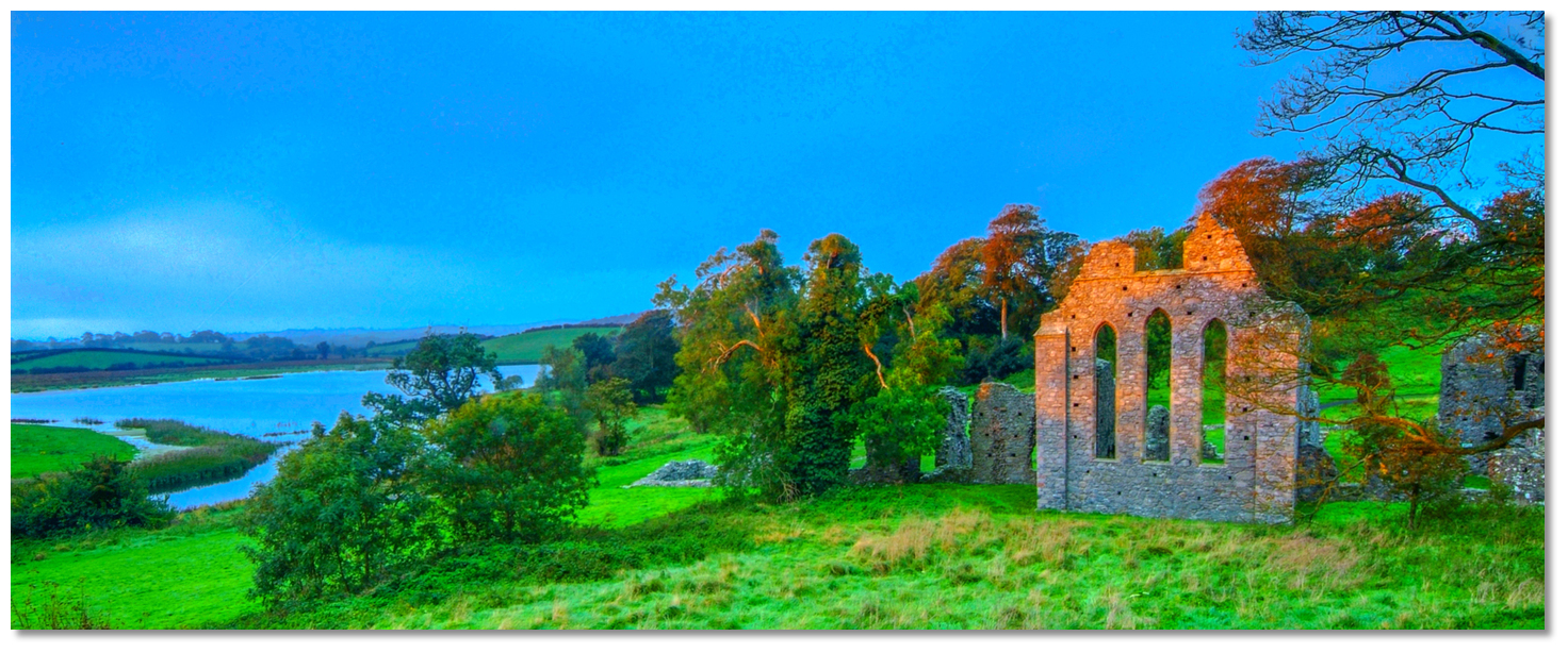 Inch Abbey Monastic Ruins overlooking the Quoile River
Image: Tourism NI
The condition of the town was greatly improved in the 18th century by a land-owning family named Southwell. In 1745, in an effort to reduce the flooding and reclaim land from the sea, Edward Southwell erected the first tidal barrage across the Quoile River at a site near the bridge on the old Belfast Road. Marshes were drained and ground that was once swamped by seawater was turned into fertile agricultural ground. Quoile Quay was developed, about a mile downriver of Downpatrick, where navigation then ceased, and it was transformed into a busy port, with sailing ships and steamers carrying timber, coal and slates to Downpatrick.
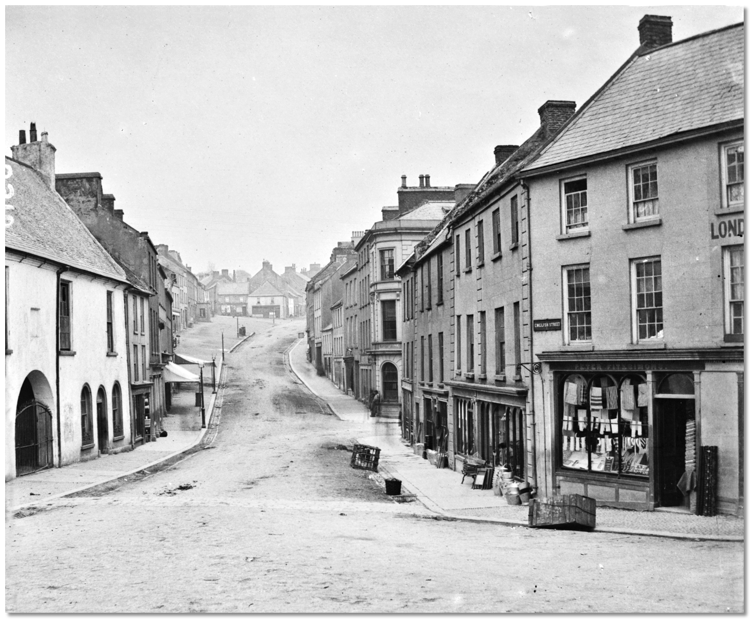 English Street, Downpatrick c.1860-1883
Image: National Library of Ireland on The Commons
The invention of steamships in the early 1800s somewhat removed the challenges of the unreliability of wind and tide bringing future enthusiasm for the port. In 1836 The County Down and Liverpool Steam-Packet Company was established to carry passengers and goods across the Irish Sea. The venture was a success and another quay, appropriately Steamboat Quay, was built in the 1850s about 160 metres downstream of the old quay, to assist the operations of the ferry and a new steamship was commissioned, the Victoria.
 English Street, Downpatrick ca. 1872-1883
Image: National Library of Ireland on The Commons
During the latter half of the 19th-century timber was landed from sailing schooners arriving from Baltic and Canadian ports here. The Downpatrick Timber, Slate and Coal Company imported building materials (mainly slate) from North Wales from its formation in 1895 until 1920. But the port was not a large success and was plagued with problems after it was opened. The principal problem that would weigh on the port was that The Narrows remained notoriously difficult to navigate and larger vessels were required to wait for high tide to pass beyond Hare Island as the river nearly dried from there on at low water.
 The tidal barrier connecting Castle and Hare islands
Image: Michael Harpur
But all this came to an end in 1957 when Quoile Quay and Steamboat Quay were closed off to sea traffic by a barrage that was constructed at Hare Island adjacent to the clubhouse. This was built to stop the frequent flooding of Downpatrick. It would be the final solution in a long line of inadequate attempts to control the tide and its effects on the lower sections of the town. The permanence of the new barrier meant that countless centuries of Downpatrick's seaborne trade ended forever. The section behind the man-made barrier of the River Quoile became a 'pondage' where the river’s saltwater and seashore were changed to freshwater and wetland.
 The Quoile River provides an anchorage or moorings in a remarkably pretty
location
Image: Michael Harpur
All of this can be explored today by the pleasant riverside walk into Downpatrick, locally 'Duno'. As soon after the barrier was built, plants and trees flourished along the former seashore making it an ideal habitat for a wide range of wildlife. It is now the Quoile Pondage National Nature Reserve which is a haven for wildfowl. The walks have views over the surrounding landscape of rounded hills and marshes it includes the Quoile Countryside Centre with displays on the wildlife and history of the area. Many of these features of historical interest are within the reserve itself, including Quoile Quay which is situated close to the Centre just beside Quoile Castle. This is a 16th-century Tower house that was inhabited into the 18th century. Another notable building of historical interest is Inch Abbey located 1.2 km northwest of Downpatrick on the north bank of the river. The abbey was originally situated on an island in what was then the Quoile Marshes and dates back to the year 800 AD. In 1002 a Viking fleet came up the Quoile and plundered the abbey. The settlement was subsequently plundered again in 1149.
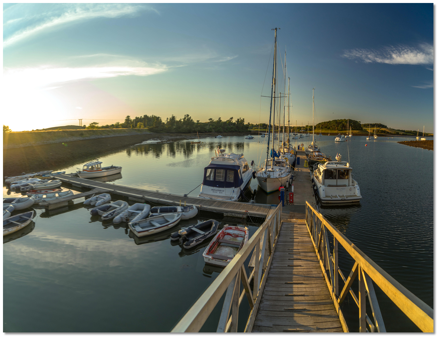 The welcoming Quoile Yacht Club Pontoon
Image: Michael Harpur
From a boating perspective, this is a quiet and secure anchorage/moorings/pontoon in a highly picturesque part of Strangford Lough. Quoile is a must-visit location in cruising terms as it has it all. Immediately ashore are a number of beautiful nature walks, that include bird hides on the freshwater side, so there is a diversity of wildlife and Downpatrick. All this comes with an outstanding welcome from the sailing club and the facilities of their well-appointed clubhouse, docks and pontoon. It is also worth noting that on most Saturday nights there is a 'bring your own' party.
What facilities are available?
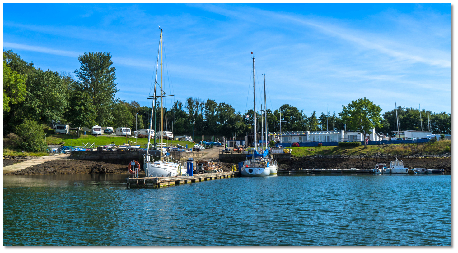
The pontoon has water and mains electrical points. Quoile Yacht Club has a beautiful, modern clubhouse and bar area that is complemented by a shower block for use by members and visitors alike. It also has a pay washing machine, tumble dryer and payphone that are all available to visitors. Outside there is a covered BBQ area overlooking the moorings and a picnic area. The club bar opens Saturday from 1700-2300, Sunday from 1500-1700, Wed after evening racing. Diesel is available from the pier head by arrangement.There are two slipways and a quay that can be used for drying out alongside and scrubbing, plus a winch that can handle vessels up to 40 foot. The nearest shops are in Downpatrick a distance of five miles that would probably require a taxi. This is a sizeable town that serves as a commercial and administrative centre for the locality.
Any security concerns?
Never a problem known to have occurred at Quoile.With thanks to:
Brian Crawford, local Strangford Lough boatman of many decades. eOceanic would like to thank Quoile Yacht Club for hosting our survey boat during the survey of Strangford Lough.
Aerial views of Quoile River
About Quoile
Quoile takes its name from the Irish 'an caol', meaning 'the narrow'. This refers to the river's narrow routes cutting between islands as it descends from Ballynahinch, some ten miles away, and meanders south before looping up northwards through Downpatrick and flowing into the Lough.
St Patrick Statue on Slieve Patrick, DownpatrickImage: Tourism NI
The town's history reaches back to the early Bronze Age. Two roundhouses were excavated on the current Meadowlands Housing Estate, one measured over 4 metres in diameter and contained a hearth in the centre and the other roundhouse was over seven metres across. There is also archaeological evidence of a Neolithic undefended settlement on Cathedral Hill on the southwest side of the hilltop that dominates the town today.
The first part of the town's name would come from a later fort, 'dún' in Irish that was later anglicised to 'down', which once stood on the hill. Ptolemy, about the year AD 130, includes it (in Latin) as 'Dunum' in his list of towns in Ireland. References of an attack on 'Dun Lethglaise' were recorded for the year A.D. 496 (or 498) that refer to a take-over of the site, possibly by the Dal Fiatach. The name 'Dun Lethglaise', then 'Dún Dá Lethglas', in turn gave way, in the 13th century, to the present name of 'Dún Phádraig' from its long association with the national saint who commenced his mission to bring Christianity to Ireland from the immediate surrounds.
St Patricks Church at nearby Saul the site of his first churchImage: Tourism NI
St Patrick's burial at Downpatrick is described in the Annals of the Four Masters following his death nearby at Saul in A.D. 493, but there is no indication that an early monastery was established to commemorate his name and mission. Down Cathedral was later constructed on this spot where he was believed to have been buried. The first mention of a Downpatrick abbot is in A.D. 780. Alas after this, the abbots are recorded at frequent intervals on account of their deaths and the destruction of the monastery by Viking raiders in A.D. 825, 942 and 989.
A stone marking the burial place of St Patrick at Down Cathedral.Image: August Schwerdfeger via CC BY 4.0
This open ecclesiastical town was the first objective that was easily taken by the Norman Knight John de Courcy early in 1177. In 1183, he brought in some Benedictines from the abbey of St. Werburgh in Chester (today Chester Cathedral) in England and built a cathedral friary for them at Downpatrick. The town was never the administrative centre for the earldom as that role was assumed by Carrickfergus that was more centrally located within the then political territory. Downpatrick, however, was well situated to act as a strategic bridgehead in the early years of the Anglo-Norman colony in Ulster. The Lecale peninsula was well protected by its encircling tidal estuaries and marshlands, and its many inlets and creeks provided natural harbours, ensuring good communication by sea with Dublin and its extended hinterland.
Celtic Stone Cross Down CathedralImage: Tourism NI
Although Ardglass, was the Lecale's main port, customs were still being levied at the port of Downpatrick in 1375 which had by then become the Lecale's urban centre and the administrative head of the area. Much of this trade was with northwestern England, where Downpatrick's main religious houses already had close ties with Chester, Barrow-in-Furness and Carlisle. But political instability from the mid-14th century inhibited the Lecale and Downpatrick could not escape the raids and open warfare that accompanied the decline of the political authority of the earldom of Ulster. The century after 1550 also treated it harshly, with the burning (and failure to rebuild) of the cathedral and the dissolution of other monasteries.
Inch Abbey Monastic Ruins overlooking the Quoile RiverImage: Tourism NI
The condition of the town was greatly improved in the 18th century by a land-owning family named Southwell. In 1745, in an effort to reduce the flooding and reclaim land from the sea, Edward Southwell erected the first tidal barrage across the Quoile River at a site near the bridge on the old Belfast Road. Marshes were drained and ground that was once swamped by seawater was turned into fertile agricultural ground. Quoile Quay was developed, about a mile downriver of Downpatrick, where navigation then ceased, and it was transformed into a busy port, with sailing ships and steamers carrying timber, coal and slates to Downpatrick.
English Street, Downpatrick c.1860-1883Image: National Library of Ireland on The Commons
The invention of steamships in the early 1800s somewhat removed the challenges of the unreliability of wind and tide bringing future enthusiasm for the port. In 1836 The County Down and Liverpool Steam-Packet Company was established to carry passengers and goods across the Irish Sea. The venture was a success and another quay, appropriately Steamboat Quay, was built in the 1850s about 160 metres downstream of the old quay, to assist the operations of the ferry and a new steamship was commissioned, the Victoria.
English Street, Downpatrick ca. 1872-1883Image: National Library of Ireland on The Commons
During the latter half of the 19th-century timber was landed from sailing schooners arriving from Baltic and Canadian ports here. The Downpatrick Timber, Slate and Coal Company imported building materials (mainly slate) from North Wales from its formation in 1895 until 1920. But the port was not a large success and was plagued with problems after it was opened. The principal problem that would weigh on the port was that The Narrows remained notoriously difficult to navigate and larger vessels were required to wait for high tide to pass beyond Hare Island as the river nearly dried from there on at low water.
The tidal barrier connecting Castle and Hare islandsImage: Michael Harpur
But all this came to an end in 1957 when Quoile Quay and Steamboat Quay were closed off to sea traffic by a barrage that was constructed at Hare Island adjacent to the clubhouse. This was built to stop the frequent flooding of Downpatrick. It would be the final solution in a long line of inadequate attempts to control the tide and its effects on the lower sections of the town. The permanence of the new barrier meant that countless centuries of Downpatrick's seaborne trade ended forever. The section behind the man-made barrier of the River Quoile became a 'pondage' where the river’s saltwater and seashore were changed to freshwater and wetland.
The Quoile River provides an anchorage or moorings in a remarkably prettylocation
Image: Michael Harpur
All of this can be explored today by the pleasant riverside walk into Downpatrick, locally 'Duno'. As soon after the barrier was built, plants and trees flourished along the former seashore making it an ideal habitat for a wide range of wildlife. It is now the Quoile Pondage National Nature Reserve which is a haven for wildfowl. The walks have views over the surrounding landscape of rounded hills and marshes it includes the Quoile Countryside Centre with displays on the wildlife and history of the area. Many of these features of historical interest are within the reserve itself, including Quoile Quay which is situated close to the Centre just beside Quoile Castle. This is a 16th-century Tower house that was inhabited into the 18th century. Another notable building of historical interest is Inch Abbey located 1.2 km northwest of Downpatrick on the north bank of the river. The abbey was originally situated on an island in what was then the Quoile Marshes and dates back to the year 800 AD. In 1002 a Viking fleet came up the Quoile and plundered the abbey. The settlement was subsequently plundered again in 1149.
The welcoming Quoile Yacht Club PontoonImage: Michael Harpur
From a boating perspective, this is a quiet and secure anchorage/moorings/pontoon in a highly picturesque part of Strangford Lough. Quoile is a must-visit location in cruising terms as it has it all. Immediately ashore are a number of beautiful nature walks, that include bird hides on the freshwater side, so there is a diversity of wildlife and Downpatrick. All this comes with an outstanding welcome from the sailing club and the facilities of their well-appointed clubhouse, docks and pontoon. It is also worth noting that on most Saturday nights there is a 'bring your own' party.
Other options in this area
Brandy Bay (North Salt Island) - 0.6 miles NE
Salt Island (South) - 0.6 miles ENE
Jackdaw Island - 1.4 miles ENE
Between Jackdaw & Chapel Island - 1.6 miles ENE
Killyleagh - 1.1 miles NNE
Holm Bay - 1.6 miles NNE
Don O’Neill Island - 1.9 miles NE
East Down Yacht Club - 1.8 miles NNE
Navigational pictures
These additional images feature in the 'How to get in' section of our detailed view for Quoile.


| Detail view | Off |
| Picture view | On |
Aerial views of Quoile River
Add your review or comment:
Rodolphe Thimonier wrote this review on Jul 30th 2016:
The landscape around Strangford Lough being low-lying hills, the shelter from the wind is not that good in the lough, specially since the best spots are, of course, already occupied by local boats. Fortunately, the lough is not subject swell and its mud provides a firm holding.
In Quoile, the shelter is fairly good. The visitors moorings have rusty chains and a depth <3m (LWS).
Very picturesque surrounding rural landscape. The boat is moored among cows, sheeps and seals.


Please log in to leave a review of this haven.
Please note eOceanic makes no guarantee of the validity of this information, we have not visited this haven and do not have first-hand experience to qualify the data. Although the contributors are vetted by peer review as practised authorities, they are in no way, whatsoever, responsible for the accuracy of their contributions. It is essential that you thoroughly check the accuracy and suitability for your vessel of any waypoints offered in any context plus the precision of your GPS. Any data provided on this page is entirely used at your own risk and you must read our legal page if you view data on this site. Free to use sea charts courtesy of Navionics.